Old Maps of Soft Maple, Croghan
Explore 15 old maps of Soft Maple, spanning from 1912 to today. These high-resolution historic maps reveal how streets, neighborhoods, landmarks, and natural features evolved over time — perfect for genealogy, metal detecting, research, and local history exploration.
What you can do with these maps:
- See how Soft Maple changed over time: Compare historical maps to modern-day views to trace roads, homesites, rail lines & more.
- View detailed metadata: Each map includes creators, publishers, year, scale, and archive source.
- Overlay maps with satellite & LiDAR: Visualize the past alongside modern tools to explore terrain & human change.
- Trusted historical sources: Maps sourced from the USGS, Library of Congress, and other archives.
- Access maps your way: View online, download high-res files, or order prints for personal or research use.
Start exploring old maps of Soft Maple to uncover forgotten places, hidden landmarks, and the deep history beneath your feet.
Soft Maple, Croghan maps
(15)- 1912 Map of Number Four
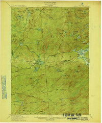
 1912 Number Four1912 Print · USGSThe Adirondack wilderness of Herkimer and Lewis counties is captured here in the early twentieth century before modern development. Trace the remote waterways from the Oswegatchie River down to Soft Maple Dam or locate family landmarks near Balsam Flats and Stillwater Mtn.
 - 1915 Map of Number Four
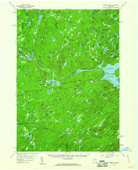
 1915 Number Four1915 Print · USGSThe wilderness of the North Country comes into focus in this pre-war survey of the Lewis and Herkimer county line. Researchers can trace the remote settlement of Number Four and locate early landmarks like Silver Mine Dam and Stillwater Mtn.5 unique versions available
 - 1950 Map of Utica, 1951 Print
 1950 Utica1951 Print · USGSCentral New York in the post-war era showcases the industrial Mohawk Valley and the pristine Adirondack interior. Researchers can trace transportation networks like the New York Central Railroad and find early Cold War sites such as Griffiss Air Force Base.
 - 1957 Map of Utica
 1957 Utica1957 Print · USGSCentral New York and the Adirondack foothills are captured here in the mid-fifties, showing a landscape defined by the Mohawk River corridor and the growing highway system. Genealogists and researchers can trace the rail lines of the New York Central and locate communities from Lowville to Gloversville.
 - 1957 Map of Number Four, 1964 Print
 1957 Number Four1964 Print · USGSThe western Adirondacks during the mid-1950s reveal a landscape of managed wilderness and remote settlements. Researchers can trace historic access routes like Prentice Road or locate the Lookout Tower near Number Four and Stillwater.4 unique versions available
 - 1962 Map of Utica
 1962 Utica1962 Print · USGSCentral New York and the Adirondack wilderness are captured here during the mid-century era of highway and industrial expansion. Genealogists and historians can trace the development of the New York State Thruway and local rail lines connecting Utica, Rome, and Gloversville.3 unique versions available
 - 1964 Map of Utica
 1964 Utica1964 Print · USGSCentral New York and the high wilderness of the Adirondacks are captured here during the post-war era of infrastructure expansion. Researchers can trace the development of the New York State Thruway alongside historic corridors like the Oneida Lake (Barge Canal Route) and the N. Y. Central railroad.
 - 1967 Map of Utica
 1967 Utica1967 Print · USGSCentral New York's industrial Mohawk Valley meets the Adirondack wilderness in the 1960s, showing the region's transition from manufacturing hubs to state-managed parklands. Trace historic settlements and sites like Griffiss Air Force Base, Colgate University, and the Lyons Falls Paper Mill.
 - 1985 Map of Watertown, 1986 Print
 1985 Watertown1986 Print · USGSThe Black River Valley and the western Adirondacks are captured here in the mid-1980s, from the urban streets of Watertown to the remote Stillwater Reservoir. Researchers can trace the Conrail lines through Carthage or locate family landmarks in Lowville, Boonville, and Old Forge.2 unique versions available
 - 1989 Map of Stillwater
 1989 Stillwater1989 Print · USGSThe Adirondack wilderness in the late 1980s reveals a landscape defined by seasonal camps and isolated waterways. Researchers can trace the remote network of trails and ponds surrounding Stillwater, Oswegatchie Camp, and the winding West Branch Oswegatchie River.
 - 2010 Map of Soft Maple Reservoir, 2010 Print
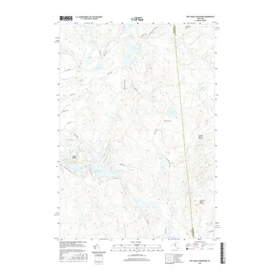
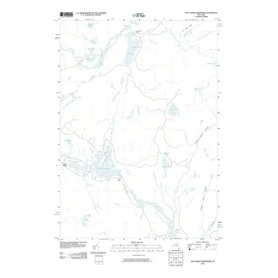 2010 Soft Maple Reservoir2010 Print · USGSCovers Soft Maple, including Croghan, New Bremen, and other nearby areas
 - 2013 Map of Soft Maple Reservoir, 2013 Print
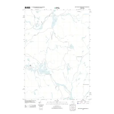 2013 Soft Maple Reservoir2013 Print · USGSCovers Soft Maple, including Croghan, New Bremen, and other nearby areas
 - 2016 Map of Soft Maple Reservoir, 2016 Print
 2016 Soft Maple Reservoir2016 Print · USGSCovers Soft Maple, including Croghan, New Bremen, and other nearby areas
 - 2019 Map of Soft Maple Reservoir, 2019 Print
 2019 Soft Maple Reservoir2019 Print · USGSCovers Soft Maple, including Croghan, New Bremen, and other nearby areas
 - 2023 Map of Soft Maple Reservoir, 2023 Print
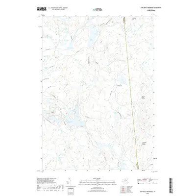
 2023 Soft Maple Reservoir2023 Print · USGSThe North Country wilderness comes into focus in this recent survey of the southwestern Adirondacks. Trace the intricate waterways of the Beaver River and Soft Maple Reservoir, or locate remote landmarks like Eagle Falls and The Hogs Back.
End of results
Showing maps 1-15 of 15
Top cities near Soft Maple
- Lowville historical maps
- Lowville historical maps
- Croghan historical maps
- New Bremen historical maps
- Watson historical maps
- Webb historical maps
See more
Frequently asked questions
- What are the different types of historical maps available for Soft Maple?
- What is the oldest map of Soft Maple?
- Where can I purchase historical maps of Soft Maple for my home or office?
- Where can I download high-res historical maps of Soft Maple?
- Are there historical topographic maps available for Soft Maple?
- Is there historical aerial imagery available for Soft Maple?
- Where are historical maps of Soft Maple sourced from?