Old Maps of Mount Morris, Mount Morris for Hiking & Exploration
Hike through history with 22 historic maps of Mount Morris. Explore old trails, ghost towns, and forgotten backroads — perfect for outdoor adventurers and local explorers.
- Rediscover forgotten places: Map out old mining camps, roads, and footpaths that no longer exist on modern maps.
- Layer with modern tools: Combine with LiDAR or satellite views to plan hikes through historical terrain.
- Made for exploration: Popular among hikers, overlanders, and local history lovers.
Use these maps to find adventure and explore the hidden past of Mount Morris.
Mount Morris, Mount Morris maps
(22)- 1905 Map of Nunda
 1905 Nunda1905 Print · USGSLivingston County rail and river life are captured here at the turn of the century, centered on the Genesee River valley. Trace the vanished streets of St Helena, locate the Sonyea P O Craig Colony, and follow the complex rail junctions at Mount Morris.6 unique versions available
 - 1943 Map of Mount Morris
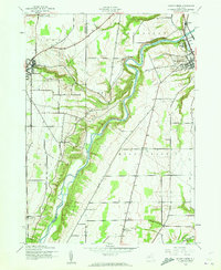 1943 Mount Morris1943 Print · USGSDuring the war years, this corner of the Genesee Valley was a landscape of dramatic river gorges and quiet upland farming. Genealogists and historians can trace the early road networks connecting Mount Morris and Perry or locate rural hamlets like Brooks Grove and Simmons Corners.2 unique versions available
 - 1943 Map of Sonyea, 1960 Print
 1943 Sonyea1960 Print · USGSLivingston County in the early 1940s is a landscape of valley rail lines and institutional grounds. Genealogists and historians can trace the expansive Craig Colony campus, the small rail stop at Sonyea, and rural settlements like Kysorville and Tuscarora.
 - 1944 Map of Sonyea
 1944 Sonyea1944 Print · USGSThe Genesee Valley during the mid-forties reveals a landscape of vital rail corridors and institutional centers. Local historians can trace the grounds of Craig Colony and the rail junctions at Groveland Sta and Tuscarora.
 - 1944 Map of Mount Morris
 1944 Mount Morris1944 Print · USGSThe Genesee Valley during the mid-forties was a landscape of dramatic river bluffs and vital rail junctions. Genealogists and local historians can trace family-named routes like Hendershot Road and locate rural hubs such as Brooks Grove and Ridge.
 - 1950 Map of Elmira
 1950 Elmira1950 Print · USGSThe Finger Lakes region thrived in the late 1940s as a hub of industry and transport. Trace family roots and vanished landmarks near Seneca Lake or explore the rail lines of the Erie RR and the sprawling Seneca Ordnance Depot.2 unique versions available
 - 1958 Map of Elmira
 1958 Elmira1958 Print · USGSThe New York Finger Lakes during the late fifties reveal a complex landscape of glacial geology and industrial growth. Researchers can trace historic transport corridors like the Erie Canal and Erie RR, or locate institutional landmarks like Cornell University.2 unique versions available
 - 1962 Map of Elmira, 1969 Print
 1962 Elmira1969 Print · USGSThe Finger Lakes region and Southern Tier are captured here during a period of industrial maturity and highway expansion. Researchers can trace the path of the Erie Canal, the footprint of the Seneca Army Depot, and legacy rail lines through Elmira and Ithaca.4 unique versions available
 - 1965 Map of Elmira
 1965 Elmira1965 Print · USGSThe Finger Lakes and Southern Tier regions are captured in the mid-sixties, showcasing a landscape of deep glacial valleys and heavy rail infrastructure. Trace old railroad corridors like the Pennsylvania RR or visit landmarks like Letchworth State Park and the Seneca Army Depot.
 - 1972 Map of Sonyea, 1974 Print
 1972 Sonyea1974 Print · USGSLivingston County in the early seventies shows a landscape of institutional history and river valley rail lines. Genealogists can locate family names at Williamsburgh Cem or trace the grounds of the Craig State School near Sonyea.2 unique versions available
 - 1972 Map of Mount Morris, 1974 Print
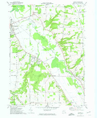
 1972 Mount Morris1974 Print · USGSLivingston County in the early seventies centers on the winding Genesee and the impressive engineering of the Mount Morris Dam. Researchers can trace the Erie-Lackawanna rail corridor and find local landmarks like Glenwood Cem and Brooks Grove.2 unique versions available
 - 1983 Map of Canandaigua, 1985 Print
 1983 Canandaigua1985 Print · USGSThe Finger Lakes and Genesee Valley appear in high detail in the early 1980s as the region's transport and academic centers reached a peak. Researchers can trace rail lines like the Lehigh Valley RR and find landmarks such as the Mount Morris Dam and Gannagaro State Historical Site.2 unique versions available
 - 2010 Map of Mount Morris, 2010 Print
 2010 Mount Morris2010 Print · USGSCovers Mount Morris, including Perry, Perry, and other nearby areas
 - 2010 Map of Sonyea, 2010 Print
 2010 Sonyea2010 Print · USGSCovers Mount Morris, including Groveland, Leicester, and other nearby areas
 - 2013 Map of Mount Morris, 2013 Print
 2013 Mount Morris2013 Print · USGSCovers Mount Morris, including Perry, Perry, and other nearby areas
 - 2013 Map of Sonyea, 2013 Print
 2013 Sonyea2013 Print · USGSCovers Mount Morris, including Groveland, Leicester, and other nearby areas
 - 2016 Map of Mount Morris, 2016 Print
 2016 Mount Morris2016 Print · USGSCovers Mount Morris, including Perry, Perry, and other nearby areas
 - 2016 Map of Sonyea, 2016 Print
 2016 Sonyea2016 Print · USGSCovers Mount Morris, including Groveland, Leicester, and other nearby areas
 - 2019 Map of Sonyea, 2019 Print
 2019 Sonyea2019 Print · USGSCovers Mount Morris, including Groveland, Leicester, and other nearby areas
 - 2019 Map of Mount Morris, 2019 Print
 2019 Mount Morris2019 Print · USGSCovers Mount Morris, including Perry, Perry, and other nearby areas
 - 2023 Map of Mount Morris, 2023 Print
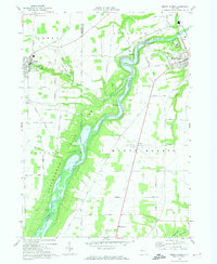
 2023 Mount Morris2023 Print · USGSThe Genesee River valley in Livingston County reveals a landscape shaped by water and aviation in the early twenty-first century. Researchers can trace family history at Mount Morris Cem or locate local landmarks like Scott's Sky Ranch Airport and Brooks Grove.
 - 2023 Map of Sonyea, 2023 Print
 2023 Sonyea2023 Print · USGSLivingston County's river valleys and institutional grounds are documented here in the early twenty-first century. Genealogists can locate family sites at Williamsburg Cem, the Craig State School, and the hamlet of Kysorville.
End of results
Showing maps 1-22 of 22
Top cities near Mount Morris
- Geneseo historical maps
- LeRoy historical maps
- Geneseo historical maps
- Livonia historical maps
- Avon historical maps
- Perry historical maps
See more
Frequently asked questions
- What are the different types of historical maps available for Mount Morris?
- What is the oldest map of Mount Morris?
- Where can I purchase historical maps of Mount Morris for my home or office?
- Where can I download high-res historical maps of Mount Morris?
- Are there historical topographic maps available for Mount Morris?
- Is there historical aerial imagery available for Mount Morris?
- Where are historical maps of Mount Morris sourced from?