Old Maps of Montgomery County, New York for Metal Detecting
Plan your next treasure hunt with 139 historic maps of Montgomery County. Find old homesites, ghost towns, trails, and gathering spots that may be lost to time — perfect for identifying promising metal detecting locations.
- Locate forgotten sites: Uncover places like long-lost settlements, abandoned rail lines, or gathering spots.
- Plan better hunts: Use map overlays combined with LiDAR or satellite views to narrow in on historically rich areas.
- Made for detectorists: Thousands of hobbyists use these maps to discover relics, coins, and hidden history.
Use these historic maps to boost your research and find new opportunities beneath the surface of Montgomery County.
Montgomery County, NY maps
(139)- 1895 Map of Amsterdam
 1895 Amsterdam1895 Print · USGSThe Mohawk River valley thrives in the late nineteenth century as a corridor of heavy rail and canal traffic. Trace the historic paths of the Erie Canal and West Shore R.R. past Amsterdam and the old Hoffman Ferry crossing.7 unique versions available
 - 1896 Map of Fonda
 1896 Fonda1896 Print · USGSThe Mohawk Valley was a technological corridor in the 1890s, defined by the convergence of major rail lines and the Erie Canal. Genealogists and historians can trace the old post offices and hamlet life at Yatesville Randall P.O., Auriesville, and Rural Grove.
 - 1898 Map of Fonda
 1898 Fonda1898 Print · USGSThe Mohawk Valley at the close of the 19th century was a powerhouse of transit and industry. Genealogists and historians can trace the bustling Erie Canal corridor through Fonda, the upland reaches of Charleston, and the path of the West Shore R. R.
 - 1898 Map of Canajoharie, 1954 Print
 1898 Canajoharie1954 Print · USGSThe Mohawk Valley was at its industrial peak in the late 1890s, when the river, canal, and railroads all shared the same narrow corridor. Genealogists and historians can trace old homesteads and local landmarks in Stone Arabia, Ft. Plain, and the historic resort at Sharon Springs.
 - 1900 Map of Little Falls
 1900 Little Falls1900 Print · USGSThe Mohawk River valley serves as a bustling industrial artery at the turn of the century, dominated by canal and rail traffic. Genealogists can trace the early footprints of Little Falls, find the County House, or locate vanished stops like Ingham Mills Sta.
 - 1900 Map of Canajoharie
 1900 Canajoharie1900 Print · USGSThe Mohawk Valley at the turn of the century shows a dense network of canal, rail, and river transportation. Genealogists can trace family footprints in historic Canajoharie, the upland farms near Stone Arabia, and the resort area of Sharon Springs.
 - 1901 Map of Lassellsville, 1959 Print
 1901 Lassellsville1959 Print · USGSFulton and Montgomery Counties come alive in this turn-of-the-century survey of the Mohawk Valley and southern Adirondacks. Genealogists and researchers can pinpoint family holdings near Irish Settlement, the industry of Newkirk Mills, and the rails of the N. Y. C. and H. R. R. R.
 - 1902 Map of Canajoharie
 1902 Canajoharie1902 Print · USGSThe Mohawk Valley was a bustling corridor of canal traffic and steam power just after the turn of the century. Genealogists can trace family names and farmsteads near Stone Arabia or explore the resort layout of Sharon Springs and the industrial hubs of Ft. Plain and Canajoharie.6 unique versions available
 - 1902 Map of Fonda
 1902 Fonda1902 Print · USGSThe Mohawk Valley at the close of the nineteenth century reveals a critical junction of the Erie Canal and major railroads. Genealogists and historians can trace old homesteads and local centers like Auriesville, Sammonsville, and the remote Charleston Four Corners.8 unique versions available
 - 1903 Map of Richfield Springs
 1903 Richfield Springs1903 Print · USGSThe northern Otsego County landscape at the turn of the century shows a bustling rural economy centered around the headwaters of the Susquehanna. Researchers can trace the early Steamboat Route on Otsego Lake and explore rail-era depots like Richfield Springs and Cherry Valley.6 unique versions available
 - 1903 Map of Lassellsville
 1903 Lassellsville1903 Print · USGSFulton County at the start of the century shows a landscape of upland mill sites and busy valley railroads. Genealogists can trace family names at Irish Settlement, Fical Corners, and the mill sites at Newkirk Mills.6 unique versions available
 - 1903 Map of Little Falls
 1903 Little Falls1903 Print · USGSThe Mohawk Valley was a bustling corridor of industry and transit at the turn of the century, where the river met a network of canals and railroads. Genealogists and historians can trace the foundations of Little Falls, find the historic site of Fort Herkimer, and locate rural landmarks like the County House.6 unique versions available
 - 1931 Map of Amsterdam
 1931 Amsterdam1931 Print · USGSThe Mohawk Valley thrives at the height of its rail and canal era in the late twenties and early thirties. Genealogists can trace family names through dozens of rural schools and churches, from St Marys Ch to the quiet hamlets of Mariaville and Scotch Bush.3 unique versions available
 - 1939 Map of Little Falls
 1939 Little Falls1939 Print · USGSThe Mohawk Valley was a bustling corridor of rail and water transport just before the mid-century, centered on the narrow gorge at Little Falls. Genealogists and historians can trace the paths of the Adirondack Division railroad and historic sites like Fort Herkimer and Indian Castle.
 - 1943 Map of Sharon Springs, 1955 Print
 1943 Sharon Springs1955 Print · USGSSchoharie and Montgomery Counties are captured in detail during the early 1940s, showing a landscape of upland farms and rural crossroads. Genealogists can locate family landmarks like Flanders Cem, the Dutch Reformed Ch, and small settlements such as Mapletown (Blaine) and Argusville.3 unique versions available
 - 1943 Map of Carlisle, 1957 Print
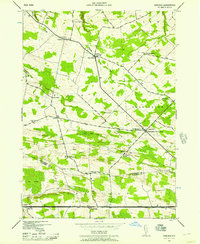 1943 Carlisle1957 Print · USGSUpper Montgomery and Schoharie counties appear here during the mid-forties, characterized by a dense network of upland farms and crossroads hamlets. Researchers can locate numerous local landmarks like Charleston Four Corners, Gove Cem, and the Cherry Valley Turnpike.2 unique versions available
 - 1943 Map of Esperance, 1959 Print
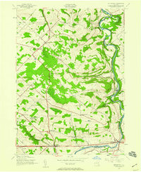 1943 Esperance1959 Print · USGSThe rural borderlands of Montgomery and Schoharie counties appear here during the mid-forties, showing a landscape of scattered crossroads and winding waterways. Family historians can locate family-named landmarks like Kimball Cem and Rockwell Corners or trace old school districts like Carytown Sch.2 unique versions available
 - 1943 Map of Sprout Brook, 1960 Print
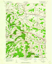 1943 Sprout Brook1960 Print · USGSAgricultural valleys and upland hamlets define this 1940s survey at the junction of Montgomery, Otsego, and Schoharie counties. Genealogists can trace family lines through Flint Cem, find old district schoolhouses like School No 14, and locate the historic depot at Cherry Valley.3 unique versions available
 - 1943 Map of East Springfield, 1960 Print
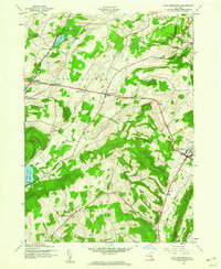 1943 East Springfield1960 Print · USGSNorthern Otsego County was a landscape of high ridges and tight valley hamlets during the mid-1940s. Genealogists can trace family footprints at Springfield Cem or Willse Hill Cem and locate rural landmarks like Stanley Sch and Dugway Gorge.2 unique versions available
 - 1943 Map of Little Falls, 1960 Print
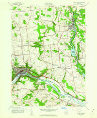 1943 Little Falls1960 Print · USGSThe Mohawk Valley at the height of the Second World War shows a landscape defined by the Barge Canal and industrial hubs like Little Falls. Trace family roots at the Fink-Van Valkenburg Cem or locate rural landmarks like Yellow Ch.2 unique versions available
 - 1943 Map of Van Hornesville, 1960 Print
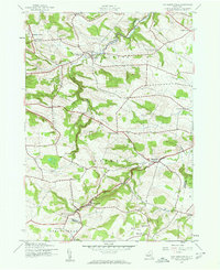 1943 Van Hornesville1960 Print · USGSThe rural landscape of Herkimer County is captured here in the mid-1940s, showing a dense network of country schoolhouses and crossroads. Researchers can trace ancestral locations like Wrights Corners, find old burials at Pumpkin Hook Cem, or locate the State Fish Hatchery.2 unique versions available
 - 1944 Map of Canajoharie, 1953 Print
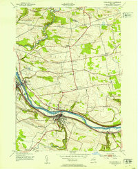 1944 Canajoharie1953 Print · USGSThe Mohawk Valley corridor thrives during the mid-forties as a vital transport artery for the New York Central railroad and the Barge Canal. Genealogists can locate family plots like Dillenback Cem and rural centers such as Stone Arabia and Nelliston.2 unique versions available
 - 1944 Map of Tribes Hill, 1959 Print
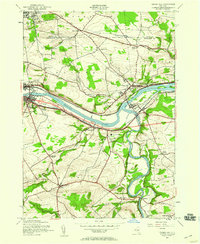 1944 Tribes Hill1959 Print · USGSThe Mohawk Valley's transition into the interstate era is documented here as the new thruway cuts across traditional canal and rail corridors. Genealogists and local historians can trace family-named sites like Wycoff Cem, Switzer Hill, and the Cadaughrity Sch.2 unique versions available
 - 1944 Map of Randall, 1959 Print
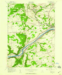 1944 Randall1959 Print · USGSThe Mohawk Valley's vital transportation corridor is captured here in the mid-1940s, showing the early integration of the Thruway alongside historic water and rail routes. Genealogists can trace family names at Sammons Cem, Winnie Sch, and the Tekakwitha Friary.3 unique versions available
 - 1944 Map of Fort Plain, 1960 Print
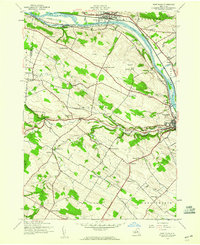 1944 Fort Plain1960 Print · USGSThe Mohawk Valley during the war years shows a landscape defined by the New York State Barge Canal and the New York Central Railroad. Genealogists can locate family landmarks like the Nellis Cem, Klock Sch, and the riverside settlement of Mindenville.2 unique versions available
Showing maps 1-25 of 139
Top cities of Montgomery County
- Amsterdam historical maps
- Amsterdam historical maps
- Minden historical maps
- Canajoharie historical maps
- Mohawk historical maps
- Palatine historical maps
See more
Frequently asked questions
- What are the different types of historical maps available for Montgomery County?
- What is the oldest map of Montgomery County?
- Where can I purchase historical maps of Montgomery County for my home or office?
- Where can I download high-res historical maps of Montgomery County?
- Are there historical topographic maps available for Montgomery County?
- Is there historical aerial imagery available for Montgomery County?
- Where are historical maps of Montgomery County sourced from?