Old Maps of Baldwin, Hempstead for Metal Detecting
Plan your next treasure hunt with 28 historic maps of Baldwin. Find old homesites, ghost towns, trails, and gathering spots that may be lost to time — perfect for identifying promising metal detecting locations.
- Locate forgotten sites: Uncover places like long-lost settlements, abandoned rail lines, or gathering spots.
- Plan better hunts: Use map overlays combined with LiDAR or satellite views to narrow in on historically rich areas.
- Made for detectorists: Thousands of hobbyists use these maps to discover relics, coins, and hidden history.
Use these historic maps to boost your research and find new opportunities beneath the surface of Baldwin.
Baldwin, Hempstead maps
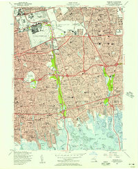
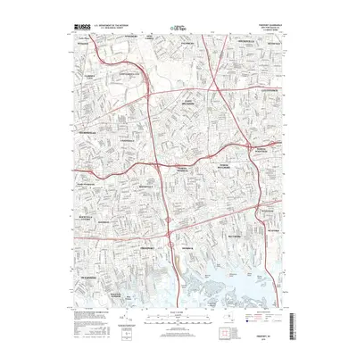
(28)- 1897 Map of Hempstead, 1961 Print
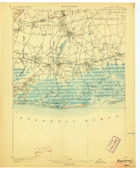
 1897 Hempstead1961 Print · USGSNassau County's transition from rural townships to a suburban rail corridor is captured here at the end of the nineteenth century. Genealogists and historians can trace the early footprints of Garden City, find the Camp Meeting Grounds, or locate coastal landmarks like the Long Beach Life Saving Station.
 - 1898 Map of Hempstead
 1898 Hempstead1898 Print · USGSNassau County's south shore is meticulously detailed in the 1890s, showing a landscape of burgeoning rail suburbs and intricate salt marshes. Genealogists and historians can trace early settlements like Christian Hook, find family Cem. sites, and locate vanished landmarks such as the Camp Meeting Grounds.
 - 1899 Map of Hempstead
 1899 Hempstead1899 Print · USGSThe South Shore of Long Island at the end of the century shows a landscape transitioning from rural townships to connected rail suburbs. Trace early settlement patterns in Hempstead and Rockville Center, or explore the old marshes around Haunts Creek and Barnum Id.
 - 1903 Map of Hempstead
 1903 Hempstead1903 Print · USGSSouthern Nassau County at the turn of the century shows a landscape transitioning from rural estates and marshlands to rail-connected villages. Genealogists can trace family footprints in Hempstead or Garden City and locate coastal landmarks like Christian Hook and the Camp Meeting Grounds.9 unique versions available
 - 1947 Map of Jones Inlet
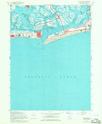
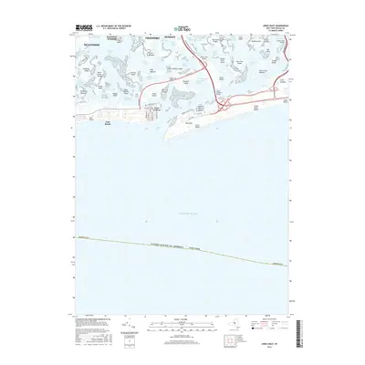
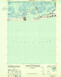 1947 Jones Inlet1947 Print · USGSThe Nassau County coastline during the post-war era reveals a landscape of developing seaside communities and expansive public works. Researchers can trace the layout of Jones Beach State Park and Point Lookout, or locate landmarks like the White House Bark Roof among the marshes.
 - 1947 Map of Freeport
 1947 Freeport1947 Print · USGSNassau County's south shore and aviation hubs are caught in detail just after the war. Local historians can trace the transition from marshland to suburbia through landmarks like Roosevelt Field, the Jones Beach Hotel, and the Meadow Brook Polo Field.
 - 1949 Map of New York, 1951 Print
 1949 New York1951 Print · USGSLong Island and its surrounding waters are documented here in the late 1940s, just as the postwar suburban boom began to transform the region. Genealogists and historians can trace the early layouts of Idlewild Airport, Mitchell Field, and the established routes of the Long Island RR.
 - 1954 Map of New York
 1954 New York1954 Print · USGSLong Island and the New York metropolitan area are shown during the height of post-war suburbanization. Genealogists and historians can trace the growth of Levittown, the infrastructure of the Long Island Rail Road, and landmarks like Mitchel Afb.2 unique versions available
 - 1954 Map of Jones Inlet, 1956 Print
 1954 Jones Inlet1956 Print · USGSThe Nassau County shoreline in the mid-fifties reveals a peak era of coastal recreation and parkway development. Trace the early layout of Jones Beach State Park, the original Marine Stadium, and the residential blocks of Point Lookout.2 unique versions available
 - 1955 Map of Freeport, 1957 Print
 1955 Freeport1957 Print · USGSNassau County is seen during its peak post-war suburban transformation, where new housing tracts meet established coastal villages. Researchers can trace family roots through dozens of local institutions like Hofstra College, Greenfield Cemetery, and the historic Mitchell Air Force Base.
 - 1957 Map of New York, 1975 Print
 1957 New York1975 Print · USGSLong Island and the New York metropolitan area are shown in this mid-century survey during a period of massive suburban growth and industrial expansion. Researchers can trace the Long Island RR network and locate landmarks like Fort Tilden or the Brookhaven National Laboratory.
 - 1958 Map of New York
 1958 New York1958 Print · USGSLong Island at the height of its postwar expansion reveals a landscape of rapidly growing suburbs and critical military installations. Genealogists and historians can trace the early footprints of Levittown, the terminals of Idlewild Airport, and the grounds of Brookhaven National Laboratory.3 unique versions available
 - 1960 Map of New York, 1979 Print
 1960 New York1979 Print · USGSLong Island and the five boroughs are shown at a transformative moment mid-century as suburban expansion reshaped the landscape. Researchers can trace family roots through evolving neighborhoods from Rockville Centre to Sayville, or locate historic maritime landmarks like Eatons Neck and Montauk Point.2 unique versions available
 - 1967 Map of Jones Inlet, 1968 Print
 1967 Jones Inlet1968 Print · USGSLong Island's south shore appears in the late sixties as a prime destination for recreation and coastal living. Trace the development of Jones Beach State Park, the Marine Theater, and the residential blocks of Point Lookout.2 unique versions available
 - 1969 Map of New York
 1969 New York1969 Print · USGSLong Island and the New York harbor area are shown here during a peak era of suburban expansion and Cold War defense. Trace the growth of Levittown, the infrastructure of Idlewild NY International Airport, and the reach of the Long Island RR.
 - 1969 Map of Freeport, 1972 Print
 1969 Freeport1972 Print · USGSNassau County is shown in the midst of its suburban height in the late sixties, where massive residential developments meet the salt marshes of the South Shore. Genealogists and local historians can trace family locations near Holy Rood Cemetery, Levittown, or the U S Naval Reserve station near Baldwin.2 unique versions available
 - 1984 Map of Long Island West, 1986 Print
 1984 Long Island West1986 Print · USGSWestern Long Island in the mid-eighties shows a mature suburban landscape defined by its famous expressways and historic rail lines. Researchers can trace the development of planned communities like Levittown or locate landmarks such as Fort Totten Mil Res and Stony Brook.2 unique versions available
 - 1994 Map of Freeport, 2000 Print
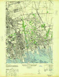
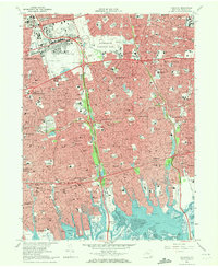
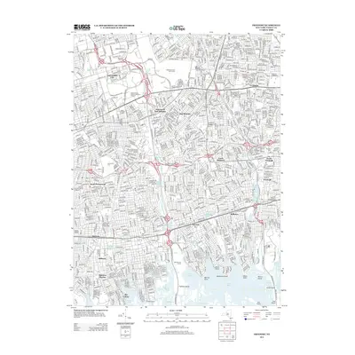
 1994 Freeport2000 Print · USGSNassau County suburbanization is in full maturity during the mid-nineties, showing a densely settled landscape from Hempstead to the South Shore. Researchers can trace local landmarks like Roosevelt Raceway, Greenfield Cemetery, and the U S Military Reservation.
 - 2010 Map of Freeport, 2010 Print
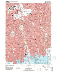
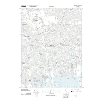 2010 Freeport2010 Print · USGSCovers Baldwin, including Hempstead, Oyster Bay, and other nearby areas
 - 2012 Map of Jones Inlet, 2012 Print
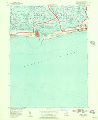
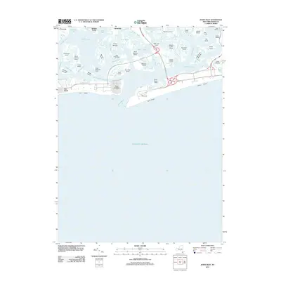 2012 Jones Inlet2012 Print · USGSCovers Baldwin, including Hempstead, Freeport, and other nearby areas
 - 2013 Map of Freeport, 2013 Print
 2013 Freeport2013 Print · USGSCovers Baldwin, including Hempstead, Oyster Bay, and other nearby areas
 - 2013 Map of Jones Inlet, 2013 Print
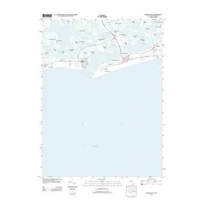 2013 Jones Inlet2013 Print · USGSCovers Baldwin, including Hempstead, Freeport, and other nearby areas
 - 2016 Map of Freeport, 2016 Print
 2016 Freeport2016 Print · USGSCovers Baldwin, including Hempstead, Oyster Bay, and other nearby areas
 - 2016 Map of Jones Inlet, 2016 Print
 2016 Jones Inlet2016 Print · USGSCovers Baldwin, including Hempstead, Freeport, and other nearby areas
 - 2019 Map of Jones Inlet, 2019 Print
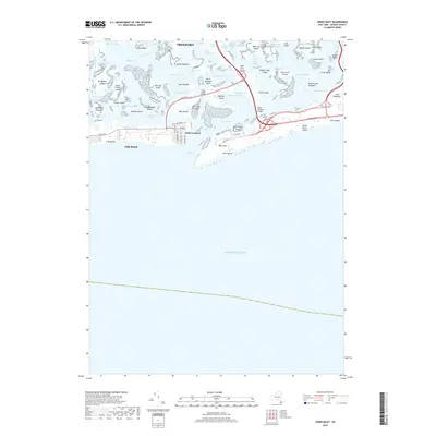 2019 Jones Inlet2019 Print · USGSCovers Baldwin, including Hempstead, Freeport, and other nearby areas
Showing maps 1-25 of 28
Top cities near Baldwin
- New York historical maps
- Hempstead historical maps
- Oyster Bay historical maps
- North Hempstead historical maps
- Babylon historical maps
- Huntington historical maps
See more
Top neighborhoods of Baldwin
Frequently asked questions
- What are the different types of historical maps available for Baldwin?
- What is the oldest map of Baldwin?
- Where can I purchase historical maps of Baldwin for my home or office?
- Where can I download high-res historical maps of Baldwin?
- Are there historical topographic maps available for Baldwin?
- Is there historical aerial imagery available for Baldwin?
- Where are historical maps of Baldwin sourced from?