Old Maps of North Tonawanda, New York
Explore old maps of North Tonawanda, spanning from 1897 to today. These high-resolution historic maps reveal how streets, neighborhoods, landmarks, and natural features evolved over time — perfect for genealogy, metal detecting, research, and local history exploration.
What you can do with these maps:
- See how North Tonawanda changed over time: Compare historical maps to modern-day views to trace roads, homesites, rail lines & more.
- View detailed metadata: Each map includes creators, publishers, year, scale, and archive source.
- Overlay maps with satellite & LiDAR: Visualize the past alongside modern tools to explore terrain & human change.
- Trusted historical sources: Maps sourced from the USGS, Library of Congress, and other archives.
- Access maps your way: View online, download high-res files, or order prints for personal or research use.
Start exploring old maps of North Tonawanda to uncover forgotten places, hidden landmarks, and the deep history beneath your feet.
North Tonawanda, NY maps
- 1897 Map of Tonawanda
 1897 Tonawanda1897 Print · USGSNiagara and Erie counties thrived at the close of the nineteenth century as vital corridors of commerce. Genealogists and historians can trace the early rail networks through Pekin or locate riverside landmarks like Sour Spring Grove and the Erie Canal.
 - 1899 Map of Niagara
 1899 Niagara1899 Print · USGSThe Niagara Frontier is mapped here in the late nineteenth century as a bustling corridor of trade and transport. Researchers can trace the path of the Erie Canal through Lockport or locate early rural settlements like Ransomville and the Tuscarora Indian Reservation.6 unique versions available
 - 1900 Map of Tonawanda
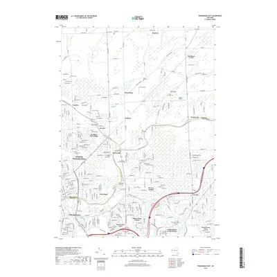
 1900 Tonawanda1900 Print · USGSNiagara County and northern Erie County are shown at the turn of the century as the Erie Canal and heavy rail lines drove the growth of the North Tonawanda lumber and shipping hub. Genealogists can trace family footprints in outlying hamlets like Bergholtz, Ransomville, and Martinsville.
 - 1901 Map of Tonawanda
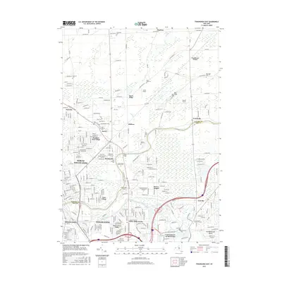
 1901 Tonawanda1901 Print · USGSAt the turn of the century, the Niagara Frontier was a powerhouse of canal and rail transit. Genealogists can trace family footprints in settlements like Sanborn, Martinsville, and Bergholtz, or follow the original path of the ERIE CANAL through Tonawanda.7 unique versions available
 - 1948 Map of Tonawanda, 1953 Print
 1948 Tonawanda1953 Print · USGSNiagara and Erie counties are shown here just after the war, where the Niagara River meets the historic Erie Canal. Genealogists and local historians can trace the early layout of North Tonawanda or locate family sites at Molyneaux Corners and Colonial Village.3 unique versions available
 - 1948 Map of Tonawanda West, 1958 Print
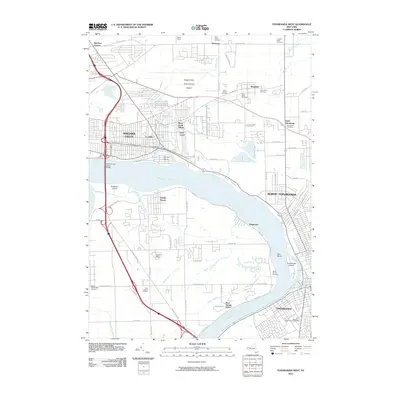
 1948 Tonawanda West1958 Print · USGSThe industrial and riverfront character of the Niagara frontier is on full display during the postwar era. Genealogists and historians can trace rail networks like the New York Central RR and locate local landmarks such as Bishop Duffy High Sch or the Holy Ghost Cem (Church).2 unique versions available
 - 1950 Map of Tonawanda East
 1950 Tonawanda East1950 Print · USGSNiagara and Erie counties meet along the canal and river during this postwar period of industrial activity and suburban expansion. Genealogists and local historians can trace the foundations of Martinsville and Hodgeville, or locate family sites near Wheatfield Cemetery and School No. 10.2 unique versions available
 - 1950 Map of Tonawanda West
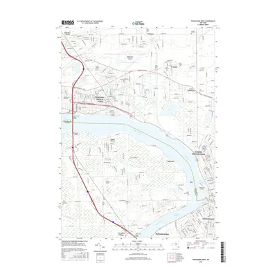
 1950 Tonawanda West1950 Print · USGSNiagara Falls and North Tonawanda are captured during a period of major post-war industrial and suburban growth. Researchers can trace the development of Cayuga Island, find local schools like Gratwick Sch, and locate family plots at White Haven Cem.
 - 1952 Map of Toronto, 1954 Print
 1952 Toronto1954 Print · USGSLake Ontario and the international border define this mid-century landscape of rapid industrial and suburban growth. Researchers can trace the vital shipping and rail corridors of the era, from the Welland Canal to the New York Central Railroad.
 - 1954 Map of Tonawanda West
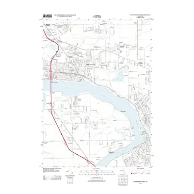
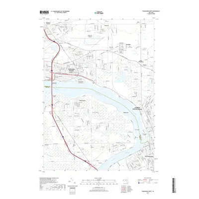
 1954 Tonawanda West1954 Print · USGSThe Niagara River corridor and Grand Island are captured during a mid-century period of industrial and suburban growth. Researchers can locate family landmarks like St Johnsburg, Holy Ghost Cem, and Bishop Duffy High Sch.
 - 1962 Map of Toronto, 1982 Print
 1962 Toronto1982 Print · USGSThe Golden Horseshoe and the Niagara Frontier meet in this early 1960s study of a growing international border region. Trace the path of the Welland Canal and locate land marks like the Scarborough Bluffs and Tuscarora Indian Reservation.
 - 1965 Map of Toronto
 1965 Toronto1965 Print · USGSThe Golden Horseshoe and Niagara Frontier are shown in detail during the early sixties, highlighting the international shipping and transit networks. Trace the path of the Erie Canal, the Welland Canal, and rail lines connecting Toronto and Niagara Falls.2 unique versions available
 - 1965 Map of Tonawanda West, 1967 Print
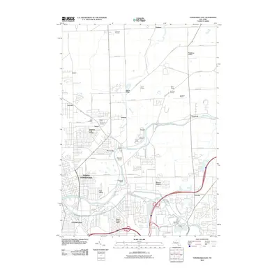
 1965 Tonawanda West1967 Print · USGSNiagara and Erie counties are captured here in the mid-sixties, a period of heavy industrial activity and Cold War aviation expansion. Researchers can trace family sites like Holy Ghost Cem or explore the massive layout of the Niagara Falls Air Force Base and the riverfront Buckhorn Island State Park.
 - 1965 Map of Tonawanda East, 1967 Print
 1965 Tonawanda East1967 Print · USGSNiagara County and northern Erie County are captured here in the mid-sixties, showing the industrial and residential expansion around the Erie Canal. Trace family roots and local history through landmarks like Wurlitzer Park Village, Beach Ridge, and St Pauls Ch.
 - 1980 Map of Tonawanda West
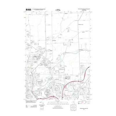
 1980 Tonawanda West1980 Print · USGSThe Niagara River frontier in the early 1980s reveals a landscape of heavy industry, military aviation, and growing suburbs. Researchers can trace historic cemeteries like Holy Ghost Cem, local schools such as Duffy High Sch, and the layout of Grand Island.
 - 1980 Map of Tonawanda East
 1980 Tonawanda East1980 Print · USGSNiagara and Erie counties meet at the historic canal in the early eighties as suburban growth reshapes the landscape. Genealogists and local historians can trace the development of North Tonawanda, the grounds of White Chapel Memorial Cem, and small hamlets like Wendelville.
 - 1984 Map of Lockport, 1985 Print
 1984 Lockport1985 Print · USGSWestern New York in the 1980s shows a landscape of lakefront parks, industrial rail corridors, and vast protected wetlands. Genealogists and historians can trace the legacy of local families through sites like Acacia Park Cem or the Tuscarora Indian Reservation.2 unique versions available
 - 2010 Map of Tonawanda West, 2010 Print
 2010 Tonawanda West2010 Print · USGSCovers North Tonawanda, including Niagara Falls, Tonawanda, and other nearby areas
 - 2010 Map of Tonawanda East, 2010 Print
 2010 Tonawanda East2010 Print · USGSCovers North Tonawanda, including Amherst, Tonawanda, and other nearby areas
 - 2013 Map of Tonawanda East, 2013 Print
 2013 Tonawanda East2013 Print · USGSCovers North Tonawanda, including Amherst, Tonawanda, and other nearby areas
 - 2013 Map of Tonawanda West, 2013 Print
 2013 Tonawanda West2013 Print · USGSCovers North Tonawanda, including Niagara Falls, Tonawanda, and other nearby areas
 - 2016 Map of Tonawanda East, 2016 Print
 2016 Tonawanda East2016 Print · USGSCovers North Tonawanda, including Amherst, Tonawanda, and other nearby areas
 - 2016 Map of Tonawanda West, 2016 Print
 2016 Tonawanda West2016 Print · USGSCovers North Tonawanda, including Niagara Falls, Tonawanda, and other nearby areas
 - 2019 Map of Tonawanda West, 2019 Print
 2019 Tonawanda West2019 Print · USGSCovers North Tonawanda, including Niagara Falls, Tonawanda, and other nearby areas
 - 2019 Map of Tonawanda East, 2019 Print
 2019 Tonawanda East2019 Print · USGSCovers North Tonawanda, including Amherst, Tonawanda, and other nearby areas
Showing maps 1-25
Top cities near North Tonawanda
- Buffalo historical maps
- Amherst historical maps
- Cheektowaga historical maps
- Tonawanda historical maps
- Niagara Falls historical maps
- West Seneca historical maps
See more
Top neighborhoods of North Tonawanda
- Park Village historical maps
- Sawyer historical maps
- Martinsville historical maps
- Wurlitzer Park Village historical maps
Frequently asked questions
- What are the different types of historical maps available for North Tonawanda?
- What is the oldest map of North Tonawanda?
- Where can I purchase historical maps of North Tonawanda for my home or office?
- Where can I download high-res historical maps of North Tonawanda?
- Are there historical topographic maps available for North Tonawanda?
- Is there historical aerial imagery available for North Tonawanda?
- Where are historical maps of North Tonawanda sourced from?