Old Maps of Trenton, New York for Academic Research
Study the evolution of Trenton with 51 high-resolution historic maps. Whether you're teaching, researching, or modeling changes in land use, these maps provide essential visual documentation of urban, environmental, and geographic change.
- Analyze long-term change: Track patterns in development, transportation, and natural features.
- Ideal for environmental or urban studies: Support academic projects with primary historical map data.
- Use in the classroom or lab: Educators and researchers rely on these maps to bring historical context to life.
These maps are a powerful tool for teaching, research, and visualizing how Trenton has changed over the decades.
Trenton, NY maps
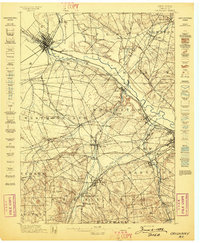
(51)- 1895 Map of Oriskany
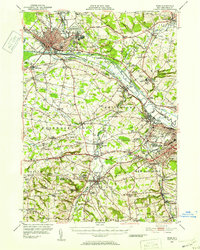
 1895 Oriskany1895 Print · USGSOneida County at the end of the nineteenth century reveals a landscape defined by the great Mohawk valley canals and emerging industrial hamlets. Researchers can trace the path of the Erie Canal, find the Franklin Iron Works, and locate early educational landmarks like College Hill.
 - 1897 Map of Remsen, 1958 Print
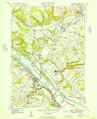
 1897 Remsen1958 Print · USGSOneida and Herkimer Counties are shown in the late 19th century as bustling timber and transit hubs before the modernization of the canal system. Local historians can trace the vital rail junctions at Remsen and the water-powered industrial sites like Bardwell Mill and Trenton Falls.
 - 1898 Map of Utica
 1898 Utica1898 Print · USGSThe Mohawk Valley was a powerhouse of industry and transport at the end of the Victorian era. Trace the path of the Erie Canal through Utica, or locate family homesteads near Barker Corners, Sheaf Corners, and Poland.
 - 1898 Map of Oriskany
 1898 Oriskany1898 Print · USGSOneida County at the close of the nineteenth century reveals a landscape defined by the intersection of the Erie Canal and major rail lines. Genealogists can trace family homes in Spencer Settlement, locate industrial sites like Hecla Works, or find the historic Oriskany Battle Monument.10 unique versions available
 - 1900 Map of Utica
 1900 Utica1900 Print · USGSThe Mohawk Valley was at its industrial peak at the turn of the century, anchored by the rail and canal nexus of Utica. Genealogists can trace family names through rural crossroads like Martin Corners and Brayton Corners, or follow the industrial sprawl of the Erie Canal into Ilion.9 unique versions available
 - 1900 Map of Remsen
 1900 Remsen1900 Print · USGSOneida and Herkimer Counties at the turn of the century show a landscape shaped by the rail-and-canal economy. Genealogists can trace family roots through settlements like Remsen, Hinckley, and Trenton Falls or locate industrial sites such as Bardwell Mill.9 unique versions available
 - 1904 Map of Boonville
 1904 Boonville1904 Print · USGSOneida County at the start of the twentieth century was defined by its water and rail networks, dominated by the Black River Canal and the N. Y. C. and H. R. R. R. Trace the early layout of Boonville and rural settlements like Westernville or North Western.6 unique versions available
 - 1945 Map of South Trenton
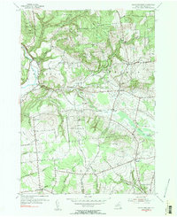
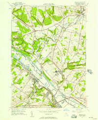
 1945 South Trenton1945 Print · USGSOneida County at the end of the war shows a landscape of upland farms and essential early infrastructure. Genealogists and local historians can trace family-named roads like Miller Road and Cruikshank Road, or locate historic sites including Salem Church and the Broadacres Sanatorium.
 - 1946 Map of Hinckley
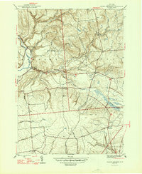
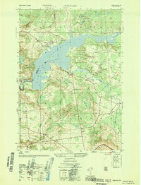 1946 Hinckley1946 Print · USGSUpper Herkimer County in the mid-1940s is defined by the winding waters of the Hinckley Reservoir and the rural crossroads of the Adirondack foothills. Researchers can locate vanished rural landmarks like School No. 4 and the Century Cem, or trace the old roads through Partyville Corners and Grant.4 unique versions available
 - 1946 Map of Remsen
 1946 Remsen1946 Print · USGSOneida County at the mid-century reveals a landscape of Welsh chapels and early hydro-power along the West Canada Creek. Researchers can locate family sites near Trenton Barneveld P O or trace the legacy of the Baron Von Steuben Monument.
 - 1947 Map of Remsen
 1947 Remsen1947 Print · USGSOneida County in the late nineteen-forties shows a landscape of Welsh chapels, hydroelectric power, and deep-rooted rail history. Genealogists can trace family lines through Sixty Cem and Capel Ysaf Cem, or locate the historic Trenton Barneveld P O and Barneveld Sta.2 unique versions available
 - 1947 Map of North Western
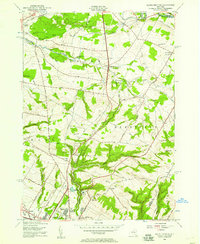
 1947 North Western1947 Print · USGSOneida County's uplands and river valleys are frozen in time just after the war, showing a network of small hamlets and family farms. Local historians can trace early school sites like South Hill Sch and numerous burial grounds including PENN MTN CEM and WARD CEM.2 unique versions available
 - 1947 Map of Hinckley
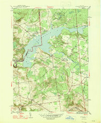 1947 Hinckley1947 Print · USGSThe foothills of the southwest Adirondacks come alive in the mid-forties, centered on the sprawling waters of Hinckley Reservoir. Researchers can trace rural life through vanished schoolhouses like School No 4 and local burials at Century Cem and Gravesville Cem.2 unique versions available
 - 1947 Map of Rome, 1952 Print
 1947 Rome1952 Print · USGSMid-century Oneida County is captured here during the height of its industrial and military significance. Researchers can trace the paths of the Old Erie Canal, locate family roots near St Johns Cem, or study the grounds of Hamilton College.3 unique versions available
 - 1949 Map of Oriskany
 1949 Oriskany1949 Print · USGSOneida County in the late 1940s reveals a landscape shaped by the Mohawk River and the historic canal systems. Local historians can trace the paths of the Erie Canal, find family burial sites at Townsend Cem, and locate the Oriskany Battle Mon.
 - 1950 Map of Utica, 1951 Print
 1950 Utica1951 Print · USGSCentral New York in the post-war era showcases the industrial Mohawk Valley and the pristine Adirondack interior. Researchers can trace transportation networks like the New York Central Railroad and find early Cold War sites such as Griffiss Air Force Base.
 - 1955 Map of North Western, 1957 Print
 1955 North Western1957 Print · USGSOneida County's rural uplands are shown in detail during the mid-1950s, highlighting the transition between valley farms and state woodlands. You can locate family burial grounds like Carmichael Hill Cem and Steuben Cem or trace old school sites such as Gifford Hill Sch.2 unique versions available
 - 1955 Map of South Trenton, 1957 Print
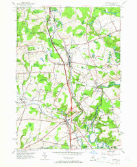
 1955 South Trenton1957 Print · USGSThe northern outskirts of Utica meet the rising hills of Oneida County in the mid-fifties, showing a landscape defined by both water and wire. Researchers can trace historic family corridors along Stage Road, locate Salem Ch, or find the grounds of the Broadacres Sanatorium.2 unique versions available
 - 1955 Map of Oriskany, 1957 Print
 1955 Oriskany1957 Print · USGSThe Mohawk Valley in the mid-1950s shows a dense intersection of industrial history and Cold War-era expansion. Local historians can trace the path of the Erie Canal past Oriskany or locate the U S Mil Res Floyd Test Site and the State Hospital.2 unique versions available
 - 1955 Map of Remsen, 1957 Print
 1955 Remsen1957 Print · USGSOneida County's landscape is captured here in the mid-fifties, showing the intersection of the New York Central rail lines and the waters of West Canada Creek. Genealogists can locate many local burial sites and churches, including Capel Isaf Cemetery, Enlli Ch Cemetery, and Penn-Y-Bryn Church.4 unique versions available
 - 1957 Map of Utica
 1957 Utica1957 Print · USGSCentral New York and the Adirondack foothills are captured here in the mid-fifties, showing a landscape defined by the Mohawk River corridor and the growing highway system. Genealogists and researchers can trace the rail lines of the New York Central and locate communities from Lowville to Gloversville.
 - 1962 Map of Utica
 1962 Utica1962 Print · USGSCentral New York and the Adirondack wilderness are captured here during the mid-century era of highway and industrial expansion. Genealogists and historians can trace the development of the New York State Thruway and local rail lines connecting Utica, Rome, and Gloversville.3 unique versions available
 - 1964 Map of Utica
 1964 Utica1964 Print · USGSCentral New York and the high wilderness of the Adirondacks are captured here during the post-war era of infrastructure expansion. Researchers can trace the development of the New York State Thruway alongside historic corridors like the Oneida Lake (Barge Canal Route) and the N. Y. Central railroad.
 - 1967 Map of Utica
 1967 Utica1967 Print · USGSCentral New York's industrial Mohawk Valley meets the Adirondack wilderness in the 1960s, showing the region's transition from manufacturing hubs to state-managed parklands. Trace historic settlements and sites like Griffiss Air Force Base, Colgate University, and the Lyons Falls Paper Mill.
 - 1983 Map of South Trenton
 1983 South Trenton1983 Print · USGSThe rural highlands of Oneida County meet the growing suburbs of Utica in the early eighties. Researchers can trace family history through South Trenton and Holland Patent, or locate lost landmarks like the Drive-in Theater and Horatio Mall.
Showing maps 1-25 of 51
Top cities near Trenton
- Utica historical maps
- Rome historical maps
- New Hartford historical maps
- Whitestown historical maps
- Kirkland historical maps
- Herkimer historical maps
See more
Top neighborhoods of Trenton
- South Trenton historical maps
- Mapledale historical maps
- Hinckley historical maps
- Trenton Falls historical maps
- Holland Patent historical maps
- Barneveld historical maps
See more
Frequently asked questions
- What are the different types of historical maps available for Trenton?
- What is the oldest map of Trenton?
- Where can I purchase historical maps of Trenton for my home or office?
- Where can I download high-res historical maps of Trenton?
- Are there historical topographic maps available for Trenton?
- Is there historical aerial imagery available for Trenton?
- Where are historical maps of Trenton sourced from?