Old Maps of Skaneateles, New York
Explore 28 old maps of Skaneateles, spanning from 1899 to today. These high-resolution historic maps reveal how streets, neighborhoods, landmarks, and natural features evolved over time — perfect for genealogy, metal detecting, research, and local history exploration.
What you can do with these maps:
- See how Skaneateles changed over time: Compare historical maps to modern-day views to trace roads, homesites, rail lines & more.
- View detailed metadata: Each map includes creators, publishers, year, scale, and archive source.
- Overlay maps with satellite & LiDAR: Visualize the past alongside modern tools to explore terrain & human change.
- Trusted historical sources: Maps sourced from the USGS, Library of Congress, and other archives.
- Access maps your way: View online, download high-res files, or order prints for personal or research use.
Start exploring old maps of Skaneateles to uncover forgotten places, hidden landmarks, and the deep history beneath your feet.
Skaneateles, NY maps
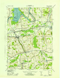
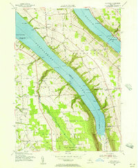
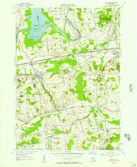
(28)- 1899 Map of Skaneateles
 1899 Skaneateles1899 Print · USGSCovers Skaneateles, including Onondaga, Marcellus, and other nearby areas
 - 1900 Map of Baldwinsville
 1900 Baldwinsville1900 Print · USGSCovers Skaneateles, including Clay, Salina, and other nearby areas9 unique versions available
 - 1902 Map of Skaneateles
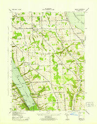
 1902 Skaneateles1902 Print · USGSCovers Skaneateles, including Onondaga, Marcellus, and other nearby areas9 unique versions available
 - 1943 Map of Jordan
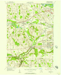
 1943 Jordan1943 Print · USGSCovers Skaneateles, including Camillus, Lysander, and other nearby areas
 - 1943 Map of Spafford
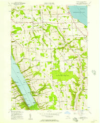
 1943 Spafford1943 Print · USGSCovers Skaneateles, including Moravia, Otisco, and other nearby areas
 - 1943 Map of Owasco
 1943 Owasco1943 Print · USGSCovers Skaneateles, including Owasco, Moravia, and other nearby areas2 unique versions available
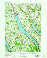
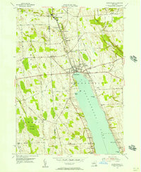
 - 1943 Map of Skaneateles
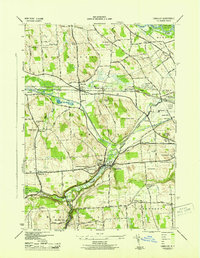
 1943 Skaneateles1943 Print · USGSCovers Skaneateles, including Owasco, Sennett, and other nearby areas
 - 1943 Map of Marcellus
 1943 Marcellus1943 Print · USGSCovers Skaneateles, including Onondaga, Marcellus, and other nearby areas
 - 1943 Map of Camillus, 1951 Print
 1943 Camillus1951 Print · USGSCovers Skaneateles, including Salina, Camillus, and other nearby areas3 unique versions available
 - 1949 Map of Skaneateles
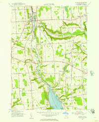
 1949 Skaneateles1949 Print · USGSCovers Skaneateles, including Owasco, Sennett, and other nearby areas
 - 1950 Map of Elmira
 1950 Elmira1950 Print · USGSCovers Skaneateles, including Syracuse, Union, and other nearby areas2 unique versions available
 - 1955 Map of Marcellus, 1957 Print
 1955 Marcellus1957 Print · USGSCovers Skaneateles, including Onondaga, Marcellus, and other nearby areas4 unique versions available
 - 1955 Map of Spafford, 1957 Print
 1955 Spafford1957 Print · USGSCovers Skaneateles, including Moravia, Otisco, and other nearby areas2 unique versions available
 - 1955 Map of Skaneateles, 1957 Print
 1955 Skaneateles1957 Print · USGSCovers Skaneateles, including Onondaga, Marcellus, and other nearby areas2 unique versions available
 - 1955 Map of Camillus, 1957 Print
 1955 Camillus1957 Print · USGSCovers Skaneateles, including Salina, Camillus, and other nearby areas2 unique versions available
 - 1955 Map of Owasco, 1957 Print
 1955 Owasco1957 Print · USGSCovers Skaneateles, including Owasco, Moravia, and other nearby areas3 unique versions available
 - 1955 Map of Jordan, 1957 Print
 1955 Jordan1957 Print · USGSCovers Skaneateles, including Camillus, Lysander, and other nearby areas2 unique versions available
 - 1955 Map of Skaneateles, 1957 Print
 1955 Skaneateles1957 Print · USGSCovers Skaneateles, including Owasco, Sennett, and other nearby areas3 unique versions available
 - 1957 Map of Baldwinsville, 1961 Print
 1957 Baldwinsville1961 Print · USGSCovers Skaneateles, including Clay, Salina, and other nearby areas
 - 1958 Map of Elmira
 1958 Elmira1958 Print · USGSCovers Skaneateles, including Syracuse, Union, and other nearby areas2 unique versions available
 - 1960 Map of Rochester
 1960 Rochester1960 Print · USGSCovers Skaneateles, including Rochester, Syracuse, and other nearby areas2 unique versions available
 - 1961 Map of Rochester, 1973 Print
 1961 Rochester1973 Print · USGSCovers Skaneateles, including Rochester, Syracuse, and other nearby areas3 unique versions available
 - 1962 Map of Elmira, 1969 Print
 1962 Elmira1969 Print · USGSCovers Skaneateles, including Syracuse, Union, and other nearby areas4 unique versions available
 - 1965 Map of Rochester
 1965 Rochester1965 Print · USGSCovers Skaneateles, including Rochester, Syracuse, and other nearby areas
 - 1965 Map of Elmira
 1965 Elmira1965 Print · USGSCovers Skaneateles, including Syracuse, Union, and other nearby areas
Showing maps 1-25 of 28
Top cities near Skaneateles
- Syracuse historical maps
- Clay historical maps
- Salina historical maps
- Auburn historical maps
- Camillus historical maps
- Lysander historical maps
See more
Top neighborhoods of Skaneateles
- Skanondaga Heights historical maps
- Shamrock historical maps
- Mandana historical maps
- Marysville historical maps
- Mottville historical maps
- Shepard Settlement historical maps
See more
Frequently asked questions
- What are the different types of historical maps available for Skaneateles?
- What is the oldest map of Skaneateles?
- Where can I purchase historical maps of Skaneateles for my home or office?
- Where can I download high-res historical maps of Skaneateles?
- Are there historical topographic maps available for Skaneateles?
- Is there historical aerial imagery available for Skaneateles?
- Where are historical maps of Skaneateles sourced from?