1950s Maps of Skaneateles, New York
Explore 10 historic maps of Skaneateles from the 1950s. These maps offer a rare glimpse into what life looked like during the 1950s — showing old roads, neighborhoods, homes, and landmarks that have changed or disappeared over time.
Whether you're researching your family's past, planning a metal detecting trip, or studying how Skaneateles's landscape evolved across the 1950s, these high-resolution maps are a powerful tool for exploring the history of this region.
- Focus on a specific era: All maps on this page are from the 1950s, giving you a focused view of this time period.
- See what’s changed: Compare century-old streets, trails, and buildings to today's modern landscape using overlays and satellite layers.
- Research with precision: Use these maps for genealogy, historical research, land use analysis, or educational projects.
- View, download, or print: Maps are fully viewable online in high resolution, and can be downloaded or printed for your own records.
Start exploring Skaneateles's history through authentic maps from the 1950s. This is your window into the past.
Skaneateles, NY maps
(10)- 1950 Map of Elmira
 1950 Elmira1950 Print · USGSThe Finger Lakes region thrived in the late 1940s as a hub of industry and transport. Trace family roots and vanished landmarks near Seneca Lake or explore the rail lines of the Erie RR and the sprawling Seneca Ordnance Depot.2 unique versions available
 - 1955 Map of Marcellus, 1957 Print
 1955 Marcellus1957 Print · USGSOnondaga County in the mid-fifties remains a landscape of historic turnpikes and clustered villages centered around the Marcellus valley. Researchers can trace ancestral roots through numerous rural landmarks like St Francis Cem, Rockwell Springs, and the northern shoreline of Otisco Lake.4 unique versions available
 - 1955 Map of Spafford, 1957 Print
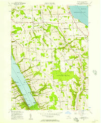
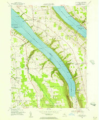 1955 Spafford1957 Print · USGSThe high ridges between Skaneateles and Otisco Lakes are captured here in the mid-fifties as reforestation efforts began reclaiming former farmland. Genealogists and researchers can trace the locations of Borodino Cem, Gamble Mill, and several historic schoolhouses.2 unique versions available
 - 1955 Map of Skaneateles, 1957 Print
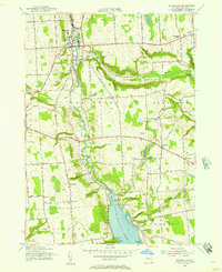
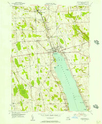
 1955 Skaneateles1957 Print · USGSThe Finger Lakes region of Central New York is shown here in the mid-fifties, centered on the deep waters of Skaneateles Lake. Researchers can trace the industrial Skaneateles Short Line Railroad or locate local landmarks like Twelve Corners Sch and St Marys Cem.2 unique versions available
 - 1955 Map of Camillus, 1957 Print
 1955 Camillus1957 Print · USGSMid-century Onondaga County is captured here as suburban growth begins to reach outward from the Syracuse area into the hill country. Researchers can trace historic transport routes including the Old Erie Canal and old crossroads at Martisco, Memphis, and Howlett Hill.2 unique versions available
 - 1955 Map of Owasco, 1957 Print
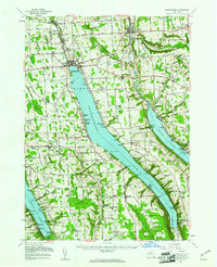
 1955 Owasco1957 Print · USGSThe Finger Lakes uplands of Cayuga County are captured here in the mid-1950s, stretching between the shores of Owasco Lake and Skaneateles Lake. Genealogists can trace early family sites at Globe Hotel Corners and several rural burial grounds like Conklin Cemetery and Twelve Corners Cemetery.3 unique versions available
 - 1955 Map of Jordan, 1957 Print
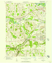
 1955 Jordan1957 Print · USGSOnondaga County in the mid-fifties shows a landscape of canal-era villages and vital rail connections during the early years of the Thruway. Researchers can locate the Skaneateles Junction, trace the Erie Canal through Jordan, and find family sites near Maple Grove Cem.2 unique versions available
 - 1955 Map of Skaneateles, 1957 Print
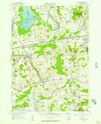
 1955 Skaneateles1957 Print · USGSSkaneateles and its northern industrial corridor are shown in detail during the mid-fifties. You can trace the path of the Skaneateles Short Line RR and locate local landmarks like Baptist Corners, Shepard Settlement, and Lakeview Cem.3 unique versions available
 - 1957 Map of Baldwinsville, 1961 Print
 1957 Baldwinsville1961 Print · USGSBaldwinsville and the river-rife lands of Onondaga County are shown here in the late fifties as the New York State Thruway began to reshape travel. Genealogists and local historians can locate many rural burial grounds, including Kingdom Cem and Elbridge Rural Cem, alongside the industrial lines of the Lackawanna Railroad.
 - 1958 Map of Elmira
 1958 Elmira1958 Print · USGSThe New York Finger Lakes during the late fifties reveal a complex landscape of glacial geology and industrial growth. Researchers can trace historic transport corridors like the Erie Canal and Erie RR, or locate institutional landmarks like Cornell University.2 unique versions available
End of results
Showing maps 1-10 of 10
Top cities near Skaneateles
- Syracuse historical maps
- Clay historical maps
- Salina historical maps
- Auburn historical maps
- Camillus historical maps
- Lysander historical maps
See more
Top neighborhoods of Skaneateles
- Marysville historical maps
- Mottville historical maps
- Shepard Settlement historical maps
- Skaneateles Falls historical maps
- Willow Glen historical maps
- Winding Ways historical maps
See more
Frequently asked questions
- What are the different types of historical maps available for Skaneateles?
- What is the oldest map of Skaneateles?
- Where can I purchase historical maps of Skaneateles for my home or office?
- Where can I download high-res historical maps of Skaneateles?
- Are there historical topographic maps available for Skaneateles?
- Is there historical aerial imagery available for Skaneateles?
- Where are historical maps of Skaneateles sourced from?