1960s Maps of Wallkill, New York
Explore 5 historic maps of Wallkill from the 1960s. These maps offer a rare glimpse into what life looked like during the 1960s — showing old roads, neighborhoods, homes, and landmarks that have changed or disappeared over time.
Whether you're researching your family's past, planning a metal detecting trip, or studying how Wallkill's landscape evolved across the 1960s, these high-resolution maps are a powerful tool for exploring the history of this region.
- Focus on a specific era: All maps on this page are from the 1960s, giving you a focused view of this time period.
- See what’s changed: Compare century-old streets, trails, and buildings to today's modern landscape using overlays and satellite layers.
- Research with precision: Use these maps for genealogy, historical research, land use analysis, or educational projects.
- View, download, or print: Maps are fully viewable online in high resolution, and can be downloaded or printed for your own records.
Start exploring Wallkill's history through authentic maps from the 1960s. This is your window into the past.
Wallkill, NY maps
(5)- 1962 Map of Scranton, 1977 Print
 1962 Scranton1977 Print · USGSThe industrial heart of eastern Pennsylvania and the New York Catskills are captured here in the early sixties. Genealogists and historians can trace the dense valley settlements from Scranton to Wilkes-Barre and the rail lines of the Erie Lackawanna Railroad.2 unique versions available
 - 1965 Map of Scranton
 1965 Scranton1965 Print · USGSThe tri-state highlands of Pennsylvania, New York, and New Jersey come alive in the mid-sixties as industry and recreation converge. Trace the intricate rail lines of the Erie Lackawanna RR or locate landmarks like the U S Military Academy.2 unique versions available
 - 1969 Map of Otisville, 1971 Print
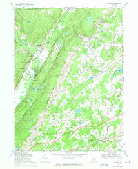 1969 Otisville1971 Print · USGSOrange and Sullivan Counties are shown in the late sixties as the ridge of the Shawangunk Mountains separates the Neversink and Shawangunk valleys. Genealogists and historians can locate the State Training School for Boys, Mount Hope Cem, and several old hamlets along the Erie Lackawanna Railroad.2 unique versions available
 - 1969 Map of Middletown, 1971 Print
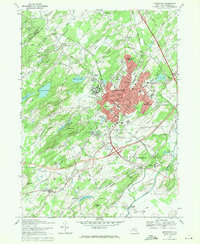 1969 Middletown1971 Print · USGSOrange County's urban and agricultural mix is on full display here in the late sixties. Genealogists and historians can trace the grounds of the State Hospital, find Randall Airport, and locate family names in Hillside Cemetery.2 unique versions available
 - 1969 Map of Wurtsboro, 1971 Print
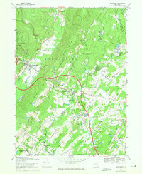 1969 Wurtsboro1971 Print · USGSSullivan and Orange County settlements are captured here in the late sixties, showing the alignment of the Shawangunk Mountains and the Basher Kill valley. Genealogists can locate family landmarks like Stanton Memorial Cem or the Chase Sch near Wurtsboro.3 unique versions available
End of results
Showing maps 1-5 of 5
Top cities near Wallkill
- Kiryas Joel historical maps
- Palm Tree historical maps
- Warwick historical maps
- Middletown historical maps
- New Windsor historical maps
- Vernon Township historical maps
See more
Top neighborhoods of Wallkill
- Crystal Run Station historical maps
- Stony Ford Station historical maps
- Fair Oaks historical maps
- Circleville historical maps
- Midway Park historical maps
- Rockville historical maps
See more
Frequently asked questions
- What are the different types of historical maps available for Wallkill?
- What is the oldest map of Wallkill?
- Where can I purchase historical maps of Wallkill for my home or office?
- Where can I download high-res historical maps of Wallkill?
- Are there historical topographic maps available for Wallkill?
- Is there historical aerial imagery available for Wallkill?
- Where are historical maps of Wallkill sourced from?