Old Maps of Pittsfield, New York for Academic Research
Study the evolution of Pittsfield with 37 high-resolution historic maps. Whether you're teaching, researching, or modeling changes in land use, these maps provide essential visual documentation of urban, environmental, and geographic change.
- Analyze long-term change: Track patterns in development, transportation, and natural features.
- Ideal for environmental or urban studies: Support academic projects with primary historical map data.
- Use in the classroom or lab: Educators and researchers rely on these maps to bring historical context to life.
These maps are a powerful tool for teaching, research, and visualizing how Pittsfield has changed over the decades.
Pittsfield, NY maps
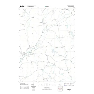
(37)- 1910 Map of Hartwick, 1953 Print
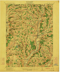
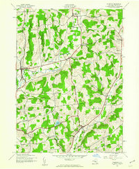
 1910 Hartwick1953 Print · USGSOtsego County's rural landscape is meticulously detailed during the early twentieth century, showing a world of hillside farms and valley hamlets. Genealogists and historians can trace old homesteads and transport routes like the O & W RR near Mt Vision and South Hartwick.
 - 1910 Map of New Berlin, 1963 Print
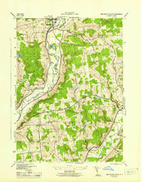
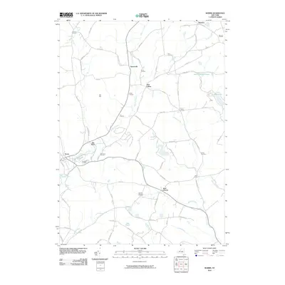
 1910 New Berlin1963 Print · USGSThe Unadilla and Chenango river valleys are seen here in the early twentieth century as established rail corridors and farming hubs. Researchers can trace the N Y O & W R R line through Holmesville or locate family sites like Kings Settlement and the Dimmick Hollow School.
 - 1912 Map of New Berlin
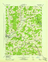
 1912 New Berlin1912 Print · USGSChenango County's river valleys and dairy uplands are meticulously captured in this pre-war survey of the New Berlin area. Genealogists can locate family-named landmarks and institutions like Columbus Hill Church, Kings Settlement, and the Dimmick Hollow School.4 unique versions available
 - 1912 Map of Hartwick
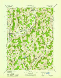
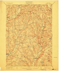 1912 Hartwick1912 Print · USGSOtsego County's rural heartland is captured here at the height of its rail-and-river economy in the years before the Great War. Genealogists can trace family homesteads near Burlington Flats, New Lisbon, and the tracks of the O & H Electric line.4 unique versions available
 - 1943 Map of New Berlin North, 1957 Print
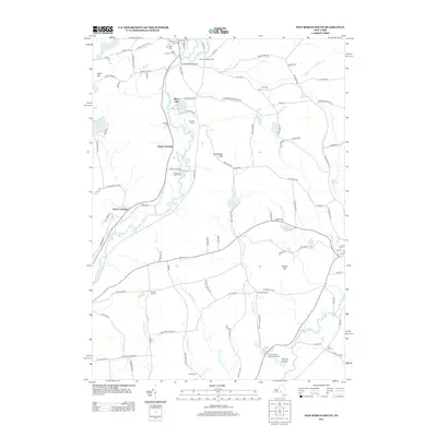
 1943 New Berlin North1957 Print · USGSChenango and Otsego counties meet along the river in the 1940s, showing a landscape of interconnected valley farms and upland hamlets. Genealogists can trace family sites like Lloyd Cem and Perkinsons Cem or follow the Unadilla Valley River rail line.4 unique versions available
 - 1943 Map of New Berlin South, 1960 Print
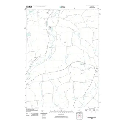
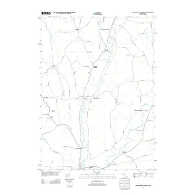
 1943 New Berlin South1960 Print · USGSOtsego and Chenango Counties are captured here in the early 1940s, showcasing a rural landscape of river valleys and upland hill farms. Researchers can trace the old school districts at Deming Sch or Wheeler Sch and locate local landmarks like Collier Bridge.3 unique versions available
 - 1943 Map of Morris, 1960 Print
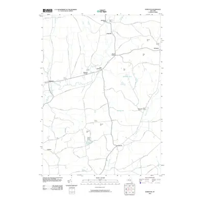
 1943 Morris1960 Print · USGSOtsego County during the early 1940s reveals a landscape of high ridges and winding creek valleys dotted with family homesteads and rural hamlets. Researchers can locate numerous historic burial sites like Old Church Cem and trace the early development of Gilbert Lake State Park.3 unique versions available
 - 1943 Map of Edmeston, 1960 Print
 1943 Edmeston1960 Print · USGSThis Otsego County landscape during the early 1940s shows a classic New York dairy and farming region defined by creek-side hamlets and hill farms. Researchers can locate many family sites via Union Cem, School No 12, and settlements like Burlington Flats.3 unique versions available
 - 1945 Map of New Berlin South
 1945 New Berlin South1945 Print · USGSThe Unadilla River valley in the mid-1940s reveals a landscape of upland farms and small rail crossings. Genealogists and local historians can trace family-named sites like Scribner Cem, the New York Ontario and Western RR, and rural schoolhouses including Deming Sch.
 - 1945 Map of Morris
 1945 Morris1945 Print · USGSOtsego County's rural valleys and hill farms are captured here just after the war, centered on the village of Morris. Researchers can locate numerous family burial grounds like Lull Cem and trace the original footprints of hamlets like New Lisbon and Welcome.
 - 1945 Map of New Berlin North
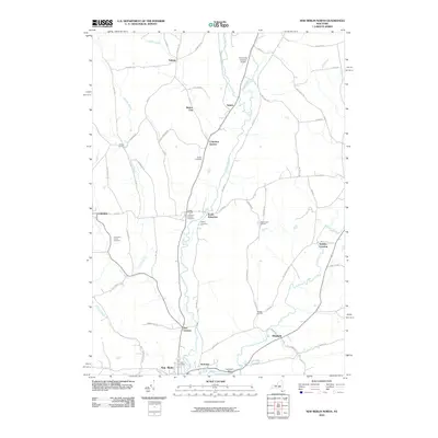
 1945 New Berlin North1945 Print · USGSThe Unadilla River valley during the mid-forties shows a landscape of tightly-knit farm communities and rural crossroads. Genealogists and local historians can trace family locations through numerous sites like Lloyd Cem, Tallette, and Amblers Crossing.
 - 1945 Map of Edmeston
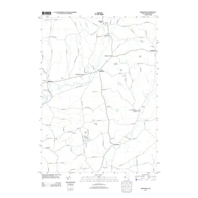
 1945 Edmeston1945 Print · USGSOtsego County's rural character is preserved here in the mid-1940s, showing the settled valleys of the Pittsfield and Burlington areas. Genealogists can trace family roots through sites like Quaker Cem, Gross Hill Sch, and hamlets like Garrattsville.
 - 1948 Map of Binghamton, 1980 Print
 1948 Binghamton1980 Print · USGSCentral New York and the Southern Tier thrive in the late 1940s as a hub of rail traffic and mountain industry. Researchers can trace historic transit lines like the Erie Railroad through Binghamton or find old valley settlements near Oneonta and Delhi.
 - 1950 Map of Binghamton
 1950 Binghamton1950 Print · USGSBinghamton and the surrounding Southern Tier are shown in the mid-century era, highlighting the intricate rail and river networks that drove local industry. Researchers can trace the path of the Erie Railroad and locate landmarks from Otsego Lake to Sidney Mountain.2 unique versions available
 - 1958 Map of Binghamton
 1958 Binghamton1958 Print · USGSCentral New York in the late fifties was a network of manufacturing cities and river valleys connected by vital rail lines. Genealogists and historians can trace family roots in Oneonta, Norwich, and Cooperstown or locate long-standing farms along Schoharie Creek.
 - 1963 Map of Binghamton
 1963 Binghamton1963 Print · USGSThe Southern Tier and Catskill peaks are shown in the early sixties as new reservoirs reshaped the valleys. Trace historic rail corridors like the Erie Lackawanna RR and explore lakeside settlements such as Cooperstown and Oneonta.
 - 1986 Map of Norwich
 1986 Norwich1986 Print · USGSCentral New York in the mid-eighties was a landscape of deep river valleys and university towns connected by historic rail corridors and state highways. Researchers can trace the rural infrastructure of Norwich and Hamilton, finding landmarks like Colgate University and the Seventh Day Hollow Church.2 unique versions available
 - 2010 Map of Edmeston, 2010 Print
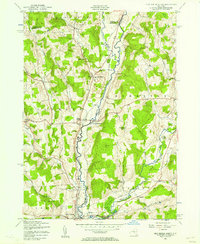
 2010 Edmeston2010 Print · USGSCovers Pittsfield, including Edmeston, New Lisbon, and other nearby areas
 - 2010 Map of New Berlin South, 2010 Print
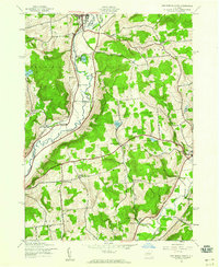
 2010 New Berlin South2010 Print · USGSCovers Pittsfield, including New Berlin, Morris, and other nearby areas
 - 2010 Map of New Berlin North, 2010 Print
 2010 New Berlin North2010 Print · USGSCovers Pittsfield, including New Berlin, Brookfield, and other nearby areas
 - 2010 Map of Morris, 2010 Print
 2010 Morris2010 Print · USGSCovers Pittsfield, including Otego, Laurens, and other nearby areas
 - 2013 Map of Morris, 2013 Print
 2013 Morris2013 Print · USGSCovers Pittsfield, including Otego, Laurens, and other nearby areas
 - 2013 Map of Edmeston, 2013 Print
 2013 Edmeston2013 Print · USGSCovers Pittsfield, including Edmeston, New Lisbon, and other nearby areas
 - 2013 Map of New Berlin South, 2013 Print
 2013 New Berlin South2013 Print · USGSCovers Pittsfield, including New Berlin, Morris, and other nearby areas
 - 2013 Map of New Berlin North, 2013 Print
 2013 New Berlin North2013 Print · USGSCovers Pittsfield, including New Berlin, Brookfield, and other nearby areas
Showing maps 1-25 of 37
Top cities near Pittsfield
- Oneonta historical maps
- Hamilton historical maps
- Oneonta historical maps
- Unadilla historical maps
- Sherburne historical maps
- Otsego historical maps
See more
Top neighborhoods of Pittsfield
Frequently asked questions
- What are the different types of historical maps available for Pittsfield?
- What is the oldest map of Pittsfield?
- Where can I purchase historical maps of Pittsfield for my home or office?
- Where can I download high-res historical maps of Pittsfield?
- Are there historical topographic maps available for Pittsfield?
- Is there historical aerial imagery available for Pittsfield?
- Where are historical maps of Pittsfield sourced from?