Old Maps of Queens County, New York for Metal Detecting
Plan your next treasure hunt with 129 historic maps of Queens County. Find old homesites, ghost towns, trails, and gathering spots that may be lost to time — perfect for identifying promising metal detecting locations.
- Locate forgotten sites: Uncover places like long-lost settlements, abandoned rail lines, or gathering spots.
- Plan better hunts: Use map overlays combined with LiDAR or satellite views to narrow in on historically rich areas.
- Made for detectorists: Thousands of hobbyists use these maps to discover relics, coins, and hidden history.
Use these historic maps to boost your research and find new opportunities beneath the surface of Queens County.
Queens County, NY maps
(129)- 1889 Map of Brooklyn
 1889 Brooklyn1889 Print · USGSBrooklyn and Queens are shown here in the late nineteenth century as urban grids began to overtake the old farm townships. Genealogists and historians can trace defunct rail lines and early settlements like Winfield Junction, Hollis, and Canarsie Landing.
 - 1891 Map of Brooklyn
 1891 Brooklyn1891 Print · USGSThe Brooklyn and Queens landscape of the early 1890s is captured here at a moment of intense rail-driven growth. Researchers can trace the original shoreline of Jamaica Bay and locate family history in the Navy Yard or at Evergreen Cemetery.
 - 1891 Map of Harlem
 1891 Harlem1891 Print · USGSUpper Manhattan and the Bronx met the burgeoning towns of Westchester and Bergen County in the late 1800s. Researchers can trace the path of the Croton Aqueduct, locate the historic site of Bulls Ferry, and explore the early rail-connected villages of Schraalenburgh and Pelhamville.
 - 1897 Map of Harlem, 1956 Print
 1897 Harlem1956 Print · USGSUpper Manhattan and Westchester thrive at the end of the nineteenth century as rail lines and reservoirs reshape the landscape. Trace early neighborhoods and landmarks like Schraalenburg, Woodlawn Cemetery, and the Jerome Park Reservoir.4 unique versions available
 - 1897 Map of Brooklyn, 1959 Print
 1897 Brooklyn1959 Print · USGSBrooklyn and Queens are captured in the late nineteenth century as rural townships began their rapid transformation into a dense urban landscape. Genealogists can locate family plots in Greenwood Cemetery or trace early neighborhood origins in New Utrecht and Flatbush.3 unique versions available
 - 1897 Map of Hempstead, 1961 Print
 1897 Hempstead1961 Print · USGSNassau County's transition from rural townships to a suburban rail corridor is captured here at the end of the nineteenth century. Genealogists and historians can trace the early footprints of Garden City, find the Camp Meeting Grounds, or locate coastal landmarks like the Long Beach Life Saving Station.
 - 1897 Map of Oyster Bay, 1963 Print
 1897 Oyster Bay1963 Print · USGSThe North Shore and Westchester coastline are captured here in the late nineteenth century as maritime trade and rail travel transformed the region. Researchers can trace the early layouts of Sea Cliff, Port Washington, and Larchmont alongside historic navigation aids like Sands Point Light.
 - 1898 Map of Harlem
 1898 Harlem1898 Print · USGSThe northern reaches of the city and its surrounding suburbs are shown in late-Victorian detail as rail lines expanded across the Hudson. Researchers can trace the early layouts of Woodlawn Cemetery, the site of Grants Tomb, and the fortifications at Fort Schuyler.
 - 1898 Map of Hempstead
 1898 Hempstead1898 Print · USGSNassau County's south shore is meticulously detailed in the 1890s, showing a landscape of burgeoning rail suburbs and intricate salt marshes. Genealogists and historians can trace early settlements like Christian Hook, find family Cem. sites, and locate vanished landmarks such as the Camp Meeting Grounds.
 - 1898 Map of Staten Island
 1898 Staten Island1898 Print · USGSGreater Staten Island and the industrial shores of New Jersey are captured during the peak of the Victorian maritime era. Genealogists can trace early neighborhood boundaries and landmarks like Moravian Cemetery, the Morris Canal, and the vanished industry of Linoleumville.
 - 1898 Map of Brooklyn
 1898 Brooklyn1898 Print · USGSBrooklyn and Queens at the close of the nineteenth century reveal a landscape of growing commuter suburbs and vast, untouched tidal marshes. Genealogists and historians can trace old property boundaries near Greenwood Cemetery or follow the early rail lines through Winfield Junction and Jamaica.
 - 1898 Map of Oyster Bay
 1898 Oyster Bay1898 Print · USGSNassau County and the Westchester shoreline are shown in detail at the end of the century, before the massive population shifts of the next century. Genealogists and maritime historians can trace the early village footprints of Sea Cliff and Oyster Bay, or locate historical markers like the Sands Point Light.
 - 1899 Map of Hempstead
 1899 Hempstead1899 Print · USGSThe South Shore of Long Island at the end of the century shows a landscape transitioning from rural townships to connected rail suburbs. Trace early settlement patterns in Hempstead and Rockville Center, or explore the old marshes around Haunts Creek and Barnum Id.
 - 1900 Map of Passaic
 1900 Passaic1900 Print · USGSNorthern New Jersey and the New York Harbor are captured here at the close of the nineteenth century, showing a landscape defined by rail, river, and coastal defense. Researchers can trace the original path of the Morris Canal, locate Seton Hall College, and explore the batteries at Fort Wadsworth.
 - 1900 Map of Staten Island
 1900 Staten Island1900 Print · USGSThe New York and New Jersey harbor comes alive in the late Victorian era, showing Staten Island when small villages and defensive forts still defined the coastline. Trace family roots and vanished landmarks through Fort Wadsworth, the Morris Canal, and historic settlements like Rossville or Tottenville.10 unique versions available
 - 1900 Map of Harlem
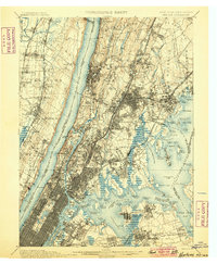 1900 Harlem1900 Print · USGSUpper Manhattan and the surrounding boroughs are shown at a pivotal moment of growth before the mid-century building boom. Genealogists can trace family footprints through the streets of Yonkers Park or locate ancestors in the sprawling Woodlawn Cemetery.16 unique versions available
 - 1900 Map of Brooklyn
 1900 Brooklyn1900 Print · USGSBrooklyn and Queens are shown here at the turn of the century as the urban grid begins to overtake rural villages and coastal marshes. Genealogists can locate family plots in Greenwood Cemetery or Evergreen Cemetery and trace early transit routes like the Electric R.R. and Kings Highway.11 unique versions available
 - 1900 Map of Oyster Bay
 1900 Oyster Bay1900 Print · USGSThe North Shore of Long Island is captured at the turn of the century as its maritime villages and sprawling estates began to transition into refined commuter suburbs. Genealogists can trace property and neighborhood development in Sea Cliff, Glen Cove, and Oyster Bay before the automobile era.15 unique versions available
 - 1903 Map of Hempstead
 1903 Hempstead1903 Print · USGSSouthern Nassau County at the turn of the century shows a landscape transitioning from rural estates and marshlands to rail-connected villages. Genealogists can trace family footprints in Hempstead or Garden City and locate coastal landmarks like Christian Hook and the Camp Meeting Grounds.9 unique versions available
 - 1905 Map of Passaic
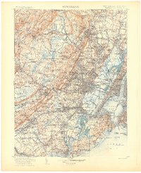 1905 Passaic1905 Print · USGSNorthern New Jersey and Staten Island appear here at a pivotal moment of early 20th-century growth and industrialization. Researchers can trace the development of transit hubs like Convent Sta. or locate legacy landmarks including Hillside Cemetery and the Moravian Cemetery.4 unique versions available
 - 1942 Map of Passaic
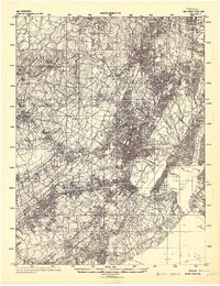 1942 Passaic1942 Print · USGSNorthern New Jersey and New York harbor appear in detail at the start of the war, showing a landscape of burgeoning suburbs and vital industry. Trace family roots and local history across the Passaic River valley, from Paterson to the Watchung Mountains.
 - 1944 Map of Newark, 1971 Print
 1944 Newark1971 Print · USGSThe industrial corridor from Philadelphia to New York was in a period of massive transition during the mid-forties. Genealogists and researchers can trace the rail lines of the Lehigh Valley RR, locate military installations like Picatinny Arsenal, and explore the early sprawl near Levittown.5 unique versions available
 - 1947 Map of Brooklyn
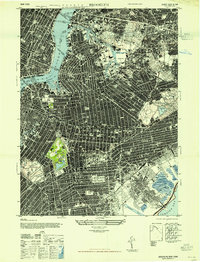 1947 Brooklyn1947 Print · USGSMid-century Brooklyn and Queens are documented here in incredible detail just after the war years. Local historians can locate the iconic Ebbets Field, trace the rail lines through the New Lots Classification Yards, or find ancestral sites at Holy Cross Cemetery.
 - 1947 Map of Sea Cliff
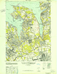 1947 Sea Cliff1947 Print · USGSThe Gold Coast of Nassau County is captured here in the late 1940s, showcasing a landscape of massive private estates and yacht clubs. Trace family-named landmarks like the Vanderbilt Estate or find historic aviation sites like the New York Seaplane Airport.
 - 1947 Map of Jamaica
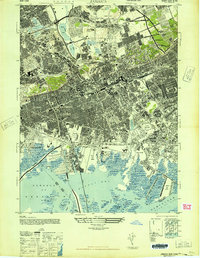 1947 Jamaica1947 Print · USGSQueens and Brooklyn are shown in a period of rapid post-war expansion, where the traditional rail-oriented neighborhoods met the dawn of the parkway era. Researchers can trace the development of South Ozone Park, locate the now-redeveloped Jamaica Race Track, or study the marshlands around Sunrise Airport before the landscape was fully transformed.
Showing maps 1-25 of 129
Frequently asked questions
- What are the different types of historical maps available for Queens County?
- What is the oldest map of Queens County?
- Where can I purchase historical maps of Queens County for my home or office?
- Where can I download high-res historical maps of Queens County?
- Are there historical topographic maps available for Queens County?
- Is there historical aerial imagery available for Queens County?
- Where are historical maps of Queens County sourced from?