2000s (21st Century) Maps of Taborton, Sand Lake
Explore 5 historic maps of Taborton from the 2000s (21st Century). These maps offer a rare glimpse into what life looked like during the 2000s — showing old roads, neighborhoods, homes, and landmarks that have changed or disappeared over time.
Whether you're researching your family's past, planning a metal detecting trip, or studying how Taborton's landscape evolved across the 2000s, these high-resolution maps are a powerful tool for exploring the history of this region.
- Focus on a specific era: All maps on this page are from the 2000s, giving you a focused view of this time period.
- See what’s changed: Compare century-old streets, trails, and buildings to today's modern landscape using overlays and satellite layers.
- Research with precision: Use these maps for genealogy, historical research, land use analysis, or educational projects.
- View, download, or print: Maps are fully viewable online in high resolution, and can be downloaded or printed for your own records.
Start exploring Taborton's history through authentic maps from the 2000s. This is your window into the past.
Taborton, Sand Lake maps
(5)- 2010 Map of Taborton, 2010 Print
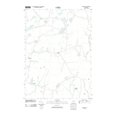 2010 Taborton2010 Print · USGSCovers Taborton, including Sand Lake, Poestenkill, and other nearby areas
 - 2013 Map of Taborton, 2013 Print
 2013 Taborton2013 Print · USGSCovers Taborton, including Sand Lake, Poestenkill, and other nearby areas
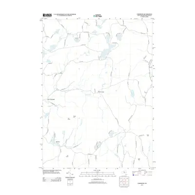
 - 2016 Map of Taborton, 2016 Print
 2016 Taborton2016 Print · USGSCovers Taborton, including Sand Lake, Poestenkill, and other nearby areas
 - 2019 Map of Taborton, 2019 Print
 2019 Taborton2019 Print · USGSCovers Taborton, including Sand Lake, Poestenkill, and other nearby areas
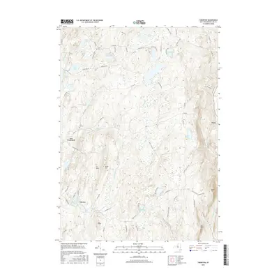
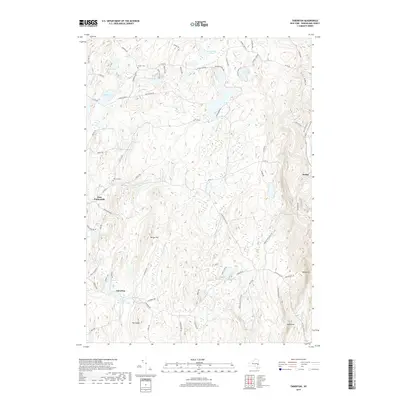
 - 2023 Map of Taborton, 2023 Print
 2023 Taborton2023 Print · USGSRensselaer County's rugged plateau and highland ponds are captured in this modern survey of the late 2010s. Researchers can trace family sites at Snyder Cem, navigate old routes like Stage Coach Rd, or locate the hamlet of East Poestenkill.
End of results
Showing maps 1-5 of 5
Top cities near Taborton
- Colonie historical maps
- Troy historical maps
- Pittsfield historical maps
- Halfmoon historical maps
- Cohoes historical maps
- East Greenbush historical maps
See more
Frequently asked questions
- What are the different types of historical maps available for Taborton?
- What is the oldest map of Taborton?
- Where can I purchase historical maps of Taborton for my home or office?
- Where can I download high-res historical maps of Taborton?
- Are there historical topographic maps available for Taborton?
- Is there historical aerial imagery available for Taborton?
- Where are historical maps of Taborton sourced from?