Old Maps of Rockland County, New York for Hiking & Exploration
Hike through history with 85 historic maps of Rockland County. Explore old trails, ghost towns, and forgotten backroads — perfect for outdoor adventurers and local explorers.
- Rediscover forgotten places: Map out old mining camps, roads, and footpaths that no longer exist on modern maps.
- Layer with modern tools: Combine with LiDAR or satellite views to plan hikes through historical terrain.
- Made for exploration: Popular among hikers, overlanders, and local history lovers.
Use these maps to find adventure and explore the hidden past of Rockland County.
Rockland County, NY maps
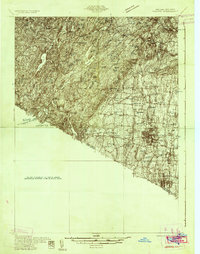
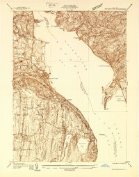
(85)- 1891 Map of Ramapo
 1891 Ramapo1891 Print · USGSCovers Rockland County, including Ramapo, Clarkstown, and other nearby areas
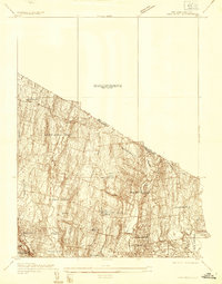
 - 1891 Map of Harlem
 1891 Harlem1891 Print · USGSCovers Rockland County, including New York, North Hempstead, and other nearby areas
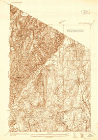
 - 1892 Map of West Point
 1892 West Point1892 Print · USGSCovers Rockland County, including Cortlandt, Yorktown, and other nearby areas
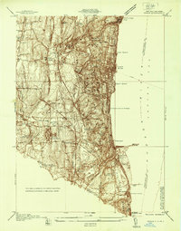
 - 1892 Map of Tarrytown
 1892 Tarrytown1892 Print · USGSCovers Rockland County, including Greenburgh, Clarkstown, and other nearby areas
 - 1893 Map of Tarrytown
 1893 Tarrytown1893 Print · USGSCovers Rockland County, including Greenburgh, Clarkstown, and other nearby areas3 unique versions available
 - 1893 Map of Ramapo
 1893 Ramapo1893 Print · USGSCovers Rockland County, including Ramapo, Clarkstown, and other nearby areas6 unique versions available
 - 1894 Map of West Point
 1894 West Point1894 Print · USGSCovers Rockland County, including Cortlandt, Yorktown, and other nearby areas3 unique versions available
 - 1897 Map of Harlem, 1956 Print
 1897 Harlem1956 Print · USGSCovers Rockland County, including New York, North Hempstead, and other nearby areas4 unique versions available
 - 1898 Map of Harlem
 1898 Harlem1898 Print · USGSCovers Rockland County, including New York, North Hempstead, and other nearby areas
 - 1899 Map of West Point
 1899 West Point1899 Print · USGSCovers Rockland County, including Cortlandt, Yorktown, and other nearby areas
 - 1900 Map of Harlem
 1900 Harlem1900 Print · USGSCovers Rockland County, including New York, North Hempstead, and other nearby areas16 unique versions available
 - 1901 Map of West Point
 1901 West Point1901 Print · USGSCovers Rockland County, including Cortlandt, Yorktown, and other nearby areas12 unique versions available
 - 1902 Map of Tarrytown
 1902 Tarrytown1902 Print · USGSCovers Rockland County, including Greenburgh, Clarkstown, and other nearby areas11 unique versions available
 - 1902 Map of Schunemunk
 1902 Schunemunk1902 Print · USGSCovers Rockland County, including Palm Tree, Kiryas Joel, and other nearby areas10 unique versions available
 - 1910 Map of Ramapo
 1910 Ramapo1910 Print · USGSCovers Rockland County, including Ramapo, Clarkstown, and other nearby areas6 unique versions available
 - 1930 Map of Schunemunk
 1930 Schunemunk1930 Print · USGSCovers Rockland County, including Palm Tree, Kiryas Joel, and other nearby areas3 unique versions available
 - 1931 Map of Ramapo
 1931 Ramapo1931 Print · USGSCovers Rockland County, including Ramapo, Clarkstown, and other nearby areas3 unique versions available
 - 1934 Map of Park Ridge
 1934 Park Ridge1934 Print · USGSCovers Rockland County, including Ramapo, Clarkstown, and other nearby areas
 - 1935 Map of Schunemunk
 1935 Schunemunk1935 Print · USGSCovers Rockland County, including Palm Tree, Kiryas Joel, and other nearby areas4 unique versions available
 - 1936 Map of West Point
 1936 West Point1936 Print · USGSCovers Rockland County, including Cortlandt, Yorktown, and other nearby areas2 unique versions available
 - 1936 Map of Ramsey
 1936 Ramsey1936 Print · USGSCovers Rockland County, including Ramapo, Ridgewood, and other nearby areas
 - 1937 Map of Nyack
 1937 Nyack1937 Print · USGSCovers Rockland County, including Greenburgh, Clarkstown, and other nearby areas
 - 1937 Map of Tarrytown
 1937 Tarrytown1937 Print · USGSCovers Rockland County, including Greenburgh, Clarkstown, and other nearby areas
 - 1938 Map of Haverstraw
 1938 Haverstraw1938 Print · USGSCovers Rockland County, including Clarkstown, Mount Pleasant, and other nearby areas
 - 1938 Map of Ramapo
 1938 Ramapo1938 Print · USGSCovers Rockland County, including Ramapo, Clarkstown, and other nearby areas3 unique versions available
Showing maps 1-25 of 85
Top cities of Rockland County
- Ramapo historical maps
- Clarkstown historical maps
- Orangetown historical maps
- Haverstraw historical maps
- Stony Point historical maps
- Pomona historical maps
Frequently asked questions
- What are the different types of historical maps available for Rockland County?
- What is the oldest map of Rockland County?
- Where can I purchase historical maps of Rockland County for my home or office?
- Where can I download high-res historical maps of Rockland County?
- Are there historical topographic maps available for Rockland County?
- Is there historical aerial imagery available for Rockland County?
- Where are historical maps of Rockland County sourced from?