Old Maps of Orangetown, New York for Genealogy
Trace your family roots with 62 historic maps of Orangetown. These high-res maps reveal old neighborhoods, homesites, landmarks, and streets — helping you uncover where your ancestors lived and how the area evolved over time.
- Explore historic neighborhoods: Identify where your relatives may have lived in the 1800s or 1900s.
- Compare maps over time: Trace the changes in streets, buildings, and landmarks for multi-generational research.
- Perfect for genealogy & ancestry research: Used by family historians and researchers to map out lineage and migration.
These maps are an incredible resource for exploring your personal connection to Orangetown's past.
Orangetown, NY maps
(62)- 1891 Map of Ramapo
 1891 Ramapo1891 Print · USGSThe Ramapo Mountains and northern New Jersey borderlands appear here in the decade before the turn of the century. Genealogists and local historians can trace the early rail networks through Sloatsburg and Suffern, or locate family sites in Pearl River and Ramseys.
 - 1891 Map of Harlem
 1891 Harlem1891 Print · USGSUpper Manhattan and the Bronx met the burgeoning towns of Westchester and Bergen County in the late 1800s. Researchers can trace the path of the Croton Aqueduct, locate the historic site of Bulls Ferry, and explore the early rail-connected villages of Schraalenburgh and Pelhamville.
 - 1892 Map of Tarrytown
 1892 Tarrytown1892 Print · USGSThe Hudson River valley in the late nineteenth century was a corridor of engineering and industrial growth. Researchers can trace the path of the Croton Aqueduct, locate the State Prison at Sing Sing, or find family names near Merritts Corners and Samsondale.
 - 1893 Map of Tarrytown
 1893 Tarrytown1893 Print · USGSThe Hudson Valley was a powerhouse of transit and utility in the late 1800s, serving as the corridor for New York’s water and rail networks. Genealogists can trace family names and old landings from Haverstraw to Tarrytown, including features like the State Prison and the massive Croton Dam.3 unique versions available
 - 1893 Map of Ramapo
 1893 Ramapo1893 Print · USGSThe Ramapo Valley and the New Jersey borderlands come alive in the late Victorian era, showing a landscape defined by mountain passes and a dense rail network. Genealogists can trace family names and early homesteads in Johnsontown, Eagle Valley, and Pearl River before modern development changed the region.6 unique versions available
 - 1897 Map of Harlem, 1956 Print
 1897 Harlem1956 Print · USGSUpper Manhattan and Westchester thrive at the end of the nineteenth century as rail lines and reservoirs reshape the landscape. Trace early neighborhoods and landmarks like Schraalenburg, Woodlawn Cemetery, and the Jerome Park Reservoir.4 unique versions available
 - 1898 Map of Harlem
 1898 Harlem1898 Print · USGSThe northern reaches of the city and its surrounding suburbs are shown in late-Victorian detail as rail lines expanded across the Hudson. Researchers can trace the early layouts of Woodlawn Cemetery, the site of Grants Tomb, and the fortifications at Fort Schuyler.
 - 1900 Map of Harlem
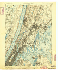 1900 Harlem1900 Print · USGSUpper Manhattan and the surrounding boroughs are shown at a pivotal moment of growth before the mid-century building boom. Genealogists can trace family footprints through the streets of Yonkers Park or locate ancestors in the sprawling Woodlawn Cemetery.16 unique versions available
 - 1902 Map of Tarrytown
 1902 Tarrytown1902 Print · USGSThe Hudson River valley at the turn of the century shows a landscape of busy river landings and nascent suburbs. Genealogists and historians can trace old homesteads and landmarks like Waldberg Landing, the State Prison at Ossining, and the Croton Aqueduct.11 unique versions available
 - 1910 Map of Ramapo
 1910 Ramapo1910 Print · USGSThe Ramapo Valley at the turn of the century served as a vital transit corridor between New York and New Jersey, dominated by rail lines and river industry. Genealogists and local historians can trace the foundations of Sloatsburg, Suffern, and Pearl River, alongside landmarks like the Ramapo Cem. and the Powder Works.6 unique versions available
 - 1931 Map of Ramapo
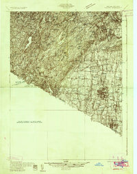 1931 Ramapo1931 Print · USGSRockland County in the late twenties and early thirties shows a unique mix of expanding suburban rail towns and state park wilderness. Genealogists and historians can trace Letchworth Village, the old Hogan Kamp Mine, and early schools like Bardonia Sch.3 unique versions available
 - 1934 Map of Park Ridge
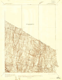 1934 Park Ridge1934 Print · USGSBergen County settlements were evolving into distinct residential hubs during the mid-1930s. Researchers can trace early infrastructure and local landmarks like Villa Maria Clare, the Western Reservoir, and the estates of Saddle River.
 - 1937 Map of Nyack
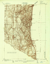 1937 Nyack1937 Print · USGSRockland County’s riverfront and wooded interior are shown here in the late 1930s as the rail-and-river economy remained in full swing. Genealogists and historians can trace family locations near the Rockland State Hospital, Piermont, and the St Catharines Cem.
 - 1937 Map of Tarrytown
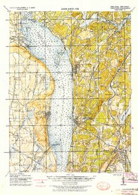 1937 Tarrytown1937 Print · USGSThe Hudson River valley during the 1930s serves as a busy corridor of rail, water, and infrastructure. Genealogists and local historians can trace the old landings at Waldberg Landing, the grounds of the State Prison in Ossining, and the rail lines through Nyack.
 - 1938 Map of Ramapo
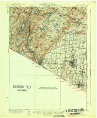 1938 Ramapo1938 Print · USGSRockland County in the late 1930s is revealed here as a landscape of institutional campuses, rail-side villages, and emerging parklands. Genealogists can trace family connections at Letchworth Village, St Agatha Home, and vanished hamlets like Sandyfield or Johnsontown.3 unique versions available
 - 1939 Map of Park Ridge
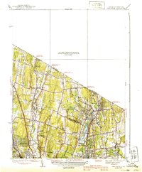 1939 Park Ridge1939 Print · USGSNorthwestern Bergen County and the New York state line are captured here during a period of steady suburban development along the rail lines. Trace the early layout of Montvale and Park Ridge or locate landmarks like Zion Tabernacle and Woodcliff Lake.2 unique versions available
 - 1940 Map of Nyack, 1952 Print
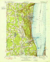 1940 Nyack1952 Print · USGSThe Hudson River shoreline and Rockland County interior are captured here just before mid-century suburban expansion. Researchers can trace the extensive grounds of the Rockland State Hospital, the paths of the West Shore RR, and historic sites like Sneden Landing.
 - 1942 Map of Nyack
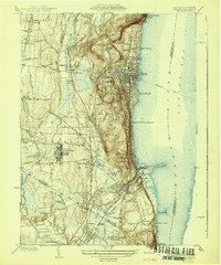 1942 Nyack1942 Print · USGSThe Hudson River riverfront and the high ridges of the Palisades define this area in the early years of the war. Researchers can trace the legacy of rail and river travel through the Tarrytown Ferry and the Erie RR, or locate family sites near Sneden Landing and Rockland State Hospital.
 - 1943 Map of Nyack
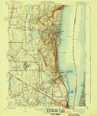 1943 Nyack1943 Print · USGSSoutheastern Rockland County and the Bergen County border are shown in the early 1940s as riverfront villages and rail-dependent towns. Trace the sprawling grounds of the Rockland State Hospital or locate ancestors in Oak Hill Cemetery and Rockland Cemetery.2 unique versions available
 - 1945 Map of Park Ridge
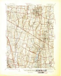 1945 Park Ridge1945 Print · USGSThe New York and New Jersey borderlands at the end of the war show a maturing landscape of suburban towns and industrial centers. Researchers can trace local heritage through landmarks like Lederle Laboratories, St Anthonys Cem, and the Erie railroad stops.2 unique versions available
 - 1947 Map of Yonkers
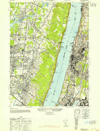 1947 Yonkers1947 Print · USGSThe Hudson River waterfronts of New York and New Jersey are captured here in the late forties, showing a landscape of suburban growth and industrial strength. Trace the old rail lines of the West Shore RR and find historic sites like the Spreckel Estate and N Y Colored Orphan Asylum.2 unique versions available
 - 1947 Map of Hartford, 1955 Print
 1947 Hartford1955 Print · USGSSouthern New England and the Hudson Valley are shown in detail during the post-war expansion era. Genealogists and researchers can trace local landmarks from the State Capitol and Yale University to the Stratford Lighthouse and Woodlawn Cem.2 unique versions available
 - 1948 Map of Hartford
 1948 Hartford1948 Print · USGSSouthern New England is captured here in the late 1940s, showcasing a landscape of thriving industrial cities and developing parkways. Genealogists and historians can trace the rail networks of the New York New Haven and Hartford RR or locate coastal defense sites like Fort Terry and Camp Shanks.2 unique versions available
 - 1949 Map of New York, 1951 Print
 1949 New York1951 Print · USGSLong Island and its surrounding waters are documented here in the late 1940s, just as the postwar suburban boom began to transform the region. Genealogists and historians can trace the early layouts of Idlewild Airport, Mitchell Field, and the established routes of the Long Island RR.
 - 1950 Map of Scranton, 1952 Print
 1950 Scranton1952 Print · USGSMid-century Northeast Pennsylvania and the Hudson Valley come alive in this survey of the tri-state region. Genealogists and historians can trace the dense rail networks of the Erie RR and DL&W RR between industrial hubs like Scranton and Wilkes-Barre.
Showing maps 1-25 of 62
Top cities near Orangetown
- New York historical maps
- North Hempstead historical maps
- Yonkers historical maps
- Ramapo historical maps
- Paterson historical maps
- Greenburgh historical maps
See more
Top neighborhoods of Orangetown
- Palisades historical maps
- Pearl River historical maps
- Nyack historical maps
- Tappan historical maps
- Blauvelt historical maps
- Orangeburg historical maps
See more
Frequently asked questions
- What are the different types of historical maps available for Orangetown?
- What is the oldest map of Orangetown?
- Where can I purchase historical maps of Orangetown for my home or office?
- Where can I download high-res historical maps of Orangetown?
- Are there historical topographic maps available for Orangetown?
- Is there historical aerial imagery available for Orangetown?
- Where are historical maps of Orangetown sourced from?