Old Maps of Stockholm, New York
Explore 55 old maps of Stockholm, spanning from 1906 to today. These high-resolution historic maps reveal how streets, neighborhoods, landmarks, and natural features evolved over time — perfect for genealogy, metal detecting, research, and local history exploration.
What you can do with these maps:
- See how Stockholm changed over time: Compare historical maps to modern-day views to trace roads, homesites, rail lines & more.
- View detailed metadata: Each map includes creators, publishers, year, scale, and archive source.
- Overlay maps with satellite & LiDAR: Visualize the past alongside modern tools to explore terrain & human change.
- Trusted historical sources: Maps sourced from the USGS, Library of Congress, and other archives.
- Access maps your way: View online, download high-res files, or order prints for personal or research use.
Start exploring old maps of Stockholm to uncover forgotten places, hidden landmarks, and the deep history beneath your feet.
Stockholm, NY maps
(55)- 1906 Map of Massena, 1956 Print
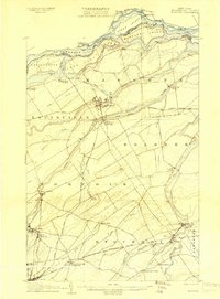
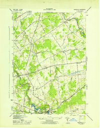
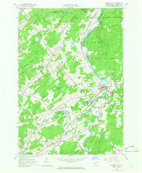
 1906 Massena1956 Print · USGSSt. Lawrence County is mapped here at the opening of the twentieth century, showcasing a landscape of powerful river rapids and vital international border crossings. Genealogists can trace early rail stations and rural hamlets like North Stockholm Knapps Sta, Massena Center, and Winthrop.
 - 1907 Map of Massena
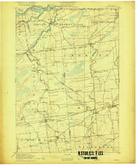
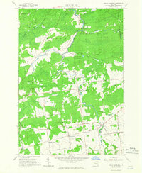
 1907 Massena1907 Print · USGSSt. Lawrence County is depicted in the early twentieth century, showing a landscape defined by the powerful rapids of the upper river before modern dams. Researchers can trace historic river landings like Louisville Landing, the path of the Massena Power Canal, and small rail stops such as North Stockholm Knapps Sta.6 unique versions available
 - 1908 Map of Potsdam
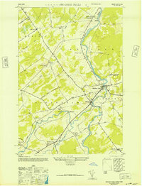
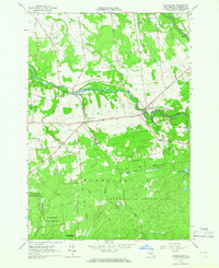
 1908 Potsdam1908 Print · USGSSt. Lawrence County is captured here in the early twentieth century as a vibrant landscape of river-powered industry and dispersed school districts. Researchers can trace the original N. Y. C. and H. R. R. R. through Norwood or locate historic rural landmarks like Browns Bridge and Old Forge School.7 unique versions available
 - 1915 Map of Moira, 1957 Print
 1915 Moira1957 Print · USGSNorthern New York's borderlands are captured here in the early twentieth century, showing the intersection of tribal lands and rail-driven commerce. Genealogists can trace family names and early rural life through Brasher Iron Works, Potter School, and Irish Corners.
 - 1917 Map of Moira
 1917 Moira1917 Print · USGSNorthern New York's borderlands come alive in the years before the Great War, showing a landscape defined by the St Regis Indian Reservation and busy rail lines. Researchers can trace family landmarks like Laverys Corner, the Brasher Iron Works, and early industrial sites like Wagstaff Factory.4 unique versions available
 - 1919 Map of Nicholville, 1958 Print
 1919 Nicholville1958 Print · USGSIn the Adirondack foothills during the early twentieth century, small riverside settlements and timber camps defined local life. Genealogists can trace family footprints through numerous rural schoolhouses like Water Street School and old crossroads like Heath Hill Corners.2 unique versions available
 - 1921 Map of Nicholville
 1921 Nicholville1921 Print · USGSUpper St. Lawrence and Franklin counties come alive in the early twentieth century as a landscape of timber-driven river towns and rural school districts. Genealogists can trace family footprints near St Regis Falls, Dickinson Center, and numerous rural sites like Harper School or Joe Indian.4 unique versions available
 - 1942 Map of Norfolk, 1961 Print
 1942 Norfolk1961 Print · USGSSt. Lawrence County in the early 1940s was a bustling corridor of river power and rail transport. Genealogists and historians can trace the foundations of Norfolk and Norwood or locate rural landmarks like Bixby Cem and School No 17.
 - 1943 Map of Potsdam
 1943 Potsdam1943 Print · USGSSt. Lawrence County during the early war years reveals a landscape of river-powered industry and dispersed school districts. Researchers can locate family heritage at Bayside Cem and St Marys Cem or trace the early industrial footprint of the Sugar Island Dam and the Garfield Gem mine.2 unique versions available
 - 1943 Map of Parishville
 1943 Parishville1943 Print · USGSSt. Lawrence County during the early years of the war reveals a landscape of river-powered hamlets and numerous rural school districts. Researchers can trace family origins across the townships of Stockholm and Hopkinton or locate sites like Fairview Cem and Allens Falls Reservoir.2 unique versions available
 - 1943 Map of Norfolk
 1943 Norfolk1943 Print · USGSNorthern St. Lawrence County during the mid-1940s is defined by a landscape of riverside industry and rural school districts. Genealogists can locate family landmarks like Bixby Cem and several numbered schoolhouses from Grantville to North Stockholm.
 - 1944 Map of Moira
 1944 Moira1944 Print · USGSNorthern New York at the height of the war years reveals a landscape defined by the St Regis Indian Reservation and the Rutland railroad. Genealogists can locate family landmarks like Taylors Corner and dozens of numbered country schoolhouses.
 - 1946 Map of Brasher Falls
 1946 Brasher Falls1946 Print · USGSSt. Lawrence County is mapped during the mid-1940s, centered on the river-fed hamlets of the St. Regis valley. Genealogists can locate family landmarks like St Patrick Cem and Willis Cem, or trace the old Rutland Branch rail line.
 - 1948 Map of Ogdensburg, 1973 Print
 1948 Ogdensburg1973 Print · USGSThe international border along the St Lawrence River comes to life in the late 1940s, showing the vital rail and water connections between New York and Ontario. Researchers can trace the grounds of St Lawrence University, the massive Camp Drum military reservation, and the historic Rideau River and Canal.2 unique versions available
 - 1951 Map of Ogdensburg
 1951 Ogdensburg1951 Print · USGSThe St. Lawrence frontier and the North Country are captured here during the post-war era, from the river ports to the high Adirondacks. Genealogists and historians can trace the rail-and-river economy through Ogdensburg, the Rutland rail lines, and Potsdam.
 - 1953 Map of Ogdensburg
 1953 Ogdensburg1953 Print · USGSThe North Country and St. Lawrence Valley are shown here in the early fifties, just as the region’s rail-and-river economy remained in full swing. Genealogists and historians can trace family-named corners and rural hubs along the Rutland railroad or locate heritage sites near Ogdensburg, Potsdam, and the St Regis Indian Reservation.
 - 1961 Map of Ogdensburg
 1961 Ogdensburg1961 Print · USGSThe St. Lawrence valley and the Adirondack high country meet in this early sixties survey during a peak era for rail and river commerce. Genealogists and historians can trace the paths of the New York Central railroad through remote settlements like Wanakena, Conifer, and Piercefield.
 - 1964 Map of Parishville, 1966 Print
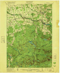
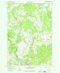 1964 Parishville1966 Print · USGSSt. Lawrence County in the mid-1960s is defined by its hydroelectric power along the river and deep-rooted rural hamlets. Genealogists and local historians can trace family locations near Parishville, Fairview Cem, and the Allen Falls Reservoir.3 unique versions available
 - 1964 Map of Norfolk, 1966 Print
 1964 Norfolk1966 Print · USGSSt. Lawrence County in the mid-1960s shows a landscape of river-driven industry and growing state forests. Trace the path of the Norwood and St Lawrence RR through the hamlets of Raymondville and Norfolk or locate family plots at Bixby Cem.
 - 1964 Map of Potsdam, 1966 Print
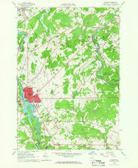 1964 Potsdam1966 Print · USGSSt. Lawrence County is captured during a period of academic and industrial growth in the mid-sixties. Researchers can trace the footprints of Clarkson College, locate family plots in Bayside Cem, and follow the New York Central Railroad through Norwood.3 unique versions available
 - 1964 Map of Brasher Falls, 1966 Print
 1964 Brasher Falls1966 Print · USGSUpper St. Lawrence County is captured in the mid-1960s, a time when the river-valley communities of Brasher Falls and Winthrop were the region's social hubs. Genealogists can trace family landmarks across the countryside, from Richardson Cem and St Patricks Cem to rural settlements like Skinnerville.2 unique versions available
 - 1964 Map of North Lawrence, 1966 Print
 1964 North Lawrence1966 Print · USGSNorthern St. Lawrence County appears here in the mid-sixties, dominated by state forests and the winding Deer River. Genealogists and local historians can trace family-named crossroads like Coteys Corner or locate ancestral sites at Flint Chaffee Cem and Lawrenceville.2 unique versions available
 - 1964 Map of Nicholville, 1966 Print
 1964 Nicholville1966 Print · USGSIn the mid-1960s, St. Lawrence County's southern townships transitioned from the rolling farmland of the St. Lawrence Valley into the dense forests of the Adirondacks. Genealogists and researchers can trace the historic riverfront hamlets of Nicholville and Fort Jackson, alongside rural landmarks like Holy Cross Cem and Independent Hill.2 unique versions available
 - 1985 Map of Massena
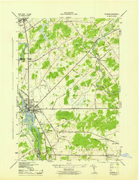
 1985 Massena1985 Print · USGSNorthern New York at the mid-eighties shows a landscape of river-driven industry and high mountain wilderness along the Canadian border. Researchers can trace the legacy of iron working and milling in Brasher Iron Works or follow the Raquette River through Massena and Potsdam.
 - 1994 Map of Massena
 1994 Massena1994 Print · USGSThe St. Lawrence River valley and northern Adirondacks meet in the mid-1990s, revealing a landscape of international shipping, rail corridors, and dense state forests. Genealogists and historians can trace the foundations of Massena, the St Regis Indian Reservation, and small hamlets like Brasher Iron Works.
Showing maps 1-25 of 55
Top cities near Stockholm
- Potsdam historical maps
- Massena historical maps
- Canton historical maps
- Massena historical maps
- Potsdam historical maps
- Norfolk historical maps
See more
Top neighborhoods of Stockholm
- Southville historical maps
- Knapps Station historical maps
- Kellogg historical maps
- Sandfordville historical maps
- Skinnerville historical maps
- West Stockholm historical maps
See more
Frequently asked questions
- What are the different types of historical maps available for Stockholm?
- What is the oldest map of Stockholm?
- Where can I purchase historical maps of Stockholm for my home or office?
- Where can I download high-res historical maps of Stockholm?
- Are there historical topographic maps available for Stockholm?
- Is there historical aerial imagery available for Stockholm?
- Where are historical maps of Stockholm sourced from?