Old Maps of Saratoga County, New York
Explore 249 old maps of Saratoga County, spanning from 1893 to today. These high-resolution historic maps reveal how streets, neighborhoods, landmarks, and natural features evolved over time — perfect for genealogy, metal detecting, research, and local history exploration.
What you can do with these maps:
- See how Saratoga County changed over time: Compare historical maps to modern-day views to trace roads, homesites, rail lines & more.
- View detailed metadata: Each map includes creators, publishers, year, scale, and archive source.
- Overlay maps with satellite & LiDAR: Visualize the past alongside modern tools to explore terrain & human change.
- Trusted historical sources: Maps sourced from the USGS, Library of Congress, and other archives.
- Access maps your way: View online, download high-res files, or order prints for personal or research use.
Start exploring old maps of Saratoga County to uncover forgotten places, hidden landmarks, and the deep history beneath your feet.
Saratoga County, NY maps
(249)- 1893 Map of Cohoes
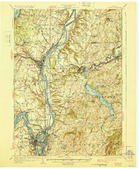
 1893 Cohoes1893 Print · USGSThe upper Hudson Valley and its industrial corridor come alive in the 1890s, from the streets of Cohoes to the Bemis Heights Battle Ground. Trace the original paths of the Erie Canal and Champlain Canal through Waterford and Mechanicsville.
 - 1893 Map of Schenectady
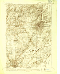
 1893 Schenectady1893 Print · USGSSchenectady and its surrounding Saratoga County townships are captured here in the 1890s, a period when canal traffic and steam rail dominated the Mohawk Valley. Genealogists can trace family lines through villages like Niskayuna and Rexford Flats or locate historic crossings like Vischer Ferry.
 - 1895 Map of Cohoes
 1895 Cohoes1895 Print · USGSThe Hudson and Mohawk river valleys at the end of the nineteenth century reveal a landscape shaped by canal trade and burgeoning rail lines. Genealogists and local historians can trace the early layouts of Cohoes, Mechanicville, and the historic Battle Ground at Bemis Heights.
 - 1895 Map of Schenectady
 1895 Schenectady1895 Print · USGSSchenectady and its surrounding river towns thrive in the 1890s as the railroad and canal networks reach their peak. Genealogists and historians can trace old homesteads near Vischer Ferry, explore the rail lines of the Fitchburg Railroad, or locate early structures in Rexford Flats and Scotia.
 - 1895 Map of Amsterdam
 1895 Amsterdam1895 Print · USGSThe Mohawk River valley thrives in the late nineteenth century as a corridor of heavy rail and canal traffic. Trace the historic paths of the Erie Canal and West Shore R.R. past Amsterdam and the old Hoffman Ferry crossing.7 unique versions available
 - 1895 Map of Glens Falls, 1955 Print
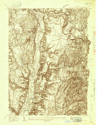
 1895 Glens Falls1955 Print · USGSThe Hudson River corridor and the southern tip of Lake George are seen here in the late nineteenth century. Researchers can trace military history at the Fort William Henry Ruins or find old industry at Griswolds Mills and Feeder Dam.
 - 1897 Map of Glens Falls
 1897 Glens Falls1897 Print · USGSThe upper Hudson River valley and the southern shores of Lake George are captured here during the late Victorian industrial era. Genealogists and historians can trace old homesteads and landmarks like the Fort Wm. Henry Ruins, Griswolds Mills, and the Delaware and Hudson RR corridor.9 unique versions available
 - 1898 Map of Schenectady
 1898 Schenectady1898 Print · USGSSchenectady and the Mohawk Valley are shown in the 1890s, when the river and rail lines drove a booming industrial economy. Local historians can trace the original path of the Erie Canal and locate historic crossings like Vischer Ferry and Rexford Flats.8 unique versions available
 - 1898 Map of Cohoes
 1898 Cohoes1898 Print · USGSUpper Hudson Valley industry and transport are captured here at the end of the nineteenth century, from the confluence of the Mohawk to the hills of Pittstown. Trace the historic path of the Champlain Canal and the storied Battle Ground near Stillwater.8 unique versions available
 - 1899 Map of Broadalbin, 1954 Print
 1899 Broadalbin1954 Print · USGSFulton and Saratoga counties are shown here just before the turn of the century as the local economy balanced rail transport and river-powered industry. Genealogists can trace family roots through numerous mill hamlets and settlements like Northampton, Vail Mills, and Osborn Bridge.
 - 1900 Map of Schuylerville
 1900 Schuylerville1900 Print · USGSUpper Hudson Valley life at the close of the nineteenth century centers on the busy canal and river corridor. Researchers can trace the Champlain Canal through Schuylerville and Fort Miller, or locate family sites near the Saratoga Battle Field and Gansevoort.7 unique versions available
 - 1902 Map of Broadalbin
 1902 Broadalbin1902 Print · USGSThe Sacandaga River valley is shown here at the turn of the century, prior to the major hydroelectric projects that reshaped this Fulton County landscape. Genealogists can trace early homesteads and milling sites near Vail Mills, Hagedorns Mills, and the Sacandaga Park rail terminus.9 unique versions available
 - 1902 Map of Saratoga
 1902 Saratoga1902 Print · USGSSaratoga County at the turn of the century reveals a landscape defined by famous spa towns and a dense web of steam and electric railways. Trace early property locations and transport routes in Saratoga Springs, Ballston Spa, and Rock City Falls.9 unique versions available
 - 1903 Map of Luzerne
 1903 Luzerne1903 Print · USGSSouthern Warren County is documented here at the turn of the century as the rail and timber economy flourished. Local historians can trace the early layouts of Luzerne and Hadley or locate vanished sites near Conklingville and Linwood.8 unique versions available
 - 1910 Map of Stony Creek
 1910 Stony Creek1910 Print · USGSThe southern Adirondacks at the turn of the century are captured here, centered on the intersection of Hamilton, Warren, and Saratoga counties. Genealogists can trace early outposts and hamlets like Harrisburg West Stony Creek PO, Hope Falls, and Griffin.7 unique versions available
 - 1929 Map of Cohoes
 1929 Cohoes1929 Print · USGSThe industrial and revolutionary history of the Hudson Valley is clear in this late twenties survey of the river's confluence. Researchers can trace early rail stops at Stillwater Center Sta, explore the Saratoga Battlefield, or locate rural schoolhouses from School No 4 to School No 13.4 unique versions available
 - 1930 Map of Schenectady
 1930 Schenectady1930 Print · USGSThe Mohawk Valley and southern Saratoga County are caught in a moment of transition in the late twenties, balancing industrial river life with rural farmsteads. Genealogists and historians can trace the Erie Canal (Abandoned) path and locate old family landmarks like Harmony Corners or Vischer Ferry.5 unique versions available
 - 1931 Map of Amsterdam
 1931 Amsterdam1931 Print · USGSThe Mohawk Valley thrives at the height of its rail and canal era in the late twenties and early thirties. Genealogists can trace family names through dozens of rural schools and churches, from St Marys Ch to the quiet hamlets of Mariaville and Scotch Bush.3 unique versions available
 - 1934 Map of Quaker Springs
 1934 Quaker Springs1934 Print · USGSSaratoga County was a landscape of busy rail lines and storied ridges in the 1930s. Researchers can trace the legacy of the Saratoga Battlefield or locate vanished local landmarks like Stafford Bridge and Quaker Ch.
 - 1934 Map of Saratoga Springs
 1934 Saratoga Springs1934 Print · USGSSaratoga Springs and Ballston Spa are shown in the mid-1930s, featuring a landscape of mineral springs, developing parklands, and rail-connected industries. Researchers can locate family landmarks like St Peters Cem or trace rural education through School No. 10 and School No. 7.
 - 1935 Map of Gansevoort
 1935 Gansevoort1935 Print · USGSSaratoga County in the mid-1930s reveals a landscape of rural crossroads and specialized institutions between the mountains and the river. Genealogists and local historians can trace family-named hubs like Travers Corners, the Mt McGregor Sanatorium, and several rural schools.
 - 1935 Map of Middle Grove
 1935 Middle Grove1935 Print · USGSSaratoga County's rural townships are captured here in the mid-1930s, showing a landscape of scattered crossroads and small school districts. Genealogists can locate family landmarks like Clark Cem or trace old routes past Pine Hill Sch and Pages Corner.
 - 1935 Map of Schuylerville
 1935 Schuylerville1935 Print · USGSThe Hudson River valley around Schuylerville and Greenwich is mapped here in the mid-1930s, showing the early evolution of the Saratoga region's industrial and historic landscape. Genealogists and historians can locate family landmarks like Rafferty Sch, the St Josephs Cem, and the now-quiet Champlain Canal (Abandoned).
 - 1935 Map of Fort Miller
 1935 Fort Miller1935 Print · USGSThe Hudson River and its engineering works dominate this mid-1930s landscape along the border of Washington and Saratoga counties. Genealogists can locate family landmarks like Ellis Farm or trace ancestors through Fort Miller Cem and the numerous rural schoolhouses such as Argyle Sch.
 - 1935 Map of Corinth
 1935 Corinth1935 Print · USGSIn the mid-1930s, the upper Hudson River powered a landscape of industry and small farming communities in Saratoga County. Researchers can trace early rural life through detailed labels for Rural Cem, the Spier Falls Hydro Sta, and the Old Thief Hollow Ch.
Showing maps 1-25 of 249
Top cities of Saratoga County
- Clifton Park historical maps
- Saratoga Springs historical maps
- Halfmoon historical maps
- Milton historical maps
- Wilton historical maps
- Malta historical maps
See more
Frequently asked questions
- What are the different types of historical maps available for Saratoga County?
- What is the oldest map of Saratoga County?
- Where can I purchase historical maps of Saratoga County for my home or office?
- Where can I download high-res historical maps of Saratoga County?
- Are there historical topographic maps available for Saratoga County?
- Is there historical aerial imagery available for Saratoga County?
- Where are historical maps of Saratoga County sourced from?