Old Maps of Schoharie County, New York for Metal Detecting
Plan your next treasure hunt with 182 historic maps of Schoharie County. Find old homesites, ghost towns, trails, and gathering spots that may be lost to time — perfect for identifying promising metal detecting locations.
- Locate forgotten sites: Uncover places like long-lost settlements, abandoned rail lines, or gathering spots.
- Plan better hunts: Use map overlays combined with LiDAR or satellite views to narrow in on historically rich areas.
- Made for detectorists: Thousands of hobbyists use these maps to discover relics, coins, and hidden history.
Use these historic maps to boost your research and find new opportunities beneath the surface of Schoharie County.
Schoharie County, NY maps
(182)- 1893 Map of Durham
 1893 Durham1893 Print · USGSThe northern Catskill foothills and the Greene-Albany county line appear here in the early 1890s, when valley farming and small-scale industry defined the region. Genealogists and hikers can trace the original paths to Union Society, Cairo Forge, and the high peaks of the Black Head Mountains.
 - 1894 Map of Durham
 1894 Durham1894 Print · USGSThe northern Catskills transition from rolling valley farms to high mountain peaks in the late nineteenth century. Genealogists and hikers can trace old routes between Preston Hollow, Hensonville, and the summits of the Black Head Mountains.10 unique versions available
 - 1895 Map of Amsterdam
 1895 Amsterdam1895 Print · USGSThe Mohawk River valley thrives in the late nineteenth century as a corridor of heavy rail and canal traffic. Trace the historic paths of the Erie Canal and West Shore R.R. past Amsterdam and the old Hoffman Ferry crossing.7 unique versions available
 - 1896 Map of Fonda
 1896 Fonda1896 Print · USGSThe Mohawk Valley was a technological corridor in the 1890s, defined by the convergence of major rail lines and the Erie Canal. Genealogists and historians can trace the old post offices and hamlet life at Yatesville Randall P.O., Auriesville, and Rural Grove.
 - 1898 Map of Fonda
 1898 Fonda1898 Print · USGSThe Mohawk Valley at the close of the 19th century was a powerhouse of transit and industry. Genealogists and historians can trace the bustling Erie Canal corridor through Fonda, the upland reaches of Charleston, and the path of the West Shore R. R.
 - 1898 Map of Canajoharie, 1954 Print
 1898 Canajoharie1954 Print · USGSThe Mohawk Valley was at its industrial peak in the late 1890s, when the river, canal, and railroads all shared the same narrow corridor. Genealogists and historians can trace old homesteads and local landmarks in Stone Arabia, Ft. Plain, and the historic resort at Sharon Springs.
 - 1898 Map of Schoharie, 1963 Print
 1898 Schoharie1963 Print · USGSSchoharie County in the late nineteenth century was a landscape of vital river valleys and developing rail lines. Local historians can trace the paths of the Delaware and Hudson RR or locate old hamlets like Breakabeen and Fultonham.
 - 1900 Map of Canajoharie
 1900 Canajoharie1900 Print · USGSThe Mohawk Valley at the turn of the century shows a dense network of canal, rail, and river transportation. Genealogists can trace family footprints in historic Canajoharie, the upland farms near Stone Arabia, and the resort area of Sharon Springs.
 - 1900 Map of Schoharie
 1900 Schoharie1900 Print · USGSSchoharie County at the turn of the century shows a landscape defined by the winding Schoharie Creek and vital rail connections. Genealogists can trace family roots through specific locations like Howe Cave, Mineral Springs, and the various stops along the Middleburg and Schoharie RR.8 unique versions available
 - 1900 Map of Schoharie, 1944 Print
 1900 Schoharie1944 Print · USGSSchoharie County at the close of the nineteenth century centers on a thriving valley rail network and small industrial settlements. Genealogists and historians can trace the paths of the Middleburg and Schoharie railroad and locate rural landmarks like Howes Cave and Boucks Falls.
 - 1900 Map of Berne, 1954 Print
 1900 Berne1954 Print · USGSAlbany County hill towns and the Helderberg Escarpment are captured here at the turn of the century as rural life centered on upland hamlets and rocky creek valleys. Researchers can trace old family sites and forgotten crossroads like Van Leuvans Corners, Chesterville, and Quaker Street.2 unique versions available
 - 1901 Map of Gilboa, 1961 Print
 1901 Gilboa1961 Print · USGSThe northern Catskills at the start of the twentieth century reveal a landscape of river-valley hamlets and high mountain peaks. Genealogists and historians can trace original homesteads near Gilboa, Prattsville, and Livingstonville, or find landmarks like Pratt Rocks.
 - 1902 Map of Canajoharie
 1902 Canajoharie1902 Print · USGSThe Mohawk Valley was a bustling corridor of canal traffic and steam power just after the turn of the century. Genealogists can trace family names and farmsteads near Stone Arabia or explore the resort layout of Sharon Springs and the industrial hubs of Ft. Plain and Canajoharie.6 unique versions available
 - 1902 Map of Fonda
 1902 Fonda1902 Print · USGSThe Mohawk Valley at the close of the nineteenth century reveals a critical junction of the Erie Canal and major railroads. Genealogists and historians can trace old homesteads and local centers like Auriesville, Sammonsville, and the remote Charleston Four Corners.8 unique versions available
 - 1903 Map of Gilboa
 1903 Gilboa1903 Print · USGSThe Schoharie Valley at the turn of the century shows a landscape of clustered hamlets and prominent mountain peaks before major regional changes. Researchers can trace the layout of early settlements like Gilboa and Prattsville, or locate family landmarks such as Pratt Rocks and Manorkill Falls.9 unique versions available
 - 1903 Map of Berne
 1903 Berne1903 Print · USGSThe Helderberg plateau in the early 1900s reveals a network of isolated hill towns and winding creek valleys. Genealogists can trace family footprints in Rensselaerville, Quaker Street, and the lakeside settlements of Thompsons Lake and Warner Lake.8 unique versions available
 - 1904 Map of Richmondville
 1904 Richmondville1904 Print · USGSSchoharie and Otsego counties appear here at the start of the century as the rail-and-river economy reached its peak. Genealogists can trace family footprints through historic hamlets like Lutheranville, Seward, and South Valley along the Delaware and Hudson RR.5 unique versions available
 - 1904 Map of Hobart
 1904 Hobart1904 Print · USGSThe northern Catskills and Delaware River headwaters come to life in this study of the region just after the turn of the century. You can trace the Ulster and Delaware rail line through high-elevation settlements like Stamford, Hobart, and Roxbury.5 unique versions available
 - 1931 Map of Amsterdam
 1931 Amsterdam1931 Print · USGSThe Mohawk Valley thrives at the height of its rail and canal era in the late twenties and early thirties. Genealogists can trace family names through dozens of rural schools and churches, from St Marys Ch to the quiet hamlets of Mariaville and Scotch Bush.3 unique versions available
 - 1943 Map of Cobleskill, 1954 Print
 1943 Cobleskill1954 Print · USGSSchoharie County's rugged valley and rail corridor are captured here during the 1940s, anchored by the town of Cobleskill. Genealogists and historians can locate specific sites like the State Agricultural School, Howe Caverns, and the Lawyer Cem.4 unique versions available
 - 1943 Map of South Valley, 1954 Print
 1943 South Valley1954 Print · USGSOtsego County's rural townships are captured here in the 1940s, showing a landscape of small hamlets and highland farms. Genealogists can trace family roots through several schools and cemeteries, from School No 9 to Maple View Cem and Gothicville.4 unique versions available
 - 1943 Map of Sharon Springs, 1955 Print
 1943 Sharon Springs1955 Print · USGSSchoharie and Montgomery Counties are captured in detail during the early 1940s, showing a landscape of upland farms and rural crossroads. Genealogists can locate family landmarks like Flanders Cem, the Dutch Reformed Ch, and small settlements such as Mapletown (Blaine) and Argusville.3 unique versions available
 - 1943 Map of Carlisle, 1957 Print
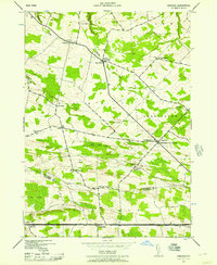 1943 Carlisle1957 Print · USGSUpper Montgomery and Schoharie counties appear here during the mid-forties, characterized by a dense network of upland farms and crossroads hamlets. Researchers can locate numerous local landmarks like Charleston Four Corners, Gove Cem, and the Cherry Valley Turnpike.2 unique versions available
 - 1943 Map of Breakabeen, 1959 Print
 1943 Breakabeen1959 Print · USGSSchoharie County in the 1940s is captured here in the transition from traditional valley farming to modern rural life. Genealogists can trace family homes near Vintonton, locate the Fulton Hill Cem, or explore the riverside layout of Breakabeen.5 unique versions available
 - 1943 Map of Schoharie, 1959 Print
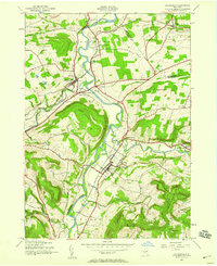 1943 Schoharie1959 Print · USGSThe Schoharie Valley was a vital rail and river corridor during the mid-forties, defined by its small farming hamlets and prominent terrain. Researchers can trace ancestral roots through the Old Stone Fort, several rural schoolhouses, and cemeteries like St Pauls Cem and Central Bridge Cem.4 unique versions available
Showing maps 1-25 of 182
Top cities of Schoharie County
- Cobleskill historical maps
- Middleburgh historical maps
- Schoharie historical maps
- Richmondville historical maps
- Esperance historical maps
- Carlisle historical maps
See more
Frequently asked questions
- What are the different types of historical maps available for Schoharie County?
- What is the oldest map of Schoharie County?
- Where can I purchase historical maps of Schoharie County for my home or office?
- Where can I download high-res historical maps of Schoharie County?
- Are there historical topographic maps available for Schoharie County?
- Is there historical aerial imagery available for Schoharie County?
- Where are historical maps of Schoharie County sourced from?