2020s Maps of Lindley, New York
Explore 4 historic maps of Lindley from the 2020s. These maps offer a rare glimpse into what life looked like during the 2020s — showing old roads, neighborhoods, homes, and landmarks that have changed or disappeared over time.
Whether you're researching your family's past, planning a metal detecting trip, or studying how Lindley's landscape evolved across the 2020s, these high-resolution maps are a powerful tool for exploring the history of this region.
- Focus on a specific era: All maps on this page are from the 2020s, giving you a focused view of this time period.
- See what’s changed: Compare century-old streets, trails, and buildings to today's modern landscape using overlays and satellite layers.
- Research with precision: Use these maps for genealogy, historical research, land use analysis, or educational projects.
- View, download, or print: Maps are fully viewable online in high resolution, and can be downloaded or printed for your own records.
Start exploring Lindley's history through authentic maps from the 2020s. This is your window into the past.
Lindley, NY maps
(4)- 2023 Map of Jackson Summit, 2023 Print
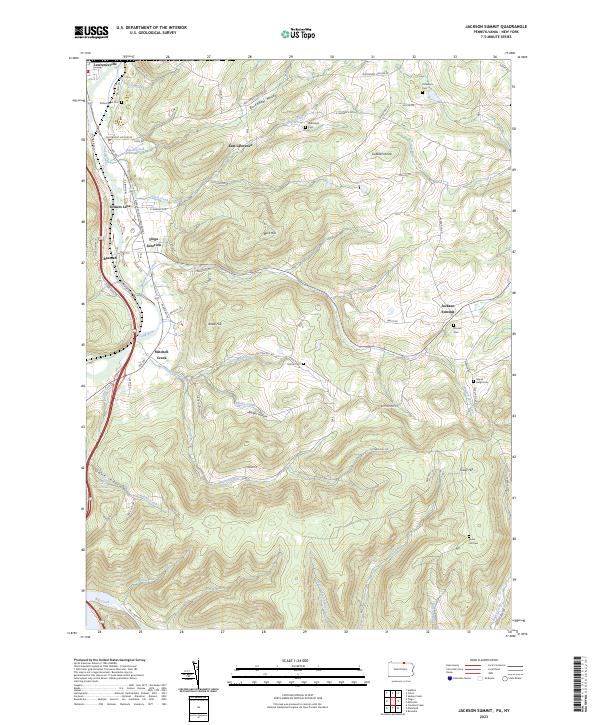 2023 Jackson Summit2023 Print · USGSTioga County's southern borderlands come to life in this detailed view of the Tioga River valley and the Appalachian Throughway. Researchers can trace family history through several rural burial grounds like Maple Ridge Cem and Tower Hill Cem, or explore the old rail-and-road junctions at Tioga Junction and Lawrenceville.
 - 2023 Map of Addison, 2023 Print
 2023 Addison2023 Print · USGSSteuben County’s river valleys and southern highlands are captured here in the early 2020s, showing the convergence of the Canisteo and Tioga Rivers. Genealogists can locate legacy burial sites like Freeman Cem and Fairview Cem, or trace the path of Towner Farm Airport.
 - 2023 Map of Tioga, 2023 Print
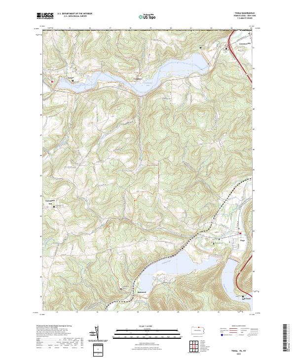 2023 Tioga2023 Print · USGSNorthern Pennsylvania’s river valleys and flood control projects are documented here in the early twenty-first century. Researchers can trace family history at Evergreen Cem and Nelson Cem or follow the Railroad Grade Trail near Hammond.
 - 2023 Map of Caton, 2023 Print
 2023 Caton2023 Print · USGSThe northern edge of Steuben County transitions from the Chemung River valley into high timber and swamp lands in the early 2020s. Trace local family roots and rural commerce through Elmwood Cem, the Old Port Royal Airport, and Cheese Factory Rd.
End of results
Showing maps 1-4 of 4
Top cities near Lindley
- Corning historical maps
- Southport historical maps
- Erwin historical maps
- Big Flats historical maps
- Corning historical maps
- Big Flats historical maps
See more
Top neighborhoods of Lindley
Frequently asked questions
- What are the different types of historical maps available for Lindley?
- What is the oldest map of Lindley?
- Where can I purchase historical maps of Lindley for my home or office?
- Where can I download high-res historical maps of Lindley?
- Are there historical topographic maps available for Lindley?
- Is there historical aerial imagery available for Lindley?
- Where are historical maps of Lindley sourced from?