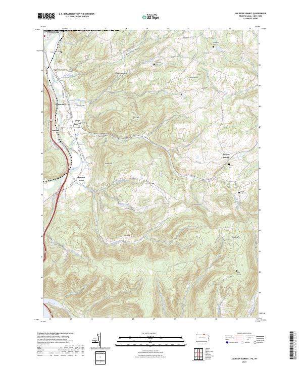
2023 Map of Jackson Summit
USGS Topo · Published 2023About this map
Lawrenceville and Jackson Summit anchor this landscape where the Tioga River flows southward toward the Tioga Reservoir. The geography is defined by a series of parallel valleys and ridges, including Buckwheat Hollow, Barber Hollow, and Dark Hollow. Settlement patterns follow the winding path of the Appalachian Throughway and Rte 287, which intersect at Tioga Junction. Local history is preserved in numerous family-named burial grounds such as Middaugh Cem and Dickenson Cem, alongside smaller hamlets like East Lawrence and Beeman. The complex drainage system, featuring Mitchell Creek, Bentley Creek, and Mutton Lane Creek, illustrates the hydraulic carving of the Northern Tier's upland terrain.
Find a feature on this map
75 named features on this map. Tap any name to fly to it.
Don’t see what you’re looking for? This feature index may not catch every label — zoom into the map to look around manually.
Map Details
Editions of this 2023 Jackson Summit Map
This is the sole edition of this map. No revisions or reprints were ever made.
Other maps of this area

1895 · Elmira
USGS Topo · 1:62,500

1900 · Tioga
USGS Topo · 1:62,500

1902 · Tioga
USGS Topo · 1:62,500

1905 · Watkins Glen
USGS Topo · 1:125,000

1914 · Corning
USGS Topo · 1:62,500

1931 · Troy
USGS Topo · 1:48,000

1938 · Troy
USGS Topo · 1:62,500

1944 · Corning
USGS Topo · 1:62,500

1950 · Elmira
USGS Topo · 1:250,000

1953 · Roseville
USGS Topo · 1:24,000