
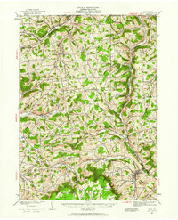
1931 Map of Troy
USGS Topo · Published 1931About this map
Sugar Creek and South Creek define the drainage patterns of this northern Tier landscape, where small agricultural hamlets and crossroads settlements thrived during the early 1930s. The region is characterized by a dense network of local institutions, including the State Road Ch and Sch, Pumpkin Hill Sch, and Everett Sch, reflecting a time of localized rural education. Significant transit corridors like the Pennsylvania RR and Erie RR cut through the valleys, facilitating movement between centers like Snedekerville and Columbia Cross Roads.
Find a feature on this map
91 named features on this map. Tap any name to fly to it.
Don’t see what you’re looking for? This feature index may not catch every label — zoom into the map to look around manually.
Map Details
Editions of this 1931 Troy Map
2 editions found
Other maps of this area

1895 · Elmira
USGS Topo · 1:62,500

1900 · Tioga
USGS Topo · 1:62,500

1902 · Waverly
USGS Topo · 1:62,500

1902 · Tioga
USGS Topo · 1:62,500

1905 · Watkins Glen
USGS Topo · 1:125,000

1914 · Corning
USGS Topo · 1:62,500

1925 · Blossburg
USGS Topo · 1:62,500

1927 · Blossburg
USGS Topo · 1:62,500

1938 · Troy
USGS Topo · 1:62,500

1939 · Sayre
USGS Topo · 1:62,500