Old Maps of Brookhaven, New York for Genealogy
Trace your family roots with 142 historic maps of Brookhaven. These high-res maps reveal old neighborhoods, homesites, landmarks, and streets — helping you uncover where your ancestors lived and how the area evolved over time.
- Explore historic neighborhoods: Identify where your relatives may have lived in the 1800s or 1900s.
- Compare maps over time: Trace the changes in streets, buildings, and landmarks for multi-generational research.
- Perfect for genealogy & ancestry research: Used by family historians and researchers to map out lineage and migration.
These maps are an incredible resource for exploring your personal connection to Brookhaven's past.
Brookhaven, NY maps
(142)- 1891 Map of Bridgeport
 1891 Bridgeport1891 Print · USGSThe industrial shoreline of Fairfield County comes to life in this late Victorian survey, capturing the region's intense rail and maritime activity. Trace the early street grids of Bridgeport and Milford, or locate family landmarks near Moodys Mill Pond and Nichols Farms.
 - 1893 Map of Bridgeport
 1893 Bridgeport1893 Print · USGSCoastal Connecticut thrived in the 1890s as a hub of manufacturing and rail transport. Genealogists and historians can trace the early street grids of Bridgeport, find old landmarks like Berkshire Mill Pond, and locate family sites in Nichols Farms.8 unique versions available
 - 1902 Map of Setauket, 1959 Print
 1902 Setauket1959 Print · USGSSuffolk County’s north and south shores are captured here at the start of the twentieth century. Researchers can trace the Port Jefferson Branch rail lines, the grounds of the State Hospital, and the early layout of Setauket and Bohemia.
 - 1902 Map of Fire Island, 1962 Print
 1902 Fire Island1962 Print · USGSThe South Shore of Long Island is captured here at the dawn of the twentieth century, anchored by the Montauk Division rail line. Genealogists and maritime historians can locate early settlements like Oakdale and trace the vital network of Life-Saving Stations including Point O'Woods L.S.S. and Blue Point L.S.S. along the barrier beach.
 - 1903 Map of Fire Island
 1903 Fire Island1903 Print · USGSLong Island's southern shore and the outer barrier beach are captured here at the turn of the century. You can trace early coastal infrastructure through the Fire Island Lighthouse and life-saving stations like Lone Hill L.S.S. and Blue Point L.S.S..6 unique versions available
 - 1903 Map of Riverhead, 1963 Print
 1903 Riverhead1963 Print · USGSThe forks of Long Island come alive in this early 1900s survey of the bustling rail and maritime corridor. Researchers can trace the Long Island Railroad through historic hamlets like Good Ground, Aquebogue, and the early shoreline of Shinnecock Bay.
 - 1904 Map of Setauket
 1904 Setauket1904 Print · USGSSuffolk County at the start of the century shows a North Shore landscape of maritime villages and inland rail depots. Genealogists can trace family names and institutions from Stony Brook to the State Hospital For The Insane and Patchogue.7 unique versions available
 - 1904 Map of Islip
 1904 Islip1904 Print · USGSSuffolk County at the start of the century reveals a landscape defined by deep north-shore harbors and the expansive Great South Bay. Genealogists and local historians can trace early rail lines through Kings Park and Stony Brook, or locate the sprawling State Hospital and St. Dominic Convent.5 unique versions available
 - 1904 Map of Riverhead
 1904 Riverhead1904 Print · USGSEastern Long Island at the turn of the century shows a landscape of rail-connected hamlets and coastal vigilance. Researchers can trace the early layout of Riverhead or locate historic life-saving outposts like Tiana L.S.S. and Potunk L.S.S. along the barrier beaches.9 unique versions available
 - 1904 Map of Moriches, 1912 Print
 1904 Moriches1912 Print · USGSCoastal Suffolk County at the start of the century shows a landscape of quiet maritime landings and early railroad hamlets. Genealogists can trace the early footprints of Wardenclyffe, Middle Island, and the Life-Saving Stations protecting Fire Island.2 unique versions available
 - 1919 Map of Setauket
 1919 Setauket1919 Print · USGSLong Island's north and south shores meet in this post-war tactical survey, documenting the transition from maritime villages to rail-linked townships. Genealogists and researchers can trace early century landmarks like the State Hospital for the Insane and the original Setauket Sta.
 - 1920 Map of Bridgeport
 1920 Bridgeport1920 Print · USGSCoastal Connecticut comes alive in the early twentieth century as a hub of maritime commerce and industrial growth. Researchers can trace the development of Bridgeport and Milford, or locate specific landmarks like Charles Island and Beardsley Park.
 - 1942 Map of Islip, 1943 Print
 1942 Islip1943 Print · USGSCentral Suffolk County is shown during the early years of the war, as the automobile began to reshape the distance between historic North Shore harbors and the South Shore bays. Researchers can trace the path of the Long Island Motor Parkway, locate family plots at Pinelawn Cem, and identify coastal landmarks like Eaton Neck L H.
 - 1943 Map of Riverhead
 1943 Riverhead1943 Print · USGSLong Island's eastern forks appear here in the early twentieth century as a landscape of coastal hamlets and maritime commerce. Trace the path of the Montauk Division railroad through RIVERHEAD or locate family roots in Mattituck, Speonk, and Good Ground.
 - 1944 Map of Bay Shore East
 1944 Bay Shore East1944 Print · USGSThe Long Island shoreline near Bay Shore and Islip is captured here during the 1940s. Researchers can trace the development of barrier island communities like Ocean Beach and Point O' Woods or locate the historic Fire Island Coast Guard station.
 - 1947 Map of St James
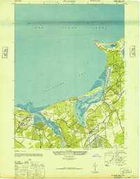 1947 St James1947 Print · USGSThe North Shore of Long Island is captured here in the years following the war, featuring the intricate tidal marshlands of Smithtown Bay. Genealogists and historians can trace the grounds of the Kings Park State Hospital for the Insane and the residential clusters at St. James and Stony Brook.2 unique versions available
 - 1947 Map of Bellport
 1947 Bellport1947 Print · USGSThe South Shore of Long Island in the late 1940s is shown here at the cusp of significant change. Genealogists and historians can trace rail-era landmarks like Yaphank Sta, the Suffolk County Alms House & Childrens Home, and the Camp Upton Military Reservation.
 - 1947 Map of Howells Point
 1947 Howells Point1947 Print · USGSThe South Shore of Long Island is documented here in the late forties, showing the vulnerable barrier beach system before modern development. Researchers can trace the early residential layout of Brookhaven and the natural state of Great South Beach and Ridge Island.
 - 1947 Map of Port Jefferson
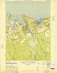 1947 Port Jefferson1947 Print · USGSMid-century coastal Long Island comes into focus in this study of the North Shore harbors just after the war. Researchers can trace the waterfront development of Port Jefferson and identify early land use in Setauket, Mount Sinai, and Belle Terre.
 - 1947 Map of Central Islip
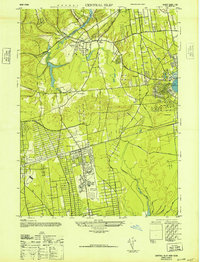 1947 Central Islip1947 Print · USGSSuffolk County is captured in the mid-1940s as institutional grounds and early aviation hubs began to reshape the Long Island interior. Researchers can trace the sprawling grounds of the Central Islip State Hospital and the early layout of Islip Airport.
 - 1947 Map of Sayville
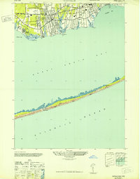 1947 Sayville1947 Print · USGSThe South Shore of Long Island is captured here in the late 1940s, showing a landscape of maritime villages and coastal retreats. Researchers can trace the development of Sayville and Bayport or locate remote landmarks like Cherry Grove and the Blue Point CG on the barrier beach.
 - 1947 Map of Riverhead
 1947 Riverhead1947 Print · USGSRiverhead and the Peconic River valley are captured here just after the war, showing the area's transition from agricultural heartland to a regional hub. Researchers can trace the Long Island Railroad route, family-named roads like Osborn Ave, and local sites like the LI Research Veg Farm.
 - 1947 Map of Patchogue
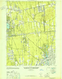 1947 Patchogue1947 Print · USGSCentral Suffolk County is documented just after the war, showing the distinct village identities of the south shore and the rural interior. Trace local genealogy and property development through the street grids of Patchogue, Bohemia, and the rail-oriented Ronkonkoma.
 - 1947 Map of Eastport
 1947 Eastport1947 Print · USGSCoastal Suffolk County thrives along the Atlantic shore in the years following World War II, when rail and road first began to transform these fishing and farming hamlets. Genealogists and historians can trace the early layouts of Eastport, Speonk, and Westhampton Beach alongside the Long Island Railroad.
 - 1947 Map of Middle Island
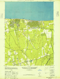 1947 Middle Island1947 Print · USGSMid-century Brookhaven comes to life as residential communities began to expand along the northern bluffs and the Port Jefferson railroad line. Researchers can trace the massive circular footprint of the RCA Radio Station and the boundary of the Camp Upton Military Reservation near Artist Lake.2 unique versions available
Showing maps 1-25 of 142
Top cities near Brookhaven
- Islip historical maps
- Smithtown historical maps
- Southampton historical maps
- Coram historical maps
- Central Islip historical maps
- Riverhead historical maps
See more
Top neighborhoods of Brookhaven
- Upton historical maps
- Miller Place historical maps
- Coram historical maps
- Centereach historical maps
- Shirley historical maps
- Medford historical maps
See more
Frequently asked questions
- What are the different types of historical maps available for Brookhaven?
- What is the oldest map of Brookhaven?
- Where can I purchase historical maps of Brookhaven for my home or office?
- Where can I download high-res historical maps of Brookhaven?
- Are there historical topographic maps available for Brookhaven?
- Is there historical aerial imagery available for Brookhaven?
- Where are historical maps of Brookhaven sourced from?