2020s Maps of Kings Park, Smithtown
Explore 4 historic maps of Kings Park from the 2020s. These maps offer a rare glimpse into what life looked like during the 2020s — showing old roads, neighborhoods, homes, and landmarks that have changed or disappeared over time.
Whether you're researching your family's past, planning a metal detecting trip, or studying how Kings Park's landscape evolved across the 2020s, these high-resolution maps are a powerful tool for exploring the history of this region.
- Focus on a specific era: All maps on this page are from the 2020s, giving you a focused view of this time period.
- See what’s changed: Compare century-old streets, trails, and buildings to today's modern landscape using overlays and satellite layers.
- Research with precision: Use these maps for genealogy, historical research, land use analysis, or educational projects.
- View, download, or print: Maps are fully viewable online in high resolution, and can be downloaded or printed for your own records.
Start exploring Kings Park's history through authentic maps from the 2020s. This is your window into the past.
Kings Park, Smithtown maps
(4)- 2023 Map of Saint James, 2023 Print
 2023 Saint James2023 Print · USGSThe North Shore of Long Island comes into focus here, showing the modern interplay between the Stony Brook University campus and coastal villages. Genealogists and historians can trace numerous burial sites like Oak Hill Cem and Saint Johnland Cem along the Nissequogue River.
 - 2023 Map of Central Islip, 2023 Print
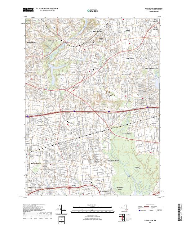 2023 Central Islip2023 Print · USGSCentral Islip and the surrounding Suffolk County townships are shown here in the early twenty-first century. Genealogists can trace family sites at Saint Patrick Cem and Calvary Cem or locate regional landmarks like Willard State Hospital.
 - 2023 Map of Northport, 2023 Print
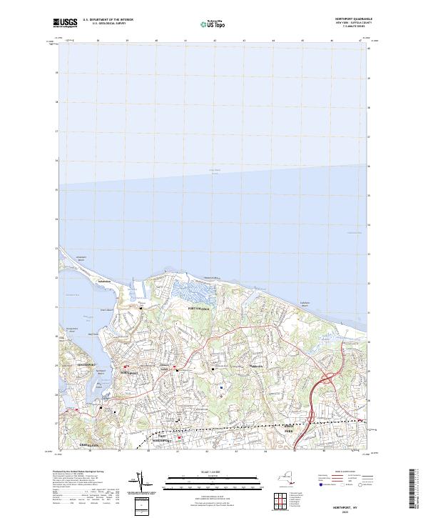 2023 Northport2023 Print · USGSThe North Shore of Long Island is mapped here in the early twenty-first century, showing the established waterfront communities from Northport to Kings Park. Family historians can trace ancestral sites through numerous grounds like Scidmore Cemetery and the Genola Rural Cemetery.
 - 2023 Map of Greenlawn, 2023 Print
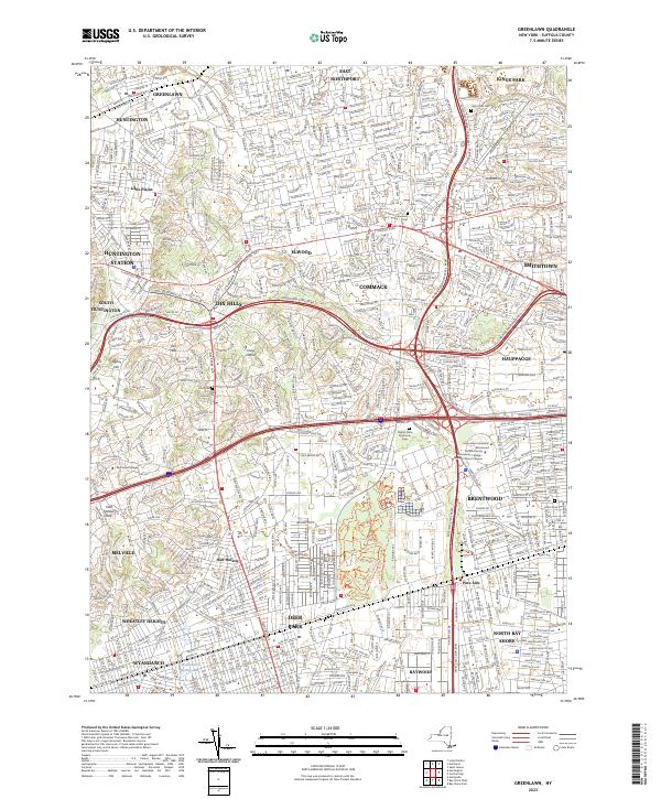 2023 Greenlawn2023 Print · USGSCentral Long Island at the start of the 2020s shows a mature suburban landscape anchored by major transit arteries and academic institutions. Trace the intersection of modern life and local history through features like Pilgrim State Psychiatric Cem, Signal Hill, and the Long Island Rail Road.
End of results
Showing maps 1-4 of 4
Top cities near Kings Park
- Hempstead historical maps
- Brookhaven historical maps
- Islip historical maps
- Oyster Bay historical maps
- Babylon historical maps
- Huntington historical maps
See more
Top neighborhoods of Kings Park
Frequently asked questions
- What are the different types of historical maps available for Kings Park?
- What is the oldest map of Kings Park?
- Where can I purchase historical maps of Kings Park for my home or office?
- Where can I download high-res historical maps of Kings Park?
- Are there historical topographic maps available for Kings Park?
- Is there historical aerial imagery available for Kings Park?
- Where are historical maps of Kings Park sourced from?