Old Maps of Sullivan County, New York
Explore 268 old maps of Sullivan County, spanning from 1901 to today. These high-resolution historic maps reveal how streets, neighborhoods, landmarks, and natural features evolved over time — perfect for genealogy, metal detecting, research, and local history exploration.
What you can do with these maps:
- See how Sullivan County changed over time: Compare historical maps to modern-day views to trace roads, homesites, rail lines & more.
- View detailed metadata: Each map includes creators, publishers, year, scale, and archive source.
- Overlay maps with satellite & LiDAR: Visualize the past alongside modern tools to explore terrain & human change.
- Trusted historical sources: Maps sourced from the USGS, Library of Congress, and other archives.
- Access maps your way: View online, download high-res files, or order prints for personal or research use.
Start exploring old maps of Sullivan County to uncover forgotten places, hidden landmarks, and the deep history beneath your feet.
Sullivan County, NY maps
(268)- 1901 Map of Margaretville, 1961 Print
 1901 Margaretville1961 Print · USGSThe Catskills at the turn of the century are defined here by river-valley settlements and the Ulster and Delaware railroad line. Genealogists and historians can trace family-named hollows and vanished settlements like Grant Mills, Arena, and Griffin Corners.
 - 1903 Map of Slide Mountain, 1961 Print
 1903 Slide Mountain1961 Print · USGSThe high peaks and deep hollows of Ulster County are captured here at the dawn of the reservoir era. Genealogists and hikers can trace old homesteads and roads near Sundown, Lackawack, and the isolated Peekamoose Lodge.
 - 1904 Map of Margaretville
 1904 Margaretville1904 Print · USGSThe Catskills' high-valley communities thrive along the Ulster and Delaware RR at the turn of the century. Trace old family farmsteads and rural mountain hamlets like Arena, New Kingston, and Griffin Corners as they appeared in 1904.7 unique versions available
 - 1904 Map of Ellenville, 1956 Print
 1904 Ellenville1956 Print · USGSThe Shawangunk Mountains and Wallkill Valley are captured here at the start of the twentieth century, showing a landscape of high ridges and industrial valleys. Researchers can trace the D. & H. Canal (Abandoned), the New York Ontario and Western RR, and historic centers like Ellenville or Wurtsboro.
 - 1905 Map of Slide Mountain
 1905 Slide Mountain1905 Print · USGSThe Catskill high peaks meet the industrializing Rondout valley in the early twentieth century. Researchers can trace old mountain outposts like Peekamoose Lodge and Sundown, or follow the New York Ontario and Western RR through Kerhonkson.8 unique versions available
 - 1906 Map of Ellenville
 1906 Ellenville1906 Print · USGSThe Shawangunk ridge and Mamakating Hollow are captured here in the early 1900s, showing the region's shift from canal to rail transport. Genealogists can locate family homes and landmarks across Ellenville, Cragsmoor, and Wurtsboro, or trace the Delaware and Hudson Canal.7 unique versions available
 - 1906 Map of Port Jervis, 1956 Print
 1906 Port Jervis1956 Print · USGSPort Jervis sits at the confluence of the Delaware and Neversink rivers during the height of the railroad era. Genealogists and local historians can trace the paths of the Erie RR, find vanished hamlets like Logtown, and locate the Old Bolton Basin along the river.
 - 1908 Map of Port Jervis
 1908 Port Jervis1908 Print · USGSThe tri-state border region comes alive at the start of the twentieth century, focused on the rail-and-river hub of Port Jervis. Genealogists and historians can trace family locations across Matamoras, Unionville, and Westtown, or locate landmarks like Tristate Rock and Old Bolton Basin.4 unique versions available
 - 1909 Map of Monticello, 1956 Print
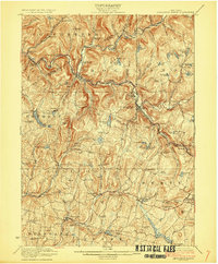
 1909 Monticello1956 Print · USGSSullivan County at the dawn of the twentieth century was a landscape of rail-connected resort communities and developing water systems. Researchers can trace the routes of the New York Ontario and Western RR to historic stops like Hurleyville Luzon Sta or the secluded Hartwood Club.
 - 1910 Map of Neversink
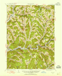
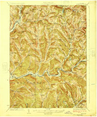
 1910 Neversink1910 Print · USGSSullivan and Ulster counties appear here in the early twentieth century, showing a region of mountain hamlets and sprawling ponds before major reservoir construction. Genealogists can trace family footprints in Grahamsville, Eureka, and Loch Sheldrake, or follow the Ontario and Western RR through Liberty.6 unique versions available
 - 1911 Map of Monticello
 1911 Monticello1911 Print · USGSSullivan County at the height of its early resort era shows a landscape shaped by competing railroads and mountain valleys. Genealogists and historians can trace the New York Ontario and Western RR through Hurleyville Luzon Sta or locate the Delaware and Hudson Canal (Abandoned).6 unique versions available
 - 1913 Map of Milford, 1958 Print
 1913 Milford1958 Print · USGSBefore the Tri-State area was suburbanized, this early twentieth-century survey captures the rugged river economy of the Delaware valley. Genealogists can trace family roots at McCartys Corner or locate vanished rural schoolhouses like the McCain School and Woodtown School.
 - 1915 Map of Milford
 1915 Milford1915 Print · USGSThe Delaware River valley at the tri-state border comes alive in this pre-war survey, capturing a world of riverside rail stations and remote mountain schoolhouses. Genealogists can locate family landmarks like McCarthys Corner or trace rural education at the Yale Forest School and Quicktown School.7 unique versions available
 - 1920 Map of Long Eddy
 1920 Long Eddy1920 Print · USGSThe Delaware River borderlands come alive in the 1920s as a hub of rail activity and riverfront commerce. Genealogists can locate family names near landmarks like Peckville P O, Equinunk, and rural schoolhouses like the South Branch School.3 unique versions available
 - 1920 Map of Damascus, 1956 Print
 1920 Damascus1956 Print · USGSThe Upper Delaware River valley at the start of the 1920s shows a landscape of river-fronting hamlets and upland dairy farms. Genealogists can locate numerous rural schoolhouses and churches, such as Kester School, Smith Hill Church, and the Oil Pumping Station at Cochecton.2 unique versions available
 - 1921 Map of Long Eddy
 1921 Long Eddy1921 Print · USGSThe Delaware River borderlands are captured here in the early twenties, showing a network of small upland communities and river crossings. Genealogists can trace family footprints through numerous rural schoolhouses and landmarks like Read Cemetery, Abrahamsville, and the Ferry.
 - 1921 Map of Livingston Manor, 1952 Print
 1921 Livingston Manor1952 Print · USGSSullivan County in the early twenties is captured here as a landscape of timber processing and rail-connected mountain towns. Genealogists and historians can trace numerous rural districts like the Ireland School or find specific industrial sites such as the Acid Plant and Dye Works.2 unique versions available
 - 1922 Map of White Lake
 1922 White Lake1922 Print · USGSSullivan County's lake-strewn highlands appear here in the early twenties, showing a landscape defined by small mountain hamlets and rural school districts. Genealogists can trace family names through landmarks like Stewart Cemetery, Bauer's Mill, and Mount Hope School.6 unique versions available
 - 1922 Map of Andes, 1955 Print
 1922 Andes1955 Print · USGSThe East Branch Delaware River valley is captured in the 1920s before the creation of the Pepacton Reservoir. Researchers can trace the original locations of Pepacton, Shavertown, and Union Grove, alongside numerous rural schoolhouses like Basin Clove School and Arbuckle School.2 unique versions available
 - 1923 Map of Damascus
 1923 Damascus1923 Print · USGSThe Delaware River valley thrived as a corridor for rail and industry in the early twenties. Genealogists and historians can trace family-named landmarks like Stanton Corner or locate vanished infrastructure like the Oil Pumping Station and Nobody Station School.5 unique versions available
 - 1923 Map of Long Eddy
 1923 Long Eddy1923 Print · USGSThe Delaware River valley thrived in the 1920s as a rail and timber hub between New York and Pennsylvania. Genealogists can trace family roots through the many rural schoolhouses and riverside settlements like Lordville, Equinunk, and Fishs Eddy.5 unique versions available
 - 1923 Map of Livingston Manor
 1923 Livingston Manor1923 Print · USGSSullivan County in the early twenties shows a landscape transitioning between timber industries and mountain recreation. Genealogists and historians can locate dozens of district schools like Sprague School and trace industrial sites like the Acid Plant along the Ontario and Western RR.5 unique versions available
 - 1924 Map of Andes
 1924 Andes1924 Print · USGSDelaware County during the mid-twenties shows a landscape of mountain hollows and river valley life. Genealogists can locate family-named landmarks and local schoolhouses like Miller Hollow School, the settlement of Shavertown, and Cabin Hill Church.4 unique versions available
 - 1942 Map of White Lake, 1957 Print
 1942 White Lake1957 Print · USGSSullivan County’s landscape of ponds and mountain ridges is detailed here in the early 1940s as the area’s agricultural roots met a growing resort era. Researchers can trace the Newburgh And Cochecton Turnpike past the Stewart Cem and vanished local schools like Birch Ridge Sch.
 - 1942 Map of Neversink, 1958 Print
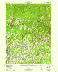 1942 Neversink1958 Print · USGSThe Catskills come alive in this wartime survey, showing the deep river valleys and high peaks of Sullivan and Ulster counties. Trace old rail lines like the NYO AND W RR or find family landmarks in hamlets such as Claryville, Loch Sheldrake, and Grahamsville.2 unique versions available
Showing maps 1-25 of 268
Top cities of Sullivan County
- Thompson historical maps
- Fallsburg historical maps
- Mamakating historical maps
- Liberty historical maps
- Bethel historical maps
- Neversink historical maps
See more
Frequently asked questions
- What are the different types of historical maps available for Sullivan County?
- What is the oldest map of Sullivan County?
- Where can I purchase historical maps of Sullivan County for my home or office?
- Where can I download high-res historical maps of Sullivan County?
- Are there historical topographic maps available for Sullivan County?
- Is there historical aerial imagery available for Sullivan County?
- Where are historical maps of Sullivan County sourced from?