2020s Maps of Tioga County, New York
Explore 23 historic maps of Tioga County from the 2020s. These maps offer a rare glimpse into what life looked like during the 2020s — showing old roads, neighborhoods, homes, and landmarks that have changed or disappeared over time.
Whether you're researching your family's past, planning a metal detecting trip, or studying how Tioga County's landscape evolved across the 2020s, these high-resolution maps are a powerful tool for exploring the history of this region.
- Focus on a specific era: All maps on this page are from the 2020s, giving you a focused view of this time period.
- See what’s changed: Compare century-old streets, trails, and buildings to today's modern landscape using overlays and satellite layers.
- Research with precision: Use these maps for genealogy, historical research, land use analysis, or educational projects.
- View, download, or print: Maps are fully viewable online in high resolution, and can be downloaded or printed for your own records.
Start exploring Tioga County's history through authentic maps from the 2020s. This is your window into the past.
Tioga County, NY maps
(23)- 2023 Map of Sayre, 2023 Print
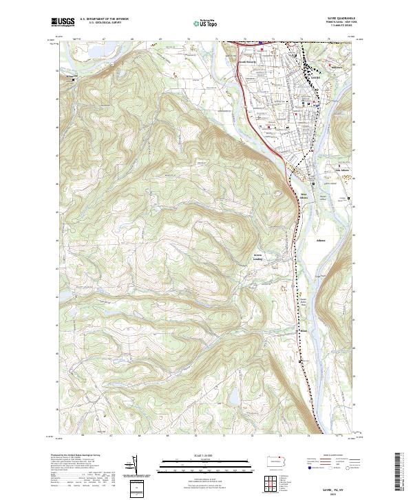 2023 Sayre2023 Print · USGSThe confluence of the Chemung River and Susquehanna River highlights this late-era survey of the Penn-York border. Researchers can trace family history at Tioga Point Cemetery, the Queen Esther Flats, and the older Old Athens Cemetery.
 - 2023 Map of Harford, 2023 Print
 2023 Harford2023 Print · USGSCentral New York hill country comes into focus in this recent survey of the rural landscape between Cortland and Tioga counties. Genealogists and hikers can trace paths to Harford Mills, the Larie Cem, and the North Country National Scenic Trl.
 - 2023 Map of Lisle, 2023 Print
 2023 Lisle2023 Print · USGSBroome County and the Tioga borderlands appear here in the early twenty-first century, showing a landscape of rural hamlets and upland cemeteries. Researchers can trace family roots through hillside sites like Mount Hunger Cem and the settlement at Ketchumville.
 - 2023 Map of Dryden, 2023 Print
 2023 Dryden2023 Print · USGSModern-day Tompkins County retains its historic village structure among the high ridges east of Ithaca. Researchers can locate family burial grounds like Caroline Grove Cem or trace the early settlement footprints of Slaterville Springs and Willow Glen.
 - 2023 Map of Maine, 2023 Print
 2023 Maine2023 Print · USGSThe Nanticoke Creek valley comes into focus in this contemporary study of central New York's hill country. Genealogists and local researchers can trace family-named burial grounds like Chrysler Road Cem and Hollenbeck Cem alongside historic crossroads at Union Center and Whittemore.
 - 2023 Map of Willseyville, 2023 Print
 2023 Willseyville2023 Print · USGSThe Tompkins and Tioga county borderlands are shown in this modern topographical survey, capturing the rural hamlets and deep valleys of Central New York. Genealogists can trace family sites at Michael Handy Farm Cem and the historic Fisher Settlement.
 - 2023 Map of Van Etten, 2023 Print
 2023 Van Etten2023 Print · USGSThe Southern Tier highlands come into focus during the early twenty-first century, centered on the rail-and-creek junction at Van Etten. Genealogists can trace family landmarks and rural homesteads through Swartwood Cem, Jenkins Cem, and the high reaches of Nobles Hill.
 - 2023 Map of Richford, 2023 Print
 2023 Richford2023 Print · USGSTioga County at the start of the 2020s reveals a rural landscape defined by deep creek valleys and family-named cemeteries. Genealogy researchers can trace local roots through Evergreen Cem, Brown's Settlement Cem, and the hamlet of Jenksville.
 - 2023 Map of Spencer, 2023 Print
 2023 Spencer2023 Print · USGSTioga County's southern tier remains a landscape of deep valleys and historic rural outposts in this modern survey. Genealogists can trace family names at Baptist Society Cem and Halsey Valley Cem, or explore the crossroads at Spencer and Straits Corners.
 - 2023 Map of Speedsville, 2023 Print
 2023 Speedsville2023 Print · USGSThe rural borderlands of Tompkins and Tioga counties are captured in this contemporary survey of their small hamlets and high ridges. Researchers can trace family history at Caroline Center Cem or Fairfield Cem and locate landmarks along the North Country National Scenic Trl.
 - 2023 Map of Friendsville, 2023 Print
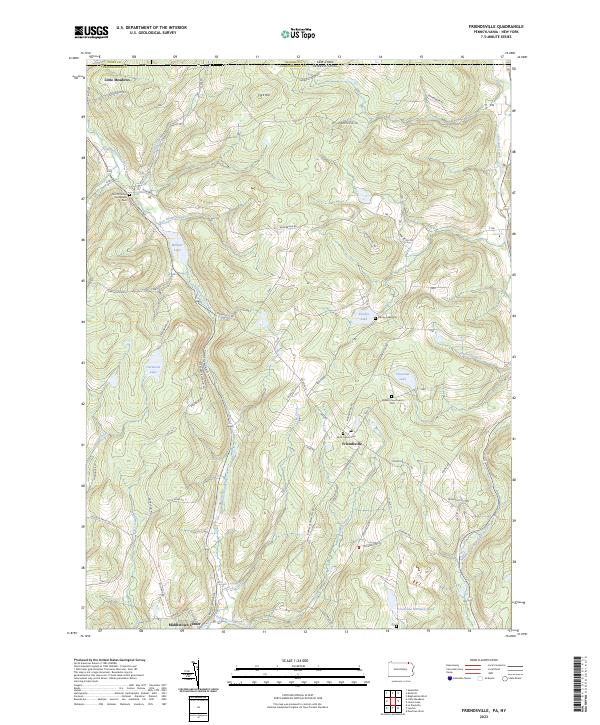 2023 Friendsville2023 Print · USGSSusquehanna County at the New York border remains a landscape of high ridges and quiet lake basins in the early twenty-first century. Researchers can locate family burial grounds and old crossroads at Quaker Churchyard Cem, Little Meadows, and Stanley Lake.
 - 2023 Map of Little Meadows, 2023 Print
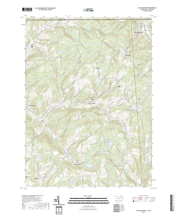 2023 Little Meadows2023 Print · USGSThe rolling hill country of the Pennsylvania-New York border comes into focus in this recent survey. Researchers can trace family history through sites like the Albert Brainard Family Cem, Cadis Cem, and the community of Warren Center.
 - 2023 Map of Litchfield, 2023 Print
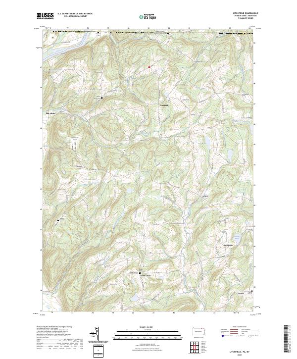 2023 Litchfield2023 Print · USGSThe Pennsylvania-New York borderlands are shown here in recent detail, where the Susquehanna River meets the high ridges of Bradford County. Genealogists can locate family burial sites at the Merrill Family Cem or trace old routes through Bumpville and North Ghent.
 - 2023 Map of Windham, 2023 Print
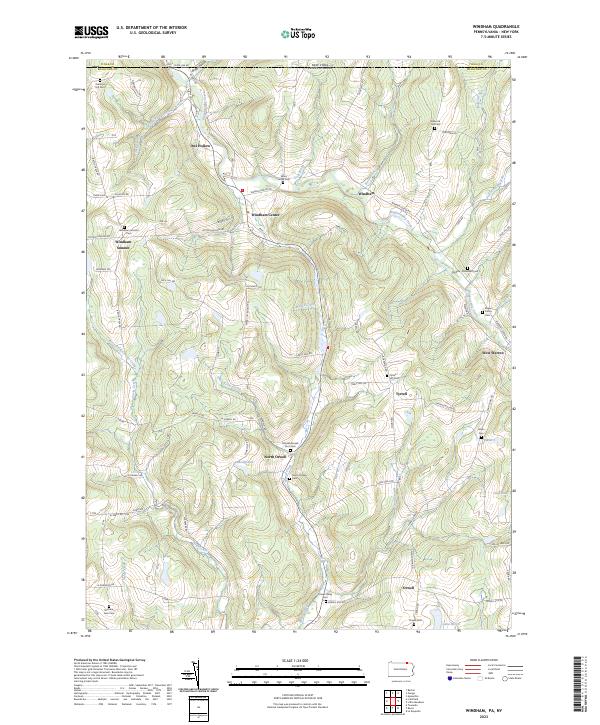 2023 Windham2023 Print · USGSBradford County near the New York border remains a region of quiet farmsteads and steep hillsides in the early twenty-first century. Researchers can trace ancestral roots through numerous family plots including the Rogers Family Cem and Babcock Hill Cem.
 - 2023 Map of Endicott, 2023 Print
 2023 Endicott2023 Print · USGSThe Susquehanna River valley near the New York and Pennsylvania border shows a landscape of established river towns and climbing hill country. Researchers can trace family history through several burial grounds like Riverside Cem and find landmarks such as the Tri-Cities Airport or Basket Lake.
 - 2023 Map of Newark Valley, 2023 Print
 2023 Newark Valley2023 Print · USGSTioga County's valley farms and upland ridges are captured in detail in the 2020s. Researchers can trace family history through numerous burial sites like Hope Cem, the waters of Alexander Lake, and the hamlet of Flemingville.
 - 2023 Map of Marathon, 2023 Print
 2023 Marathon2023 Print · USGSModern-day Cortland and Broome Counties still reflect the river-valley settlement patterns established centuries ago. Genealogists and local historians can trace family roots through several rural burial sites, including Killawog Cem, Parker Street Cem, and Hunts Corners Cem.
 - 2023 Map of Candor, 2023 Print
 2023 Candor2023 Print · USGSTioga County’s rural valleys and upland hamlets are captured in this recent survey of the southern Tier. Genealogists and local historians can trace family-named sites across the hills, from Maple Grove Cem to the settlement at Germany Hill.
 - 2023 Map of West Danby, 2023 Print
 2023 West Danby2023 Print · USGSThe hills of Tompkins and Chemung Counties are captured here in the 2020s, showing a landscape defined by deep hollows and historic rural settlements. Genealogists can locate family burial sites at People's Baptist Cem and Valley View Cem or trace the Norfolk Southern rail line through West Danby.
 - 2023 Map of Barton, 2023 Print
 2023 Barton2023 Print · USGSTioga County's riverfront and upland ridges come into sharp focus in this detailed survey of the southern Tier. Genealogists can locate family burial sites at Asbury Church Cem and Light Cem, or trace the winding course of Flag Marsh Run through Ellistown.
 - 2023 Map of Apalachin, 2023 Print
 2023 Apalachin2023 Print · USGSTioga County's river valley and southern uplands are shown in this 2023 survey. Genealogists and historians can locate numerous burial sites like Riverside Cem and Hiawatha Cem along the Susquehanna River.
 - 2023 Map of Waverly, 2023 Print
 2023 Waverly2023 Print · USGSTioga County settlement and the Chemung River valley are captured in this modern survey of the New York-Pennsylvania border. Genealogists can locate numerous burial sites such as Price-Simcoe Cem and French Cem near the village of Waverly.
 - 2023 Map of Owego, 2023 Print
 2023 Owego2023 Print · USGSTioga County is centered here on the Susquehanna River corridor as it winds through southern New York. Genealogists and local historians can trace family roots at Riverside Cem, the Tioga County Courthouse, and throughout the village of Owego.
End of results
Showing maps 1-23 of 23
Top cities of Tioga County
- Owego historical maps
- Barton historical maps
- Candor historical maps
- Tioga historical maps
- Newark Valley historical maps
- Spencer historical maps
See more
Frequently asked questions
- What are the different types of historical maps available for Tioga County?
- What is the oldest map of Tioga County?
- Where can I purchase historical maps of Tioga County for my home or office?
- Where can I download high-res historical maps of Tioga County?
- Are there historical topographic maps available for Tioga County?
- Is there historical aerial imagery available for Tioga County?
- Where are historical maps of Tioga County sourced from?