Old Maps of Campville, Owego for Hiking & Exploration
Hike through history with 17 historic maps of Campville. Explore old trails, ghost towns, and forgotten backroads — perfect for outdoor adventurers and local explorers.
- Rediscover forgotten places: Map out old mining camps, roads, and footpaths that no longer exist on modern maps.
- Layer with modern tools: Combine with LiDAR or satellite views to plan hikes through historical terrain.
- Made for exploration: Popular among hikers, overlanders, and local history lovers.
Use these maps to find adventure and explore the hidden past of Campville.
Campville, Owego maps
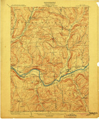
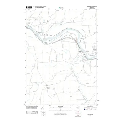
(17)- 1901 Map of Apalachin
 1901 Apalachin1901 Print · USGSThe Susquehanna River valley at the start of the twentieth century shows the rise of industrial towns and old riverside settlements. Researchers can trace early rail corridors like the Auburn Div or locate family homesteads near Waite Settlement and Flemingsville.
 - 1904 Map of Apalachin
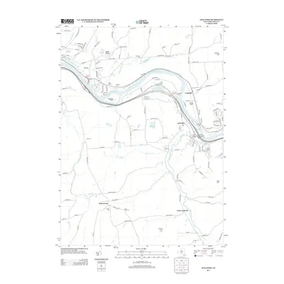
 1904 Apalachin1904 Print · USGSThe Susquehanna River valley at the turn of the century shows a landscape defined by heavy rail and early industry. Genealogists can trace family names and small upland hamlets like Waite Settlement, Oakley Cors, and Newark Valley before the modern highway era.8 unique versions available
 - 1906 Map of Catatonk
 1906 Catatonk1906 Print · USGSThe Southern Tier and Finger Lakes foothills are shown here at the peak of the rail era, before the expansion of modern highways. Genealogists can locate family lands near Slaterville Springs, trace the Lehigh Valley RR, or find early sites like White Church.
 - 1950 Map of Elmira
 1950 Elmira1950 Print · USGSThe Finger Lakes region thrived in the late 1940s as a hub of industry and transport. Trace family roots and vanished landmarks near Seneca Lake or explore the rail lines of the Erie RR and the sprawling Seneca Ordnance Depot.2 unique versions available
 - 1956 Map of Endicott
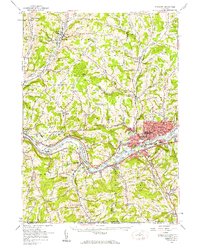 1956 Endicott1956 Print · USGSThe Susquehanna River valley thrives in the mid-fifties as industrial centers and educational institutions expand across the Southern Tier. Researchers can trace the development of Harpur College, the busy Tri-Cities Airport, and established rural sites like St Johns Ch.4 unique versions available
 - 1956 Map of Apalachin, 1958 Print
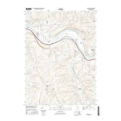
 1956 Apalachin1958 Print · USGSTioga County is captured here in the mid-fifties as the rail corridors still defined the river valley. Genealogists can locate family landmarks like Broadway Cem, Hiawatha Cem, and rural schoolhouses such as the South Apalachin Sch.2 unique versions available
 - 1958 Map of Elmira
 1958 Elmira1958 Print · USGSThe New York Finger Lakes during the late fifties reveal a complex landscape of glacial geology and industrial growth. Researchers can trace historic transport corridors like the Erie Canal and Erie RR, or locate institutional landmarks like Cornell University.2 unique versions available
 - 1962 Map of Elmira, 1969 Print
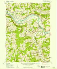
 1962 Elmira1969 Print · USGSThe Finger Lakes region and Southern Tier are captured here during a period of industrial maturity and highway expansion. Researchers can trace the path of the Erie Canal, the footprint of the Seneca Army Depot, and legacy rail lines through Elmira and Ithaca.4 unique versions available
 - 1965 Map of Elmira
 1965 Elmira1965 Print · USGSThe Finger Lakes and Southern Tier regions are captured in the mid-sixties, showcasing a landscape of deep glacial valleys and heavy rail infrastructure. Trace old railroad corridors like the Pennsylvania RR or visit landmarks like Letchworth State Park and the Seneca Army Depot.
 - 1969 Map of Apalachin, 1972 Print
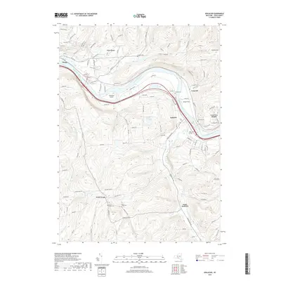
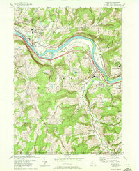 1969 Apalachin1972 Print · USGSThe Susquehanna River valley and the Pennsylvania borderlands meet in Tioga County during the late sixties. Researchers can trace family history through sites like Broadway Cem, St Margaret Mary Ch, and the riverside Hiawatha Island.2 unique versions available
 - 1986 Map of Elmira
 1986 Elmira1986 Print · USGSThe Southern Tier and Finger Lakes regions meet in this mid-eighties survey of the river valleys and high ridges. Genealogists can trace family names at Forest Lawn Memorial Park or locate homesteads near Breesport and Newark Valley.
 - 1992 Map of Elmira, 1993 Print
 1992 Elmira1993 Print · USGSThe Finger Lakes and Southern Tier regions are captured in the early nineties as industrial hubs like Elmira and Endicott thrived alongside university life in Ithaca. Genealogists and researchers can trace the CONRAIL rail corridors, family hilltops such as Hornby Hill, and the extensive Newtown Battlefield Reservation.
 - 2010 Map of Apalachin, 2010 Print
 2010 Apalachin2010 Print · USGSCovers Campville, including Owego, Owego, and other nearby areas
 - 2013 Map of Apalachin, 2013 Print
 2013 Apalachin2013 Print · USGSCovers Campville, including Owego, Owego, and other nearby areas
 - 2016 Map of Apalachin, 2016 Print
 2016 Apalachin2016 Print · USGSCovers Campville, including Owego, Owego, and other nearby areas
 - 2019 Map of Apalachin, 2019 Print
 2019 Apalachin2019 Print · USGSCovers Campville, including Owego, Owego, and other nearby areas
 - 2023 Map of Apalachin, 2023 Print
 2023 Apalachin2023 Print · USGSTioga County's river valley and southern uplands are shown in this 2023 survey. Genealogists and historians can locate numerous burial sites like Riverside Cem and Hiawatha Cem along the Susquehanna River.
End of results
Showing maps 1-17 of 17
Top cities near Campville
- Union historical maps
- Binghamton historical maps
- Vestal historical maps
- Owego historical maps
- Johnson City historical maps
- Endicott historical maps
See more
Frequently asked questions
- What are the different types of historical maps available for Campville?
- What is the oldest map of Campville?
- Where can I purchase historical maps of Campville for my home or office?
- Where can I download high-res historical maps of Campville?
- Are there historical topographic maps available for Campville?
- Is there historical aerial imagery available for Campville?
- Where are historical maps of Campville sourced from?