Old Maps of Palentown, Rochester for Genealogy
Trace your family roots with 17 historic maps of Palentown. These high-res maps reveal old neighborhoods, homesites, landmarks, and streets — helping you uncover where your ancestors lived and how the area evolved over time.
- Explore historic neighborhoods: Identify where your relatives may have lived in the 1800s or 1900s.
- Compare maps over time: Trace the changes in streets, buildings, and landmarks for multi-generational research.
- Perfect for genealogy & ancestry research: Used by family historians and researchers to map out lineage and migration.
These maps are an incredible resource for exploring your personal connection to Palentown's past.
Palentown, Rochester maps
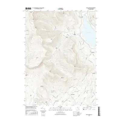
(17)- 1903 Map of Slide Mountain, 1961 Print
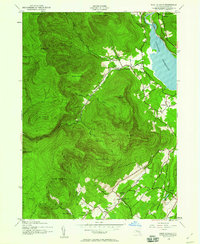
 1903 Slide Mountain1961 Print · USGSThe high peaks and deep hollows of Ulster County are captured here at the dawn of the reservoir era. Genealogists and hikers can trace old homesteads and roads near Sundown, Lackawack, and the isolated Peekamoose Lodge.
 - 1905 Map of Slide Mountain
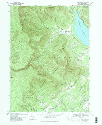
 1905 Slide Mountain1905 Print · USGSThe Catskill high peaks meet the industrializing Rondout valley in the early twentieth century. Researchers can trace old mountain outposts like Peekamoose Lodge and Sundown, or follow the New York Ontario and Western RR through Kerhonkson.8 unique versions available
 - 1942 Map of West Shokan, 1958 Print
 1942 West Shokan1958 Print · USGSThe Catskill mountain foothills in the early 1940s reveal a landscape of secluded hollows and high peaks bordering the Ashokan Reservoir. Genealogists and historians can trace old community hubs like Samsonville, Krumville, and several rural schoolhouses such as West Shokan Sch.2 unique versions available
 - 1943 Map of West Shokan
 1943 West Shokan1943 Print · USGSWar-era Ulster County is defined here by the rise of the Ashokan Reservoir against the high Catskill peaks. Local historians can trace old family names and small schoolhouses like Brodhead School or visit landmarks like the Father Divine Lodge.
 - 1950 Map of Scranton, 1952 Print
 1950 Scranton1952 Print · USGSMid-century Northeast Pennsylvania and the Hudson Valley come alive in this survey of the tri-state region. Genealogists and historians can trace the dense rail networks of the Erie RR and DL&W RR between industrial hubs like Scranton and Wilkes-Barre.
 - 1953 Map of Scranton
 1953 Scranton1953 Print · USGSNortheastern Pennsylvania and the Catskills are shown in great detail during the early fifties, a time when rail lines and river valleys dictated the region's growth. Genealogists and historians can trace the industrial hearts of Scranton and Wilkes-Barre or locate remote landmarks like High Point and Lake Wallenpaupack.
 - 1959 Map of Scranton
 1959 Scranton1959 Print · USGSThe northern coalfields and the Hudson Valley meet in this mid-century survey of the Pennsylvania and New York borderlands. Genealogists and historians can trace the intricate rail networks of the Erie Railroad and the vast waters of Lake Wallenpaupack.2 unique versions available
 - 1962 Map of Scranton, 1977 Print
 1962 Scranton1977 Print · USGSThe industrial heart of eastern Pennsylvania and the New York Catskills are captured here in the early sixties. Genealogists and historians can trace the dense valley settlements from Scranton to Wilkes-Barre and the rail lines of the Erie Lackawanna Railroad.2 unique versions available
 - 1965 Map of Scranton
 1965 Scranton1965 Print · USGSThe tri-state highlands of Pennsylvania, New York, and New Jersey come alive in the mid-sixties as industry and recreation converge. Trace the intricate rail lines of the Erie Lackawanna RR or locate landmarks like the U S Military Academy.2 unique versions available
 - 1969 Map of West Shokan, 1971 Print
 1969 West Shokan1971 Print · USGSThe eastern Catskills meet the waters of the Ashokan Reservoir in the late 1960s. Genealogists and hikers can trace old mountain roads to Samsonville, find the Palentown Cem, or locate landmarks like High Point (Samson).3 unique versions available
 - 1986 Map of Monticello
 1986 Monticello1986 Print · USGSThe Catskills and Shawangunk Ridge meet in the mid-eighties, showing a landscape defined by massive reservoirs and valley towns. Genealogists and researchers can trace the growth of Monticello, Ellenville, and New Paltz alongside landmarks like Mohonk Preserve and Stewart Airport.2 unique versions available
 - 1997 Map of West Shokan, 2001 Print
 1997 West Shokan2001 Print · USGSThe Catskill peaks and the western edge of the Ashokan Reservoir are captured here as they appeared in the late nineties. Genealogists and researchers can trace old family roads to the Palentown Cem or explore the mountain hamlets of Samsonville and West Shokan.
 - 2010 Map of West Shokan, 2010 Print
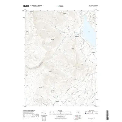
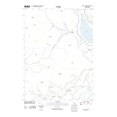 2010 West Shokan2010 Print · USGSCovers Palentown, including Rochester, Olive, and other nearby areas
 - 2013 Map of West Shokan, 2013 Print
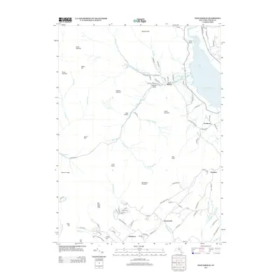 2013 West Shokan2013 Print · USGSCovers Palentown, including Rochester, Olive, and other nearby areas
 - 2016 Map of West Shokan, 2016 Print
 2016 West Shokan2016 Print · USGSCovers Palentown, including Rochester, Olive, and other nearby areas
 - 2019 Map of West Shokan, 2019 Print
 2019 West Shokan2019 Print · USGSCovers Palentown, including Rochester, Olive, and other nearby areas
 - 2023 Map of West Shokan, 2023 Print
 2023 West Shokan2023 Print · USGSThe Catskill high peaks and the Ashokan watershed meet in this 2023 survey of Ulster County. Local historians can trace the roads through Watson Hollow and Samsonville or locate family sites near Palentown Cem and Brodhead.
End of results
Showing maps 1-17 of 17
Top cities near Palentown
- Thompson historical maps
- New Paltz historical maps
- Fallsburg historical maps
- Shawangunk historical maps
- Wawarsing historical maps
- Mamakating historical maps
See more
Frequently asked questions
- What are the different types of historical maps available for Palentown?
- What is the oldest map of Palentown?
- Where can I purchase historical maps of Palentown for my home or office?
- Where can I download high-res historical maps of Palentown?
- Are there historical topographic maps available for Palentown?
- Is there historical aerial imagery available for Palentown?
- Where are historical maps of Palentown sourced from?