Old Maps of Cleverdale, Queensbury for Academic Research
Study the evolution of Cleverdale with 17 high-resolution historic maps. Whether you're teaching, researching, or modeling changes in land use, these maps provide essential visual documentation of urban, environmental, and geographic change.
- Analyze long-term change: Track patterns in development, transportation, and natural features.
- Ideal for environmental or urban studies: Support academic projects with primary historical map data.
- Use in the classroom or lab: Educators and researchers rely on these maps to bring historical context to life.
These maps are a powerful tool for teaching, research, and visualizing how Cleverdale has changed over the decades.
Cleverdale, Queensbury maps
(17)- 1895 Map of Glens Falls, 1955 Print
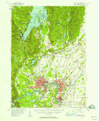
 1895 Glens Falls1955 Print · USGSThe Hudson River corridor and the southern tip of Lake George are seen here in the late nineteenth century. Researchers can trace military history at the Fort William Henry Ruins or find old industry at Griswolds Mills and Feeder Dam.
 - 1897 Map of Glens Falls
 1897 Glens Falls1897 Print · USGSThe upper Hudson River valley and the southern shores of Lake George are captured here during the late Victorian industrial era. Genealogists and historians can trace old homesteads and landmarks like the Fort Wm. Henry Ruins, Griswolds Mills, and the Delaware and Hudson RR corridor.9 unique versions available
 - 1938 Map of Glens Falls
 1938 Glens Falls1938 Print · USGSUpper Hudson Valley and Lake George history comes alive in this survey of a developing industrial and resort corridor. Researchers can locate colonial military sites like Fort George Ruins, early industry at Griswolds Mills, and the path of the Cable RR.
 - 1947 Map of Glens Falls
 1947 Glens Falls1947 Print · USGSThe upper Hudson Valley and the southern gateway to the Adirondacks are captured here during a period of robust industrial and rail growth. Researchers can trace historic fortifications like Fort George Ruins and identify old milling sites such as Pattens Mills and Griswolds Mills.
 - 1950 Map of Glens Falls
 1950 Glens Falls1950 Print · USGSThe Adirondacks and the Green Mountains meet in this mid-century survey of the New York and Vermont borderlands. Researchers can trace the industrial rail corridors of the Rutland RR and Delaware & Hudson RR connecting Glens Falls, Rutland, and the shores of Lake George.
 - 1955 Map of Glens Falls, 1958 Print
 1955 Glens Falls1958 Print · USGSThe Hudson River valley and the southern gateway to the Adirondacks are captured here in the mid-fifties. Genealogists and local historians can trace family plots at Union Cem, locate the Mud Street Sch, and explore the grounds of Fort William Henry.4 unique versions available
 - 1956 Map of Glens Falls, 1968 Print
 1956 Glens Falls1968 Print · USGSUpper New York and the Vermont mountains are captured here in the mid-fifties, showing the rugged rail-and-river network of the Northeast. Researchers can trace the paths of the Delaware and Hudson RR and Rutland RR as they wind through valley towns like Poultney and Whitehall.3 unique versions available
 - 1959 Map of Glens Falls
 1959 Glens Falls1959 Print · USGSUpper New York and Vermont are captured here during the late 1950s, a period of transition for these mountain communities. Researchers can trace the legacy of the region's river-and-rail economy through landmarks like Lake George, Saratoga Springs, and Killington Peak.2 unique versions available
 - 1964 Map of Glens Falls
 1964 Glens Falls1964 Print · USGSThe tri-state borderlands of New York, Vermont, and New Hampshire appear here in the mid-1960s. Researchers can trace the rail routes of the Rutland RR and find historic sites like Ticonderoga and Saratoga National Historical Park.
 - 1966 Map of Lake George, 1969 Print
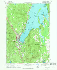 1966 Lake George1969 Print · USGSLake George enters a new era of accessibility in the mid-sixties as the Adirondack Northway connects with established mountain resorts. Researchers can trace historic sites like Fort William Henry alongside local landmarks such as the Stone Schoolhouse and Bloody Pond.3 unique versions available
 - 1986 Map of Glens Falls
 1986 Glens Falls1986 Print · USGSThe Upper Hudson Valley and Vermont borderlands come together in this mid-eighties survey of industrial river towns and mountain retreats. Genealogists and historians can trace the rail lines of the Delaware and Hudson Railway or locate landmarks like the Mount McGregor Correctional Facility and Saratoga Spa State Park.2 unique versions available
 - 1989 Map of Glens Falls
 1989 Glens Falls1989 Print · USGSThe Upper Hudson Valley and the Vermont borderlands are captured here during the late eighties, showing a landscape of river-town industry and mountain recreation. Researchers can trace the Champlain Canal, the Delaware and Hudson RR, and historic sites like Saratoga National Historical Park.
 - 2010 Map of Lake George, 2010 Print
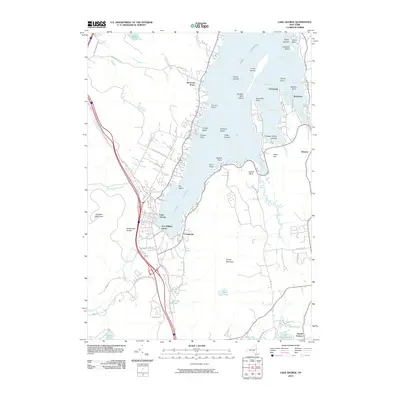 2010 Lake George2010 Print · USGSCovers Cleverdale, including Queensbury, Fort Ann, and other nearby areas
 - 2013 Map of Lake George, 2013 Print
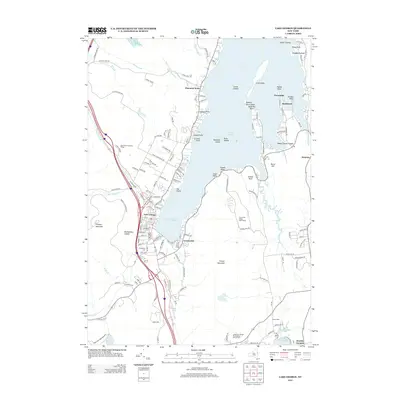 2013 Lake George2013 Print · USGSCovers Cleverdale, including Queensbury, Fort Ann, and other nearby areas
 - 2016 Map of Lake George, 2016 Print
 2016 Lake George2016 Print · USGSCovers Cleverdale, including Queensbury, Fort Ann, and other nearby areas
 - 2019 Map of Lake George, 2019 Print
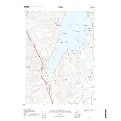 2019 Lake George2019 Print · USGSCovers Cleverdale, including Queensbury, Fort Ann, and other nearby areas
 - 2023 Map of Lake George, 2023 Print
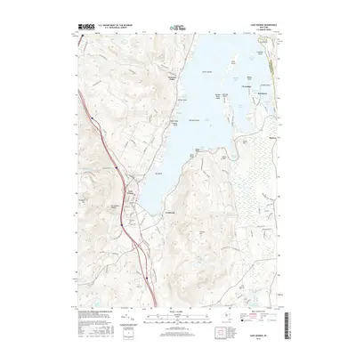
 2023 Lake George2023 Print · USGSThe southern basin of Lake George is captured here in the early twenty-first century, showing the established communities of Cleverdale and Diamond Point. Researchers can trace local heritage at Caldwell Cem or follow the terrain from French Mountain to the shores of Harris Bay.
End of results
Showing maps 1-17 of 17
Top cities near Cleverdale
- Queensbury historical maps
- Moreau historical maps
- Glens Falls historical maps
- Kingsbury historical maps
- Glens Falls North historical maps
- Hudson Falls historical maps
See more
Frequently asked questions
- What are the different types of historical maps available for Cleverdale?
- What is the oldest map of Cleverdale?
- Where can I purchase historical maps of Cleverdale for my home or office?
- Where can I download high-res historical maps of Cleverdale?
- Are there historical topographic maps available for Cleverdale?
- Is there historical aerial imagery available for Cleverdale?
- Where are historical maps of Cleverdale sourced from?