Old Maps of Perry, New York for Academic Research
Study the evolution of Perry with 28 high-resolution historic maps. Whether you're teaching, researching, or modeling changes in land use, these maps provide essential visual documentation of urban, environmental, and geographic change.
- Analyze long-term change: Track patterns in development, transportation, and natural features.
- Ideal for environmental or urban studies: Support academic projects with primary historical map data.
- Use in the classroom or lab: Educators and researchers rely on these maps to bring historical context to life.
These maps are a powerful tool for teaching, research, and visualizing how Perry has changed over the decades.
Perry, NY maps
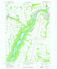
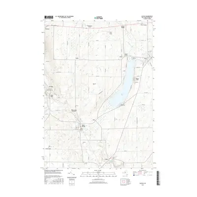
(28)- 1905 Map of Portage
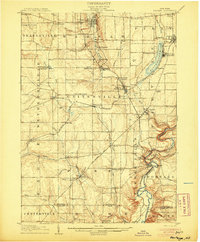 1905 Portage1905 Print · USGSWyoming County at the turn of the century shows a landscape defined by the deep gorge of the Genesee River and a busy rail network. Genealogists can trace family names at Halls Corners, explore the Silver Lake Assembly, or locate the mills and stations at Rock Glen and Portageville.6 unique versions available
 - 1905 Map of Nunda
 1905 Nunda1905 Print · USGSLivingston County rail and river life are captured here at the turn of the century, centered on the Genesee River valley. Trace the vanished streets of St Helena, locate the Sonyea P O Craig Colony, and follow the complex rail junctions at Mount Morris.6 unique versions available
 - 1943 Map of Mount Morris
 1943 Mount Morris1943 Print · USGSDuring the war years, this corner of the Genesee Valley was a landscape of dramatic river gorges and quiet upland farming. Genealogists and historians can trace the early road networks connecting Mount Morris and Perry or locate rural hamlets like Brooks Grove and Simmons Corners.2 unique versions available
 - 1943 Map of Castile, 1960 Print
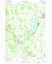
 1943 Castile1960 Print · USGSMid-century Wyoming County centers on the busy waters of Silver Lake and the critical rail crossings of the war years. Local historians can trace the paths of the Baltimore and Ohio railroad through Silver Springs, Castile, and the junction at Rock Glen.
 - 1944 Map of Mount Morris
 1944 Mount Morris1944 Print · USGSThe Genesee Valley during the mid-forties was a landscape of dramatic river bluffs and vital rail junctions. Genealogists and local historians can trace family-named routes like Hendershot Road and locate rural hubs such as Brooks Grove and Ridge.
 - 1944 Map of Castile
 1944 Castile1944 Print · USGSWyoming County at the height of the mid-century salt and rail era shows a landscape of busy junctions and lakeside settlements. Trace the industrial footprint of the Worcester Salt Works and the rail corridors through Silver Springs and Rock Glen.
 - 1950 Map of Elmira
 1950 Elmira1950 Print · USGSThe Finger Lakes region thrived in the late 1940s as a hub of industry and transport. Trace family roots and vanished landmarks near Seneca Lake or explore the rail lines of the Erie RR and the sprawling Seneca Ordnance Depot.2 unique versions available
 - 1958 Map of Elmira
 1958 Elmira1958 Print · USGSThe New York Finger Lakes during the late fifties reveal a complex landscape of glacial geology and industrial growth. Researchers can trace historic transport corridors like the Erie Canal and Erie RR, or locate institutional landmarks like Cornell University.2 unique versions available
 - 1960 Map of Buffalo
 1960 Buffalo1960 Print · USGSWestern New York and the Niagara Peninsula thrive during the mid-twentieth century industrial peak. Genealogists and historians can trace family-named points and early settlements from Dunkirk Light to the Allegany Indian Reservation.
 - 1962 Map of Elmira, 1969 Print
 1962 Elmira1969 Print · USGSThe Finger Lakes region and Southern Tier are captured here during a period of industrial maturity and highway expansion. Researchers can trace the path of the Erie Canal, the footprint of the Seneca Army Depot, and legacy rail lines through Elmira and Ithaca.4 unique versions available
 - 1962 Map of Buffalo, 1980 Print
 1962 Buffalo1980 Print · USGSThe Niagara Frontier and Western New York are captured here in the early sixties, showing the vital industrial and maritime nexus between the U.S. and Canada. Researchers can trace the path of the Welland Canal, locate the Allegany Indian Reservation, or find family sites near Chautauqua Lake.2 unique versions available
 - 1965 Map of Elmira
 1965 Elmira1965 Print · USGSThe Finger Lakes and Southern Tier regions are captured in the mid-sixties, showcasing a landscape of deep glacial valleys and heavy rail infrastructure. Trace old railroad corridors like the Pennsylvania RR or visit landmarks like Letchworth State Park and the Seneca Army Depot.
 - 1967 Map of Buffalo
 1967 Buffalo1967 Print · USGSWestern New York and the Lake Erie shoreline are shown here during the mid-1960s industrial peak. Researchers can trace the massive rail networks of the Erie Railroad, locate the Cattaraugus Indian Reservation, or find historic sites like Fort Erie.
 - 1972 Map of Mount Morris, 1974 Print
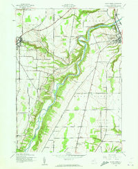
 1972 Mount Morris1974 Print · USGSLivingston County in the early seventies centers on the winding Genesee and the impressive engineering of the Mount Morris Dam. Researchers can trace the Erie-Lackawanna rail corridor and find local landmarks like Glenwood Cem and Brooks Grove.2 unique versions available
 - 1972 Map of Castile, 1974 Print
 1972 Castile1974 Print · USGSWyoming County's rail-and-resort landscape is captured here in the 1970s, centered on the activity surrounding Silver Lake. Researchers can trace the dual rail lines of the Baltimore and Ohio and Erie-Lackawanna through Silver Springs or locate family sites like St Marys Cem and Elmwood Cem.2 unique versions available
 - 1973 Map of Buffalo
 1973 Buffalo1973 Print · USGSWestern New York and Ontario's Golden Horseshoe meet in the early seventies, spanning from the industrial waterfronts of Buffalo to the hills of Allegany State Park. Trace the paths of the Welland Canal and Erie Lackawanna railroad through the lakefront towns of Dunkirk and Port Colborne.
 - 1983 Map of Canandaigua, 1985 Print
 1983 Canandaigua1985 Print · USGSThe Finger Lakes and Genesee Valley appear in high detail in the early 1980s as the region's transport and academic centers reached a peak. Researchers can trace rail lines like the Lehigh Valley RR and find landmarks such as the Mount Morris Dam and Gannagaro State Historical Site.2 unique versions available
 - 1984 Map of Buffalo, 1985 Print
 1984 Buffalo1985 Print · USGSWestern New York's industrial and transport hubs are in full view during the mid-eighties, from the Lake Erie waterfront to the Genesee Valley. Researchers can trace the legacy of the Erie Canal, find ancestral sites like Mount Calvary Cem, or locate the Attica Correctional Facility.2 unique versions available
 - 2010 Map of Mount Morris, 2010 Print
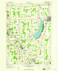
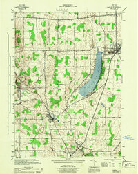
 2010 Mount Morris2010 Print · USGSCovers Perry, including Mount Morris, Mount Morris, and other nearby areas
 - 2010 Map of Castile, 2010 Print
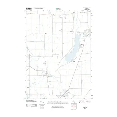 2010 Castile2010 Print · USGSCovers Perry, including Warsaw, Warsaw, and other nearby areas
 - 2013 Map of Castile, 2013 Print
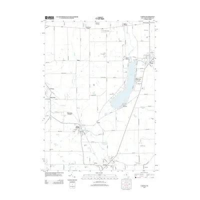 2013 Castile2013 Print · USGSCovers Perry, including Warsaw, Warsaw, and other nearby areas
 - 2013 Map of Mount Morris, 2013 Print
 2013 Mount Morris2013 Print · USGSCovers Perry, including Mount Morris, Mount Morris, and other nearby areas
 - 2016 Map of Castile, 2016 Print
 2016 Castile2016 Print · USGSCovers Perry, including Warsaw, Warsaw, and other nearby areas
 - 2016 Map of Mount Morris, 2016 Print
 2016 Mount Morris2016 Print · USGSCovers Perry, including Mount Morris, Mount Morris, and other nearby areas
 - 2019 Map of Mount Morris, 2019 Print
 2019 Mount Morris2019 Print · USGSCovers Perry, including Mount Morris, Mount Morris, and other nearby areas
Showing maps 1-25 of 28
Top cities near Perry
- Geneseo historical maps
- Geneseo historical maps
- Avon historical maps
- Perry historical maps
- Attica historical maps
- Warsaw historical maps
See more
Frequently asked questions
- What are the different types of historical maps available for Perry?
- What is the oldest map of Perry?
- Where can I purchase historical maps of Perry for my home or office?
- Where can I download high-res historical maps of Perry?
- Are there historical topographic maps available for Perry?
- Is there historical aerial imagery available for Perry?
- Where are historical maps of Perry sourced from?