Old Maps of Sheldon, New York for Hiking & Exploration
Hike through history with 35 historic maps of Sheldon. Explore old trails, ghost towns, and forgotten backroads — perfect for outdoor adventurers and local explorers.
- Rediscover forgotten places: Map out old mining camps, roads, and footpaths that no longer exist on modern maps.
- Layer with modern tools: Combine with LiDAR or satellite views to plan hikes through historical terrain.
- Made for exploration: Popular among hikers, overlanders, and local history lovers.
Use these maps to find adventure and explore the hidden past of Sheldon.
Sheldon, NY maps
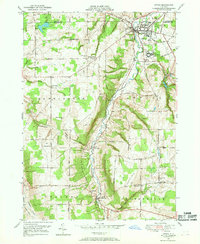
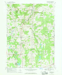
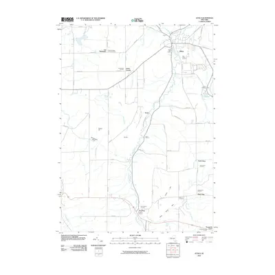
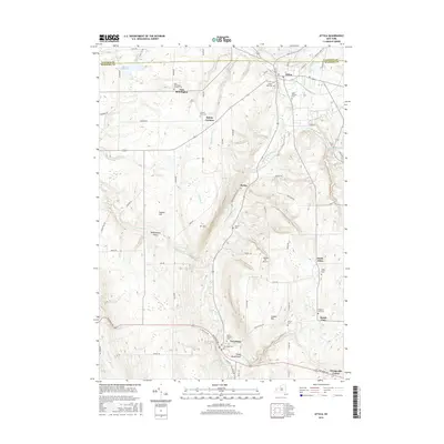
(35)- 1905 Map of Attica
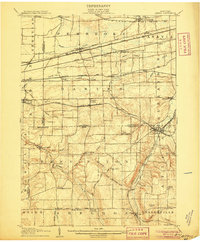 1905 Attica1905 Print · USGSWestern New York at the turn of the century shows a landscape dominated by a massive web of competing railroads. Genealogists can trace family names and small hamlets like Folsomdale, Darien Center, and the industrial hub at Attica.5 unique versions available
 - 1923 Map of Arcade, 1957 Print
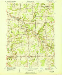
 1923 Arcade1957 Print · USGSWyoming County is captured in the early 1920s, showing a landscape defined by dairy farming and the vital rail connections of the Arcade and Attica. Genealogists can trace family names at Hicks Corners and Toziers Corners, or locate rural landmarks like Klein School and Java Lake.2 unique versions available
 - 1925 Map of Arcade
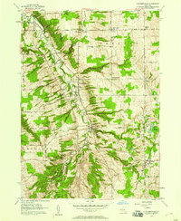
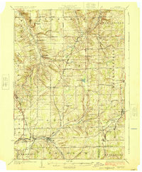 1925 Arcade1925 Print · USGSWestern New York’s rural landscape is captured here in the mid-1920s, a time when one-room schoolhouses and family-named crossroads still defined the countryside. Genealogists can trace property vicinities near Java Village, locate the elusive Cheery Tavern, or follow the path of the Arcade and Attica railroad.4 unique versions available
 - 1949 Map of Attica, 1953 Print
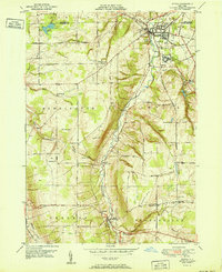
 1949 Attica1953 Print · USGSWestern New York at mid-century reveals a dense network of major railroads and rural hamlets across Genesee and Wyoming counties. Genealogists and historians can trace family locations through numerous numbered schools, named crossroads like Brick House Corners, and landmarks such as the Attica State Prison.
 - 1949 Map of Cowlesville, 1969 Print
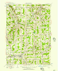
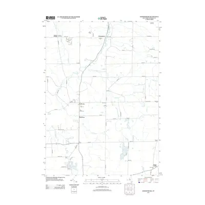
 1949 Cowlesville1969 Print · USGSWyoming County's rural character is well-preserved here in the years following the war, showing a landscape defined by small crossroads hamlets and creek-side settlements. Genealogists can trace family roots through sites like Persons Corners, Persons Cem, and several numbered schoolhouses including School No 19.
 - 1949 Map of Attica, 1969 Print
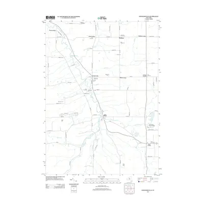
 1949 Attica1969 Print · USGSWestern New York’s rural landscape is captured here in the late 1940s, centered on the rail hub of Attica. Researchers can trace the dual rail lines of the Erie RR and Attica and Arcade RR or locate family sites near Varysburg and East Bennington.2 unique versions available
 - 1951 Map of Cowlesville
 1951 Cowlesville1951 Print · USGSWestern New York's rural Wyoming County townships are shown here in the early fifties, a landscape of creek-fed valleys and small crossroads hamlets. Researchers can trace historic district schools and cemeteries like School No 12 and Fairview Cem near Cowlesville.
 - 1951 Map of Attica
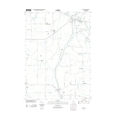
 1951 Attica1951 Print · USGSWestern New York's Wyoming County is surveyed here in the early postwar years, centered on the vital rail hub of Attica. Genealogists and historians can trace the rural landscape through family-named sites and landmarks like Danley Corners, St Vincent Cem, and the County Home.
 - 1957 Map of Strykersville, 1958 Print
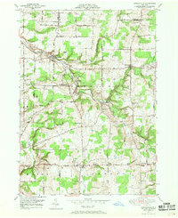
 1957 Strykersville1958 Print · USGSWyoming and Erie County rural life is frozen here in the late fifties, as the valley of Buffalo Creek connects a network of crossroad hamlets and parish schools. Researchers can trace family sites near St Marys Cemetery, Plants Corners, and Dutch Hollow.2 unique versions available
 - 1960 Map of Buffalo
 1960 Buffalo1960 Print · USGSWestern New York and the Niagara Peninsula thrive during the mid-twentieth century industrial peak. Genealogists and historians can trace family-named points and early settlements from Dunkirk Light to the Allegany Indian Reservation.
 - 1962 Map of Buffalo, 1980 Print
 1962 Buffalo1980 Print · USGSThe Niagara Frontier and Western New York are captured here in the early sixties, showing the vital industrial and maritime nexus between the U.S. and Canada. Researchers can trace the path of the Welland Canal, locate the Allegany Indian Reservation, or find family sites near Chautauqua Lake.2 unique versions available
 - 1966 Map of Johnsonburg, 1968 Print
 1966 Johnsonburg1968 Print · USGSWyoming County's rural character is preserved here in the mid-sixties, from the rail corridor in Johnsonburg to the waters of Java Lake. Genealogists can trace family landmarks like St Nicholas Cem, Southburg, and the remote Torrey Hill Cem.
 - 1967 Map of Buffalo
 1967 Buffalo1967 Print · USGSWestern New York and the Lake Erie shoreline are shown here during the mid-1960s industrial peak. Researchers can trace the massive rail networks of the Erie Railroad, locate the Cattaraugus Indian Reservation, or find historic sites like Fort Erie.
 - 1973 Map of Buffalo
 1973 Buffalo1973 Print · USGSWestern New York and Ontario's Golden Horseshoe meet in the early seventies, spanning from the industrial waterfronts of Buffalo to the hills of Allegany State Park. Trace the paths of the Welland Canal and Erie Lackawanna railroad through the lakefront towns of Dunkirk and Port Colborne.
 - 1984 Map of Buffalo, 1985 Print
 1984 Buffalo1985 Print · USGSWestern New York's industrial and transport hubs are in full view during the mid-eighties, from the Lake Erie waterfront to the Genesee Valley. Researchers can trace the legacy of the Erie Canal, find ancestral sites like Mount Calvary Cem, or locate the Attica Correctional Facility.2 unique versions available
 - 2010 Map of Johnsonburg, 2010 Print
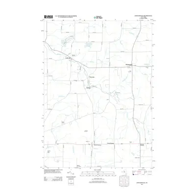
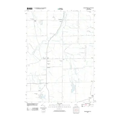 2010 Johnsonburg2010 Print · USGSCovers Sheldon, including Java, Orangeville, and other nearby areas
 - 2010 Map of Cowlesville, 2010 Print
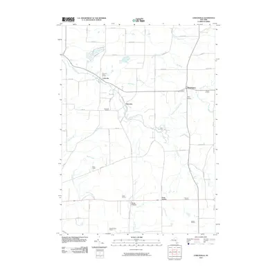 2010 Cowlesville2010 Print · USGSCovers Sheldon, including Alden, Marilla, and other nearby areas
 - 2010 Map of Strykersville, 2010 Print
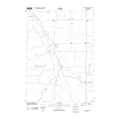 2010 Strykersville2010 Print · USGSCovers Sheldon, including Holland, Wales, and other nearby areas
 - 2010 Map of Attica, 2010 Print
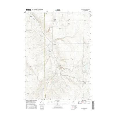
 2010 Attica2010 Print · USGSCovers Sheldon, including Attica, Bennington, and other nearby areas
 - 2013 Map of Johnsonburg, 2013 Print
 2013 Johnsonburg2013 Print · USGSCovers Sheldon, including Java, Orangeville, and other nearby areas
 - 2013 Map of Strykersville, 2013 Print
 2013 Strykersville2013 Print · USGSCovers Sheldon, including Holland, Wales, and other nearby areas
 - 2013 Map of Attica, 2013 Print
 2013 Attica2013 Print · USGSCovers Sheldon, including Attica, Bennington, and other nearby areas
 - 2013 Map of Cowlesville, 2013 Print
 2013 Cowlesville2013 Print · USGSCovers Sheldon, including Alden, Marilla, and other nearby areas
 - 2016 Map of Attica, 2016 Print
 2016 Attica2016 Print · USGSCovers Sheldon, including Attica, Bennington, and other nearby areas
 - 2016 Map of Strykersville, 2016 Print
 2016 Strykersville2016 Print · USGSCovers Sheldon, including Holland, Wales, and other nearby areas
Showing maps 1-25 of 35
Top cities near Sheldon
- Lancaster historical maps
- Clarence historical maps
- Aurora historical maps
- Elma historical maps
- Alden historical maps
- Newstead historical maps
See more
Top neighborhoods of Sheldon
- Harris Corners historical maps
- North Sheldon historical maps
- Persons Corners historical maps
- Plants Corner historical maps
- Sheldon Center historical maps
- Johnsonburg historical maps
See more
Frequently asked questions
- What are the different types of historical maps available for Sheldon?
- What is the oldest map of Sheldon?
- Where can I purchase historical maps of Sheldon for my home or office?
- Where can I download high-res historical maps of Sheldon?
- Are there historical topographic maps available for Sheldon?
- Is there historical aerial imagery available for Sheldon?
- Where are historical maps of Sheldon sourced from?