Old Maps of Alamance County, North Carolina for Metal Detecting
Plan your next treasure hunt with 100 historic maps of Alamance County. Find old homesites, ghost towns, trails, and gathering spots that may be lost to time — perfect for identifying promising metal detecting locations.
- Locate forgotten sites: Uncover places like long-lost settlements, abandoned rail lines, or gathering spots.
- Plan better hunts: Use map overlays combined with LiDAR or satellite views to narrow in on historically rich areas.
- Made for detectorists: Thousands of hobbyists use these maps to discover relics, coins, and hidden history.
Use these historic maps to boost your research and find new opportunities beneath the surface of Alamance County.
Alamance County, NC maps
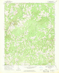
(100)- 1953 Map of Raleigh, 1965 Print
 1953 Raleigh1965 Print · USGSCentral North Carolina in the early sixties shows a landscape of growing towns and military hubs before the full expansion of the interstate system. Genealogists can trace family footprints across the Piedmont through Wake Forest, Siler City, and the large Fort Bragg Military Reservation.4 unique versions available
 - 1953 Map of Greensboro, 1981 Print
 1953 Greensboro1981 Print · USGSThe Piedmont borderlands of North Carolina and Virginia show a landscape defined by new reservoirs and old rail lines. Trace family roots and the changing river geography through Elon College, the John H Kerr Reservoir, and South Boston.
 - 1954 Map of Greensboro
 1954 Greensboro1954 Print · USGSThe Piedmont borderlands of North Carolina and Virginia come alive in this mid-fifties study of a region defined by its rivers and rails. Researchers can trace the growing Buggs Island Lake or follow the paths of the Southern Ry and Seaboard Air Line RR through towns like Oxford and Reidsville.
 - 1954 Map of Raleigh
 1954 Raleigh1954 Print · USGSThe North Carolina Piedmont and Sandhills are captured in the mid-fifties during a period of steady regional growth. Genealogists and historians can trace the development of towns like Siler City or locate landmarks such as Falls of Neuse and Camp Mackall.
 - 1962 Map of Greensboro
 1962 Greensboro1962 Print · USGSThe Piedmont region along the Virginia and North Carolina border comes alive in the early 1960s, showing a landscape defined by industry and new reservoirs. Trace the path of the Virginian RR or explore the early development of Greensboro and Durham.
 - 1966 Map of Greensboro
 1966 Greensboro1966 Print · USGSThe North Carolina and Virginia Piedmont thrives during the mid-sixties, showcasing a landscape of textile hubs and expanding river reservoirs. Researchers can trace the rail corridors of the Southern Railway, find local landmarks like Elon College, or locate the extensive Camp Butner Military Reservation.
 - 1968 Map of White Cross, 1969 Print
 1968 White Cross1969 Print · USGSOrange County's rural crossroads and family settlements are captured here in the late sixties as the region maintained its agrarian character. Researchers can trace historic church sites like Alston Grove Ch and locate family landmarks from Thompson Mtn to Orange Grove.2 unique versions available
 - 1968 Map of Bynum, 1970 Print
 1968 Bynum1970 Print · USGSChatham County’s rural riverfront comes to life in this late sixties survey of the Haw River valley and its surrounding hill country. Genealogists and historians can trace family roots through a dense concentration of local landmarks like Cedar Grove Ch, Gum Springs, and Hunter.
 - 1969 Map of Burlington, 1972 Print
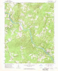
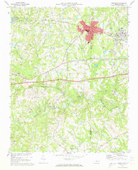
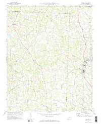
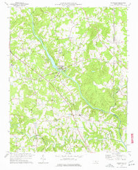
 1969 Burlington1972 Print · USGSMid-century Alamance County is captured here as the growing hubs of Burlington and Graham expand toward the Haw River. Local historians can trace the development of numerous neighborhood schools and churches, from Elon College to the Technical Institute of Alamance.2 unique versions available
 - 1969 Map of Mebane, 1972 Print
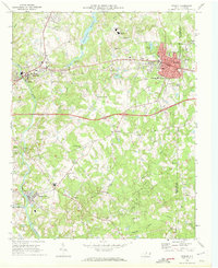 1969 Mebane1972 Print · USGSMebane and the Haw River corridor are captured here during a period of steady growth in the late sixties. Genealogists and historians can locate family landmarks like Oakwood Cem, Phillips Chapel, and the rural community of Florence Town.2 unique versions available
 - 1969 Map of Lake Burlington, 1972 Print
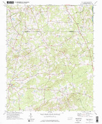
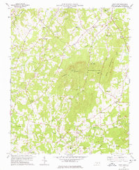
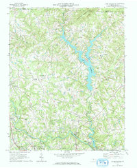 1969 Lake Burlington1972 Print · USGSNorth Carolina’s Piedmont countryside is captured here in the late sixties as new reservoirs began to reshape the rural landscape. Researchers can find traditional settlements like Altamahaw and Union Ridge alongside old landmarks like Stony Creek Ch and Glencoe.2 unique versions available
 - 1969 Map of Burlington NE, 1972 Print
 1969 Burlington NE1972 Print · USGSNorth Carolina's Piedmont region in the late sixties shows a landscape of rural schoolhouses and family churches at the crossroads of three counties. Researchers can trace the communities of Pleasant Grove and Just Crossroads or locate Martins Chapel and Snow Hill Ch.2 unique versions available
 - 1970 Map of Gibsonville, 1973 Print
 1970 Gibsonville1973 Print · USGSThe Guilford and Alamance county line meets at the height of the Vietnam era, capturing the development of Gibsonville and Elon College. Researchers can trace rural community roots through numerous landmarks like Brick Ch, St Marks Ch, and Whitsett.2 unique versions available
 - 1970 Map of Kimesville, 1973 Print
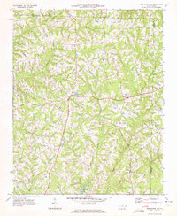
 1970 Kimesville1973 Print · USGSThe rural tri-county border area of Guilford, Alamance, and Randolph was a landscape of small churches and local airfields in the early 1970s. Researchers can trace family sites like Greene Sch and the Hornaday Pleasant Union Ch Cem or locate Causey Airfield.2 unique versions available
 - 1970 Map of Ossipee, 1973 Print
 1970 Ossipee1973 Print · USGSThe borderlands of Alamance and Guilford Counties come into focus in the early 1970s as the Haw River winds past small rural hubs. Researchers can trace local heritage through numerous landmarks like Altamahaw-Ossipee Sch, Apples Chapel Cem, and Friedens Ch.
 - 1972 Map of Williamsburg, 1974 Print
 1972 Williamsburg1974 Print · USGSRockingham and Caswell counties in the early 1970s reveal a landscape of interconnected farm communities and country roads. Genealogists can trace family footprints at Williamsburg, Settle Cem, and numerous rural sanctuaries like Browns Arbor Ch.
 - 1974 Map of Silk Hope, 1976 Print
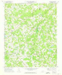
 1974 Silk Hope1976 Print · USGSChatham County in the 1970s remains a landscape of quiet rural settlements and established country churches. Genealogists can locate family landmarks like Mt Vernon Ch and Emmaus Ch or trace the early paths of Terrells Creek and Cattail Creek.
 - 1974 Map of Crutchfield Crossroads, 1976 Print
 1974 Crutchfield Crossroads1976 Print · USGSThe rural border of Alamance and Chatham counties is captured here in the mid-seventies, showing a landscape of timber, small farms, and deep-rooted congregations. Genealogists and historians can trace family locations near Crutchfield Crossroads or churches like Piney Grove Ch and Pleasant Grove Ch.2 unique versions available
 - 1974 Map of Liberty, 1977 Print
 1974 Liberty1977 Print · USGSRandolph County in the 1970s remains a landscape of traditional crossroads communities and rural churches centered on Liberty and Staley. Genealogists and local historians can trace family locations through sites like Old Mc Masters Cem, Fairview Cem, and the Eastern Randolph High Sch.
 - 1977 Map of Saxapahaw
 1977 Saxapahaw1977 Print · USGSThe Piedmont landscape along the Haw River is captured here in the mid-seventies, showing the rural communities of Alamance and Orange counties. Researchers can trace family roots through numerous local landmarks like Maxwell Chapel, Eli Whitney, and Burnetts Chapel.2 unique versions available
 - 1978 Map of Snow Camp
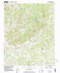
 1978 Snow Camp1978 Print · USGSSnow Camp and the surrounding Alamance County countryside are captured here in the late seventies, showing a landscape defined by prominent ridges and rural crossroads. Genealogists and local historians can trace family locations near Cane Creek Ch, Sylvan Sch, and the historical settlement of Rock Creek.
 - 1980 Map of Burlington, 1983 Print
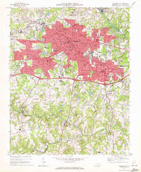
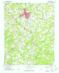
 1980 Burlington1983 Print · USGSThe Piedmont landscape of the early eighties is captured here in photographic detail, showing the expanding urban centers of Burlington and Graham. Genealogists and local researchers can trace old property lines and residential growth near Bellemont and the banks of the Haw River.
 - 1984 Map of Greensboro
 1984 Greensboro1984 Print · USGSThe North Carolina Piedmont in the mid-eighties shows a region of growing urban centers and vital water resources. Local historians can trace the development of Greensboro, locate the Elon College campus, or explore the grounds of Guilford Courthouse National Military Park.
 - 1984 Map of Chapel Hill, 1985 Print
 1984 Chapel Hill1985 Print · USGSNorth Carolina’s Piedmont and the northern reaches of the Uwharrie Mountains are captured here in the mid-eighties. Genealogists can trace family roots through rural landmarks like Union Chapel or locate old rail stops along the Seaboard line.
 - 1997 Map of Williamsburg, 2000 Print
 1997 Williamsburg2000 Print · USGSThe Piedmont landscape of Rockingham and Caswell Counties in the late nineties is detailed here through its rural settlements and river networks. Genealogists can trace family landmarks like Settle Cem and Garrett Grove Ch along the Haw River.
Showing maps 1-25 of 100
Top cities of Alamance County
- Burlington historical maps
- Graham historical maps
- Elon historical maps
- Green Level historical maps
- Haw River historical maps
- Saxapahaw historical maps
See more
Frequently asked questions
- What are the different types of historical maps available for Alamance County?
- What is the oldest map of Alamance County?
- Where can I purchase historical maps of Alamance County for my home or office?
- Where can I download high-res historical maps of Alamance County?
- Are there historical topographic maps available for Alamance County?
- Is there historical aerial imagery available for Alamance County?
- Where are historical maps of Alamance County sourced from?