1900s (20th Century) Maps of Lansing, North Carolina
Explore 13 historic maps of Lansing from the 1900s (20th Century). These maps offer a rare glimpse into what life looked like during the 1900s — showing old roads, neighborhoods, homes, and landmarks that have changed or disappeared over time.
Whether you're researching your family's past, planning a metal detecting trip, or studying how Lansing's landscape evolved across the 1900s, these high-resolution maps are a powerful tool for exploring the history of this region.
- Focus on a specific era: All maps on this page are from the 1900s, giving you a focused view of this time period.
- See what’s changed: Compare century-old streets, trails, and buildings to today's modern landscape using overlays and satellite layers.
- Research with precision: Use these maps for genealogy, historical research, land use analysis, or educational projects.
- View, download, or print: Maps are fully viewable online in high resolution, and can be downloaded or printed for your own records.
Start exploring Lansing's history through authentic maps from the 1900s. This is your window into the past.
Lansing, NC maps
(13)- 1902 Map of Cranberry
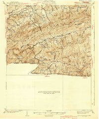
 1902 Cranberry1902 Print · USGSThe North Carolina and Tennessee borderlands are captured here at the turn of the century as early railroads began penetrating the high ridges. Genealogists can trace family names and old settlements like Mountain City, Shoun Crossroads, and the industry at Rhea Forge.6 unique versions available
 - 1909 Map of Abingdon
 1909 Abingdon1909 Print · USGSSouthwest Virginia at the first decade's end shows a valley landscape defined by the iron rail and steep ridges. Genealogists and historians can trace the early layouts of Abingdon and Glade Spring, or locate landmarks like Dove Mills and the County Farm.2 unique versions available
 - 1911 Map of Abingdon
 1911 Abingdon1911 Print · USGSSouthwest Virginia's rugged corridors are captured here during the height of the mountain rail era. Genealogists and historians can trace old homesteads and local landmarks such as Whites Mill, Valley Church, and the County Farm near Abingdon.5 unique versions available
 - 1935 Map of Park
 1935 Park1935 Print · USGSThe high-country borderlands of North Carolina and Virginia appear here in the mid-1930s just as early aerial mapping began. Researchers can locate the mountain settlement of Park and trace the drainage of Green Creek through the Unaka National Forest.
 - 1935 Map of Mount Rogers
 1935 Mount Rogers1935 Print · USGSThe high peaks of Grayson and Smyth Counties are documented here in the mid-1930s as the Appalachian Trail was being established across Mount Rogers. Genealogists and historians can trace the foundations of mountain life at Konnarock, the Iron Mountain Boys Sch, and Taylors Valley.
 - 1939 Map of Mount Rogers
 1939 Mount Rogers1939 Print · USGSThe Virginia and Tennessee borderlands come alive in this survey from the 1930s, showing the mountain communities and logging-era geography of the High Country. Researchers can locate the Konnarock Girls Sch, family-named mill sites like Loves Mill, and the early path of the Appalachian Trail.3 unique versions available
 - 1953 Map of Winston-Salem, 1974 Print
 1953 Winston-Salem1974 Print · USGSThe North Carolina Piedmont and Virginia highlands meet in the mid-1950s, a landscape defined by the tobacco and textile hubs of the Blue Ridge foothills. Researchers can trace the rail-and-river geography connecting Winston-Salem to mountain towns like Mount Airy and Galax.2 unique versions available
 - 1955 Map of Winston-Salem
 1955 Winston-Salem1955 Print · USGSThe Central Blue Ridge and Piedmont transition are captured here in the mid-fifties, from the industrial hub of Winston-Salem to the high peaks of Southwest Virginia. Genealogists can trace family landmarks like Richmond Hill Ch, Siloam Ch, and the old rail stops along the Southern Railway.
 - 1959 Map of Park, 1960 Print
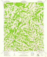 1959 Park1960 Print · USGSThe mountain borderlands of North Carolina and Virginia come alive in the late fifties, showing a landscape shaped by the Norfolk and Western line. Genealogists can trace family roots through dozens of local burial sites and landmarks like Nella (PO), Apple Grove Post Office, and Byars Cem.3 unique versions available
 - 1962 Map of Winston-Salem
 1962 Winston-Salem1962 Print · USGSThe North Carolina Piedmont meets the Virginia highlands in the early sixties, showing the rail corridors and mountain gaps of the southern Appalachians. Researchers can trace the Blue Ridge Parkway or locate family sites near Winston-Salem, Mount Airy, and Hanging Rock Mountain.
 - 1966 Map of Warrensville, 1969 Print
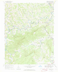 1966 Warrensville1969 Print · USGSAshe County high country in the mid-1960s was a landscape of steep ridges and river-valley hamlets. Genealogists can trace family sites from Milam Cem to Ashley Chapel, or follow the Norfolk and Western Railway through Lansing and Warrensville.3 unique versions available
 - 1982 Map of Wytheville, 1983 Print
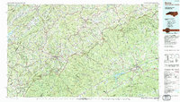
 1982 Wytheville1983 Print · USGSSouthwest Virginia's ridge-and-valley landscape is shown here in the early 1980s as the Interstate era fully connected the region. Genealogists and historians can trace family locations near Emory and Henry College, the historic Austinville Mine, and settlements like Saltville or Lansing.3 unique versions available
 - 1985 Map of Boone, 1986 Print
 1985 Boone1986 Print · USGSThe High Country and Blue Ridge Mountains come into focus during the mid-eighties as Boone and its surrounding wilderness areas undergo modern expansion. Genealogists and historians can trace family-named ridges and landmarks near Appalachian State University, the Cranberry Mines, and Valle Crucis.2 unique versions available
End of results
Showing maps 1-13 of 13
Top cities near Lansing
Frequently asked questions
- What are the different types of historical maps available for Lansing?
- What is the oldest map of Lansing?
- Where can I purchase historical maps of Lansing for my home or office?
- Where can I download high-res historical maps of Lansing?
- Are there historical topographic maps available for Lansing?
- Is there historical aerial imagery available for Lansing?
- Where are historical maps of Lansing sourced from?