Old Maps of Ashe County, North Carolina
Explore 137 old maps of Ashe County, spanning from 1889 to today. These high-resolution historic maps reveal how streets, neighborhoods, landmarks, and natural features evolved over time — perfect for genealogy, metal detecting, research, and local history exploration.
What you can do with these maps:
- See how Ashe County changed over time: Compare historical maps to modern-day views to trace roads, homesites, rail lines & more.
- View detailed metadata: Each map includes creators, publishers, year, scale, and archive source.
- Overlay maps with satellite & LiDAR: Visualize the past alongside modern tools to explore terrain & human change.
- Trusted historical sources: Maps sourced from the USGS, Library of Congress, and other archives.
- Access maps your way: View online, download high-res files, or order prints for personal or research use.
Start exploring old maps of Ashe County to uncover forgotten places, hidden landmarks, and the deep history beneath your feet.
Ashe County, NC maps
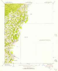
(137)- 1889 Map of Wytheville
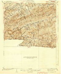
 1889 Wytheville1889 Print · USGSSouthwestern Virginia and northwestern North Carolina are mapped here during the late nineteenth-century rise of the mountain iron industry. Genealogists and historians can locate early post offices and industrial sites such as Bridle Creek P.O., Eagle Furnace, and Rural Retreat.2 unique versions available
 - 1889 Map of Wilkesboro, 1960 Print
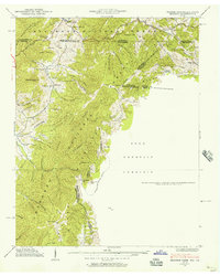
 1889 Wilkesboro1960 Print · USGSWilkes and Ashe counties are shown here in the late 1880s as the region's mountain economy relied on river fords and valley mills. Researchers can trace ancestral locations from Jefferson to Wilkesboro, including landmarks like Lomax Store and Dunkirk Ch.
 - 1891 Map of Abingdon
 1891 Abingdon1891 Print · USGSSouthwest Virginia in the 1890s reveals a landscape of mountain ridges and thriving valley settlements along the Norfolk and Western R. R. Lineages can be traced through sites like Emory and Henry College, Saltville, and numerous family-named landmarks like Vance's Mill.
 - 1891 Map of Wilkesboro, 1940 Print
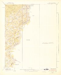
 1891 Wilkesboro1940 Print · USGSThe foothills and high ridges of Northwest North Carolina are seen here in the late nineteenth century before modern highway development. Local historians can locate early post offices at Brown P.O., the mining area of Ore Knob, and ancestral landmarks like Dunkirk Ch. and Hall Mills.
 - 1892 Map of Wytheville, 1897 Print
 1892 Wytheville1897 Print · USGSThe high ridges and river valleys of Southwest Virginia and Northwest North Carolina are captured here in the late nineteenth century. Genealogists can trace family footprints across the Iron Mountains to old industrial sites like White Rock Furnace and remote post offices such as Hampton P.O.6 unique versions available
 - 1893 Map of Cranberry
 1893 Cranberry1893 Print · USGSThe high country of the Blue Ridge and Appalachians is captured here during the late 1800s, showing the early settlements and crossroads of Watauga and Johnson counties. Genealogists can trace family landmarks and early industry at Rhea Forge, Shulls Mill, and the many hamlets like Vilas and Sutherland.
 - 1894 Map of Abingdon, 1896 Print
 1894 Abingdon1896 Print · USGSSouthwest Virginia's valley and ridge country is captured here during the peak of the rail era, centered on the Abingdon and Marion corridors. Local historians can trace the foundations of Emory and Henry College and numerous rural mill sites like Belfast Mills or Vance's Mill.5 unique versions available
 - 1895 Map of Cranberry
 1895 Cranberry1895 Print · USGSThe High Country of North Carolina and Tennessee comes alive in this late nineteenth-century survey. Genealogists and historians can trace the foundations of Mountain City or locate old community centers like Valle Cruces, Banners Elk, and Rhea Forge.
 - 1899 Map of Cranberry
 1899 Cranberry1899 Print · USGSThe high Appalachian borderlands of North Carolina and Tennessee appear here in the late nineteenth century, defined by mountain settlements and early river-powered industry. Researchers can trace the era's geography through landmarks like Rhea Forge, Shills Mill, and the historic Yonhalossee Road.
 - 1902 Map of Cranberry
 1902 Cranberry1902 Print · USGSThe North Carolina and Tennessee borderlands are captured here at the turn of the century as early railroads began penetrating the high ridges. Genealogists can trace family names and old settlements like Mountain City, Shoun Crossroads, and the industry at Rhea Forge.6 unique versions available
 - 1909 Map of Abingdon
 1909 Abingdon1909 Print · USGSSouthwest Virginia at the first decade's end shows a valley landscape defined by the iron rail and steep ridges. Genealogists and historians can trace the early layouts of Abingdon and Glade Spring, or locate landmarks like Dove Mills and the County Farm.2 unique versions available
 - 1911 Map of Abingdon
 1911 Abingdon1911 Print · USGSSouthwest Virginia's rugged corridors are captured here during the height of the mountain rail era. Genealogists and historians can trace old homesteads and local landmarks such as Whites Mill, Valley Church, and the County Farm near Abingdon.5 unique versions available
 - 1935 Map of Mouth of Wilson
 1935 Mouth of Wilson1935 Print · USGSGrayson County was a landscape of high ridges and river crossings in the mid-1930s. Researchers can trace family sites at Youngs Chapel, find early crossings like Halsey Ferry, and locate old mountain schoolhouses like Oak Hill Sch and Fairwood Sch.
 - 1935 Map of Grayson
 1935 Grayson1935 Print · USGSThe high tri-state ridges of Washington County, Tennessee, and neighboring Virginia are shown here just before the mid-century. Genealogists and hikers can trace old mountain paths through Cut Laurel Gap, find the State Line Sch, and locate the Norfolk and Western rail line near Green Cove.
 - 1935 Map of Park
 1935 Park1935 Print · USGSThe high-country borderlands of North Carolina and Virginia appear here in the mid-1930s just as early aerial mapping began. Researchers can locate the mountain settlement of Park and trace the drainage of Green Creek through the Unaka National Forest.
 - 1935 Map of Baldwin Gap
 1935 Baldwin Gap1935 Print · USGSThe high ridges of the Tennessee and North Carolina border come into focus in the mid-1930s. Genealogists can trace early mountain life through the sites of Snyder Chapel, Curds Sch, and the isolated Wallace Cem.
 - 1935 Map of Mount Rogers
 1935 Mount Rogers1935 Print · USGSThe high peaks of Grayson and Smyth Counties are documented here in the mid-1930s as the Appalachian Trail was being established across Mount Rogers. Genealogists and historians can trace the foundations of mountain life at Konnarock, the Iron Mountain Boys Sch, and Taylors Valley.
 - 1935 Map of Zionville
 1935 Zionville1935 Print · USGSThe Tennessee and North Carolina borderlands are captured here in the mid-1930s as high-country roads began to improve. Genealogists and hikers can trace old routes through the Gap of Rich Mtn or locate small settlements like Trade and Silverstone.
 - 1936 Map of Blowing Rock
 1936 Blowing Rock1936 Print · USGSThe North Carolina high country around Boone and Blowing Rock is documented here in the mid-1930s. Genealogists and researchers can trace family-named landmarks and mountain institutions, from the COUNTY HOME to remote sites like Bailey Camp Sch and St Marys Ch.
 - 1938 Map of Baldwin Gap, 1957 Print
 1938 Baldwin Gap1957 Print · USGSThe high ridges of the Blue Ridge along the Tennessee and North Carolina border were surveyed in the late thirties. Genealogists and local historians can trace family locations near Hemlock, Wallace Cem, and rural institutions like Curd Sch and Snyder Chapel.
 - 1938 Map of Grayson, 1957 Print
 1938 Grayson1957 Print · USGSThe Appalachian high country at the junction of Tennessee, Virginia, and North Carolina comes into focus in the late 1930s. Genealogists and historians can trace rail-side life along the Norfolk and Western and locate landmarks like Waldener Grove Ch and the Sutherland Cem.
 - 1939 Map of Zionville
 1939 Zionville1939 Print · USGSThe North Carolina and Tennessee borderlands come alive in this late 1930s survey of the high mountain gaps. Genealogists can trace early homesteads near Zionville, Trade, and Greer Cem or find local landmarks like the Rich Mtn Sch.2 unique versions available
 - 1939 Map of Baldwin Gap
 1939 Baldwin Gap1939 Print · USGSThe high ridges of the Tennessee and North Carolina border come alive in this pre-war survey of the Appalachian backcountry. Genealogists can trace family footprints through numerous hollows to find Bethel Ch, Payne Cem, and the old Laurel Springs Sch.2 unique versions available
 - 1939 Map of Mount Rogers
 1939 Mount Rogers1939 Print · USGSThe Virginia and Tennessee borderlands come alive in this survey from the 1930s, showing the mountain communities and logging-era geography of the High Country. Researchers can locate the Konnarock Girls Sch, family-named mill sites like Loves Mill, and the early path of the Appalachian Trail.3 unique versions available
 - 1940 Map of Mouth of Wilson
 1940 Mouth of Wilson1940 Print · USGSGrayson County's high ridges and river valleys were home to a dense network of mountain communities in the 1930s. Genealogists and historians can trace long-gone rural institutions like the COUNTY HOME, Cornell Store, and schools such as Razor Ridge Sch or Bethel Sch.3 unique versions available
Showing maps 1-25 of 137
Top cities of Ashe County
Frequently asked questions
- What are the different types of historical maps available for Ashe County?
- What is the oldest map of Ashe County?
- Where can I purchase historical maps of Ashe County for my home or office?
- Where can I download high-res historical maps of Ashe County?
- Are there historical topographic maps available for Ashe County?
- Is there historical aerial imagery available for Ashe County?
- Where are historical maps of Ashe County sourced from?