1960s Maps of Ingalls, North Carolina
Explore 3 historic maps of Ingalls from the 1960s. These maps offer a rare glimpse into what life looked like during the 1960s — showing old roads, neighborhoods, homes, and landmarks that have changed or disappeared over time.
Whether you're researching your family's past, planning a metal detecting trip, or studying how Ingalls's landscape evolved across the 1960s, these high-resolution maps are a powerful tool for exploring the history of this region.
- Focus on a specific era: All maps on this page are from the 1960s, giving you a focused view of this time period.
- See what’s changed: Compare century-old streets, trails, and buildings to today's modern landscape using overlays and satellite layers.
- Research with precision: Use these maps for genealogy, historical research, land use analysis, or educational projects.
- View, download, or print: Maps are fully viewable online in high resolution, and can be downloaded or printed for your own records.
Start exploring Ingalls's history through authentic maps from the 1960s. This is your window into the past.
Ingalls, NC maps
(3)- 1960 Map of Knoxville
 1960 Knoxville1960 Print · USGSThe Southern Appalachians come alive in the 1950s, showing the intersection of new national park tourism and deep-rooted mountain industry. Trace old rail lines like the Clinchfield RR and find high-altitude landmarks from Mt Le Conte to the Cherokee Indian Reservation.2 unique versions available
 - 1960 Map of Spruce Pine, 1962 Print
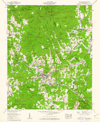 1960 Spruce Pine1962 Print · USGSSpruce Pine and the Toe River valley were bustling with mountain industry and rail transport in the early sixties. Genealogists and historians can trace family names and old landmarks across the Pisgah National Forest, including Altapass, the Clinchfield RR, and the Chestnut Flats Mine.5 unique versions available
 - 1964 Map of Knoxville
 1964 Knoxville1964 Print · USGSThe Southern Appalachians and Great Smokies are captured here during the mid-sixties, showing the rugged borderlands of Tennessee and North Carolina. Researchers can trace historic mountain routes like U S 441, the expanse of Pisgah National Forest, and the growing footprints of Asheville and Knoxville.
End of results
Showing maps 1-3 of 3
Top cities near Ingalls
- Morganton historical maps
- Spruce Pine historical maps
- Banner Elk historical maps
- Glen Alpine historical maps
- Newland historical maps
- Elk Park historical maps
See more
Frequently asked questions
- What are the different types of historical maps available for Ingalls?
- What is the oldest map of Ingalls?
- Where can I purchase historical maps of Ingalls for my home or office?
- Where can I download high-res historical maps of Ingalls?
- Are there historical topographic maps available for Ingalls?
- Is there historical aerial imagery available for Ingalls?
- Where are historical maps of Ingalls sourced from?