Old Maps of Black Mountain, North Carolina
Explore 25 old maps of Black Mountain, spanning from 1900 to today. These high-resolution historic maps reveal how streets, neighborhoods, landmarks, and natural features evolved over time — perfect for genealogy, metal detecting, research, and local history exploration.
What you can do with these maps:
- See how Black Mountain changed over time: Compare historical maps to modern-day views to trace roads, homesites, rail lines & more.
- View detailed metadata: Each map includes creators, publishers, year, scale, and archive source.
- Overlay maps with satellite & LiDAR: Visualize the past alongside modern tools to explore terrain & human change.
- Trusted historical sources: Maps sourced from the USGS, Library of Congress, and other archives.
- Access maps your way: View online, download high-res files, or order prints for personal or research use.
Start exploring old maps of Black Mountain to uncover forgotten places, hidden landmarks, and the deep history beneath your feet.
Black Mountain, NC maps
(25)- 1900 Map of Mount Mitchell, 1963 Print
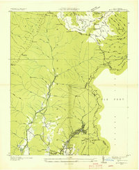
 1900 Mount Mitchell1963 Print · USGSWestern North Carolina at the turn of the century shows a landscape of high peaks and isolated river settlements before the arrival of modern highways. Genealogists and mountain historians can trace early homesteads along the Cane River or follow the Southern RR through Old Fort and Black Mountain.3 unique versions available
 - 1902 Map of Mount Mitchell, 1937 Print
 1902 Mount Mitchell1937 Print · USGSThe high peaks of Western North Carolina are captured here at the start of the twentieth century, showing the rail and river corridors that shaped the region. Trace early settlements like Burnsville, Montreat, and the winding Southern Railway.3 unique versions available
 - 1935 Map of Montreat
 1935 Montreat1935 Print · USGSMontreat and the surrounding Black Mountains are shown here in the mid-1930s, documenting the area's religious centers and early park development. Genealogists and hikers can trace the Toll Road up to Clingmans Peak or locate old community landmarks like Brookside Sch and Homers Chapel.
 - 1935 Map of Black Mountain
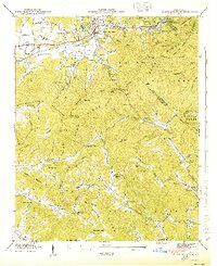
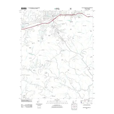
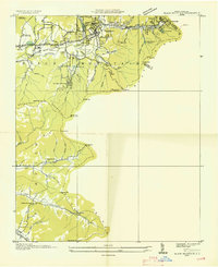 1935 Black Mountain1935 Print · USGSBuncombe County in the mid-1930s reveals a landscape shaped by mountain transit and social institutions. Genealogists can locate family landmarks like Tabernacle Ch, Pleasant Grove Sch, and the remote Mountain Orphanage along the rail-and-river corridor.
 - 1941 Map of Black Mountain, 1957 Print
 1941 Black Mountain1957 Print · USGSThe Swannanoa Valley and the Blue Ridge crest come alive in this early 1940s survey. Genealogists can trace the institutional history of the State Hospital or locate family landmarks like Tabernacle Ch and Curteys Chapel.6 unique versions available
 - 1942 Map of Montreat, 1957 Print
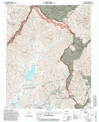
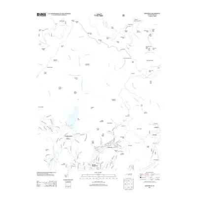
 1942 Montreat1957 Print · USGSThe high peaks of Buncombe County are captured in the early 1940s, showing the settled valleys of Montreat and Walkertown before postwar development. Genealogists and historians can trace local landmarks like Mtn View Cem, find family-named points like Allen Mtn, and locate the Southern Railway route through Jarrett Tunnel.5 unique versions available
 - 1943 Map of Black Mountain
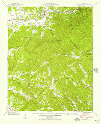
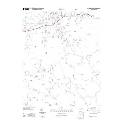
 1943 Black Mountain1943 Print · USGSThe Black Mountain area in the early 1940s served as a critical hub for mountain institutions, from religious retreats to state health facilities. Researchers can trace the path of the Southern Railway through the Swannanoa Gap or locate family-named landmarks like Isinglass Ridge and Garren Mountain.
 - 1943 Map of Montreat
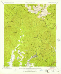
 1943 Montreat1943 Print · USGSBuncombe County's mountain coves and the Blue Ridge Parkway are detailed here during the mid-1940s. Researchers can trace the early grounds of Black Mtn College, locate families near Walkertown, or find industrial sites like the Graphite mine.2 unique versions available
 - 1955 Map of Knoxville
 1955 Knoxville1955 Print · USGSThe Southern Appalachians and the Smoky Mountains are shown here at a peak of mid-century development and conservation. Genealogists and historians can trace the early road networks connecting Gatlinburg, Waynesville, and the Cherokee Indian Reservation across the high ridges.
 - 1957 Map of Knoxville, 1966 Print
 1957 Knoxville1966 Print · USGSThe Southern Appalachians of Tennessee and North Carolina are mapped here during the mid-twentieth century as new highways reached the high country. Genealogists and historians can trace the topography between Knoxville and Asheville, locating family landmarks near Fontana Lake or along the Blue Ridge Parkway.4 unique versions available
 - 1960 Map of Knoxville
 1960 Knoxville1960 Print · USGSThe Southern Appalachians come alive in the 1950s, showing the intersection of new national park tourism and deep-rooted mountain industry. Trace old rail lines like the Clinchfield RR and find high-altitude landmarks from Mt Le Conte to the Cherokee Indian Reservation.2 unique versions available
 - 1964 Map of Knoxville
 1964 Knoxville1964 Print · USGSThe Southern Appalachians and Great Smokies are captured here during the mid-sixties, showing the rugged borderlands of Tennessee and North Carolina. Researchers can trace historic mountain routes like U S 441, the expanse of Pisgah National Forest, and the growing footprints of Asheville and Knoxville.
 - 1985 Map of Asheville
 1985 Asheville1985 Print · USGSWestern North Carolina during the mid-eighties shows a region of deep mountain heritage and expanding highway networks. Genealogists and historians can trace the foundations of Asheville alongside older rail corridors like the Clinchfield Railroad and the high elevations of Mount Mitchell.2 unique versions available
 - 1994 Map of Montreat, 1998 Print
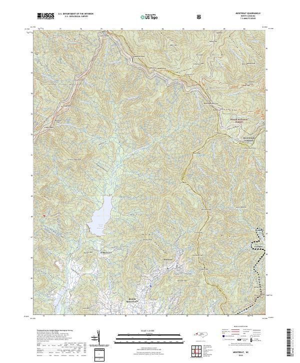
 1994 Montreat1998 Print · USGSHigh peaks and protected watersheds dominate the Buncombe County landscape in the 1990s as the Blue Ridge Parkway skirts the eastern ridges. Researchers can trace the grounds of Black Mountain College or locate the Graphite Mine and Homers Chapel in the valleys below.
 - 1994 Map of Black Mountain, 1998 Print
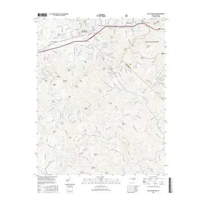
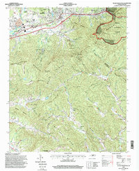 1994 Black Mountain1998 Print · USGSBuncombe and McDowell counties appear in the mid-1990s as a high-altitude crossroads for the railway and Interstate 40. Researchers can trace the legacy of local institutions like the Mountain Orphanage and find family landmarks such as Wilkes Church or the Swannanoa Tunnel.
 - 2011 Map of Montreat, 2011 Print
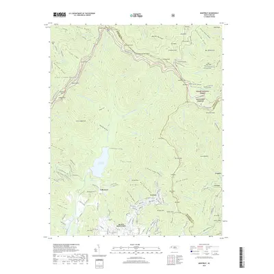
 2011 Montreat2011 Print · USGSCovers Black Mountain, including Montreat, Graphite, and other nearby areas
 - 2011 Map of Black Mountain, 2011 Print
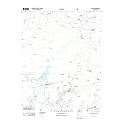
 2011 Black Mountain2011 Print · USGSCovers Black Mountain, including Swannanoa, Fairview, and other nearby areas
 - 2013 Map of Black Mountain, 2013 Print
 2013 Black Mountain2013 Print · USGSCovers Black Mountain, including Swannanoa, Fairview, and other nearby areas
 - 2013 Map of Montreat, 2013 Print
 2013 Montreat2013 Print · USGSCovers Black Mountain, including Montreat, Graphite, and other nearby areas
 - 2016 Map of Black Mountain, 2016 Print
 2016 Black Mountain2016 Print · USGSCovers Black Mountain, including Swannanoa, Fairview, and other nearby areas
 - 2016 Map of Montreat, 2016 Print
 2016 Montreat2016 Print · USGSCovers Black Mountain, including Montreat, Graphite, and other nearby areas
 - 2019 Map of Montreat, 2019 Print
 2019 Montreat2019 Print · USGSCovers Black Mountain, including Montreat, Graphite, and other nearby areas
 - 2019 Map of Black Mountain, 2019 Print
 2019 Black Mountain2019 Print · USGSCovers Black Mountain, including Swannanoa, Fairview, and other nearby areas
 - 2022 Map of Montreat, 2022 Print
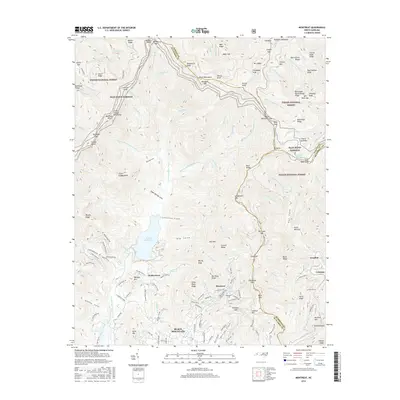
 2022 Montreat2022 Print · USGSMontreat and Black Mountain are shown in the twenty-first century, positioned where high peaks meet established valley communities. Researchers can trace the boundaries of the Pisgah National Forest, the Montreat College Main Campus, and the North Fork Reservoir.
 - 2022 Map of Black Mountain, 2022 Print
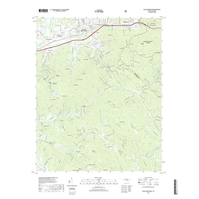
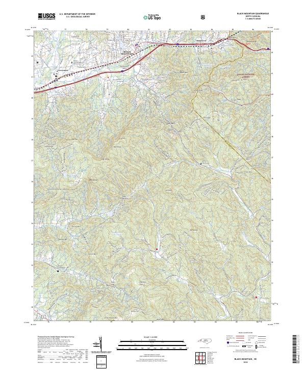 2022 Black Mountain2022 Print · USGSThe eastern Continental Divide is captured here in the early 2020s, showing the high-elevation development between the Swannanoa and Blue Ridge ranges. Genealogists and historians can locate landmarks like the Western Carolina State Veterans Cem and Wilkey Baptist Church Cem among the peaks.
End of results
Showing maps 1-25 of 25
Top cities near Black Mountain
- Asheville historical maps
- Fletcher historical maps
- Mills River historical maps
- Swannanoa historical maps
- Royal Pines historical maps
- Woodfin historical maps
See more
Top neighborhoods of Black Mountain
Frequently asked questions
- What are the different types of historical maps available for Black Mountain?
- What is the oldest map of Black Mountain?
- Where can I purchase historical maps of Black Mountain for my home or office?
- Where can I download high-res historical maps of Black Mountain?
- Are there historical topographic maps available for Black Mountain?
- Is there historical aerial imagery available for Black Mountain?
- Where are historical maps of Black Mountain sourced from?