Old Maps of Stocksville, North Carolina
Explore 18 old maps of Stocksville, spanning from 1894 to today. These high-resolution historic maps reveal how streets, neighborhoods, landmarks, and natural features evolved over time — perfect for genealogy, metal detecting, research, and local history exploration.
What you can do with these maps:
- See how Stocksville changed over time: Compare historical maps to modern-day views to trace roads, homesites, rail lines & more.
- View detailed metadata: Each map includes creators, publishers, year, scale, and archive source.
- Overlay maps with satellite & LiDAR: Visualize the past alongside modern tools to explore terrain & human change.
- Trusted historical sources: Maps sourced from the USGS, Library of Congress, and other archives.
- Access maps your way: View online, download high-res files, or order prints for personal or research use.
Start exploring old maps of Stocksville to uncover forgotten places, hidden landmarks, and the deep history beneath your feet.
Stocksville, NC maps
(18)- 1894 Map of Asheville
 1894 Asheville1894 Print · USGSAsheville and the French Broad River valley are shown here in the 1890s, when rail travel was transforming the Southern Appalachians. Genealogists can locate family landmarks like Gudgers Mill, Pendletons Mill, and the early development of Biltmore.2 unique versions available
 - 1901 Map of Asheville
 1901 Asheville1901 Print · USGSWestern North Carolina at the turn of the century shows a mountain landscape adapting to the arrival of major railroads. Genealogists and historians can trace family-named peaks and early communities like Mars Hill, Hot Springs, and the estates at Biltmore.9 unique versions available
 - 1936 Map of Weaverville
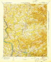
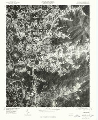
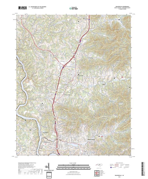
 1936 Weaverville1936 Print · USGSBuncombe County in the mid-1930s shows a landscape of mountain settlements and river industry between Weaverville and Asheville. Genealogists and researchers can locate family landmarks like Garrison Cemetery and historic rural hubs such as Britten Cove School and Clarks Chapel.
 - 1942 Map of Weaverville, 1954 Print
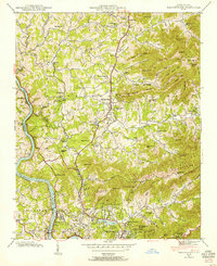 1942 Weaverville1954 Print · USGSBuncombe County's highland terrain in the early 1940s reveals a landscape of mountain settlements and river-valley rail lines. Family historians can locate specific landmarks including Clarks Chapel, the Brittain Cove Sch, and the winding French Broad River.
 - 1943 Map of Weaverville
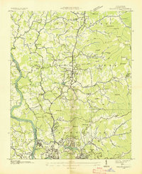
 1943 Weaverville1943 Print · USGSThe Buncombe County foothills north of Asheville appear here in the early 1940s, showing a landscape of upland coves and developing mountain communities. Genealogists and local historians can locate family-named landmarks and old meeting houses like Clarks Chapel, Garrison Cem, and the Brittain Cove Sch.2 unique versions available
 - 1955 Map of Knoxville
 1955 Knoxville1955 Print · USGSThe Southern Appalachians and the Smoky Mountains are shown here at a peak of mid-century development and conservation. Genealogists and historians can trace the early road networks connecting Gatlinburg, Waynesville, and the Cherokee Indian Reservation across the high ridges.
 - 1957 Map of Knoxville, 1966 Print
 1957 Knoxville1966 Print · USGSThe Southern Appalachians of Tennessee and North Carolina are mapped here during the mid-twentieth century as new highways reached the high country. Genealogists and historians can trace the topography between Knoxville and Asheville, locating family landmarks near Fontana Lake or along the Blue Ridge Parkway.4 unique versions available
 - 1960 Map of Knoxville
 1960 Knoxville1960 Print · USGSThe Southern Appalachians come alive in the 1950s, showing the intersection of new national park tourism and deep-rooted mountain industry. Trace old rail lines like the Clinchfield RR and find high-altitude landmarks from Mt Le Conte to the Cherokee Indian Reservation.2 unique versions available
 - 1962 Map of Weaverville, 1965 Print
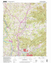
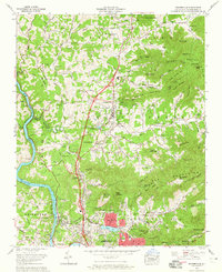 1962 Weaverville1965 Print · USGSBuncombe County underwent significant development in the early sixties as the suburbs of Asheville pushed north toward Weaverville. Local researchers can trace family roots through sites like Coles Cem, find the Asheville-Weaverville Speedway, and locate the historic Craggy Prison near the river.3 unique versions available
 - 1964 Map of Knoxville
 1964 Knoxville1964 Print · USGSThe Southern Appalachians and Great Smokies are captured here during the mid-sixties, showing the rugged borderlands of Tennessee and North Carolina. Researchers can trace historic mountain routes like U S 441, the expanse of Pisgah National Forest, and the growing footprints of Asheville and Knoxville.
 - 1976 Map of Weaverville, 1979 Print
 1976 Weaverville1979 Print · USGSThe northern corridor of the French Broad valley comes to life in this mid-seventies aerial survey. Researchers can trace land use and development patterns between Weaverville and Stocksville, or locate family sites near Reynolds Mountain.
 - 1985 Map of Asheville
 1985 Asheville1985 Print · USGSWestern North Carolina during the mid-eighties shows a region of deep mountain heritage and expanding highway networks. Genealogists and historians can trace the foundations of Asheville alongside older rail corridors like the Clinchfield Railroad and the high elevations of Mount Mitchell.2 unique versions available
 - 1997 Map of Weaverville, 2001 Print
 1997 Weaverville2001 Print · USGSBuncombe County's transition from rural mountain coves to suburban corridors is captured here during the late nineties. Genealogists and local historians can trace family-named sites like Whitted Knob and Garrison Cem, or locate landmarks such as the Asheville Weaverville Speedway and Craggy Prison.
 - 2010 Map of Weaverville, 2010 Print
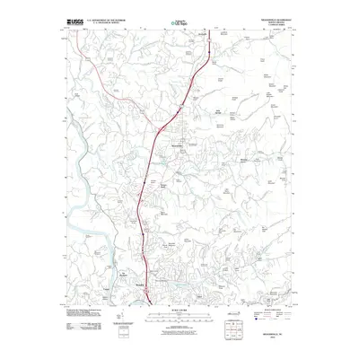 2010 Weaverville2010 Print · USGSCovers Stocksville, including Asheville, Woodfin, and other nearby areas
 - 2013 Map of Weaverville, 2013 Print
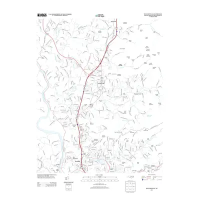 2013 Weaverville2013 Print · USGSCovers Stocksville, including Asheville, Woodfin, and other nearby areas
 - 2016 Map of Weaverville, 2016 Print
 2016 Weaverville2016 Print · USGSCovers Stocksville, including Asheville, Woodfin, and other nearby areas
 - 2019 Map of Weaverville, 2019 Print
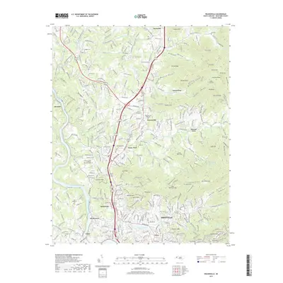 2019 Weaverville2019 Print · USGSCovers Stocksville, including Asheville, Woodfin, and other nearby areas
 - 2022 Map of Weaverville, 2022 Print
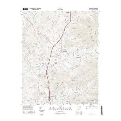
 2022 Weaverville2022 Print · USGSBuncombe County's mountain settlements and river valleys are captured here as they appeared in 2022. Researchers can trace family plots at West Memorial Park Cem or explore the rugged terrain near Stoney Knob and the French Broad River.
End of results
Showing maps 1-18 of 18
Top cities near Stocksville
- Asheville historical maps
- Black Mountain historical maps
- Swannanoa historical maps
- Woodfin historical maps
- Weaverville historical maps
- Mars Hill historical maps
See more
Frequently asked questions
- What are the different types of historical maps available for Stocksville?
- What is the oldest map of Stocksville?
- Where can I purchase historical maps of Stocksville for my home or office?
- Where can I download high-res historical maps of Stocksville?
- Are there historical topographic maps available for Stocksville?
- Is there historical aerial imagery available for Stocksville?
- Where are historical maps of Stocksville sourced from?