Old Maps of Drexel, North Carolina
Explore 30 old maps of Drexel, spanning from 1905 to today. These high-resolution historic maps reveal how streets, neighborhoods, landmarks, and natural features evolved over time — perfect for genealogy, metal detecting, research, and local history exploration.
What you can do with these maps:
- See how Drexel changed over time: Compare historical maps to modern-day views to trace roads, homesites, rail lines & more.
- View detailed metadata: Each map includes creators, publishers, year, scale, and archive source.
- Overlay maps with satellite & LiDAR: Visualize the past alongside modern tools to explore terrain & human change.
- Trusted historical sources: Maps sourced from the USGS, Library of Congress, and other archives.
- Access maps your way: View online, download high-res files, or order prints for personal or research use.
Start exploring old maps of Drexel to uncover forgotten places, hidden landmarks, and the deep history beneath your feet.
Drexel, NC maps
(30)- 1905 Map of Morganton, 1941 Print
 1905 Morganton1941 Print · USGSThe foothills and high peaks of the Blue Ridge come alive in the early twentieth century, centered on the growing towns of Morganton and Lenoir. Genealogists and historians can trace the early rail corridor of the Southern Railway and locate vanished landmarks like Arneys Store and Rutherford College.2 unique versions available
 - 1953 Map of Charlotte, 1968 Print
 1953 Charlotte1968 Print · USGSThe North Carolina Piedmont and South Carolina borderlands are shown in detail during a period of significant growth and reservoir development. Trace the rail corridors of the Southern Railway or find family roots in towns like China Grove, Misenheimer, and Lincolnton.3 unique versions available
 - 1954 Map of Charlotte
 1954 Charlotte1954 Print · USGSThe North Carolina Piedmont in the mid-1950s shows a region of rapid growth and industrial expansion centered around Charlotte. Trace the era's infrastructure through the Southern railroad lines and locate significant landmarks like the Charlotte Naval Ammunition Depot and Lake Norman.2 unique versions available
 - 1956 Map of Valdese, 1958 Print
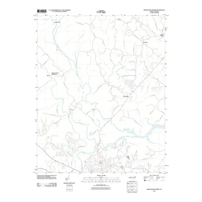
 1956 Valdese1958 Print · USGSBurke County in the mid-fifties shows a landscape of busy textile and furniture towns connected by the rail corridor. Genealogists can locate family sites among numerous landmarks like Bollingers Chapel, Hildebran Sch, and Connellys Springs.2 unique versions available
 - 1956 Map of Morganton North, 1958 Print
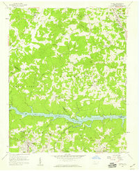
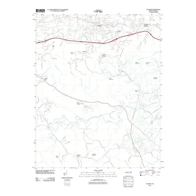
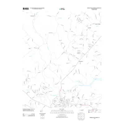
 1956 Morganton North1958 Print · USGSMorganton and the river valleys of Burke County are captured in the mid-fifties, showing the rural landscapes of Quaker Meadow. Researchers can trace family sites like Arneys Store, Corpening Sch, and several mission churches along the Johns River.2 unique versions available
 - 1956 Map of Drexel, 1959 Print
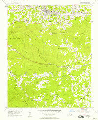
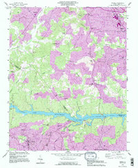
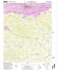
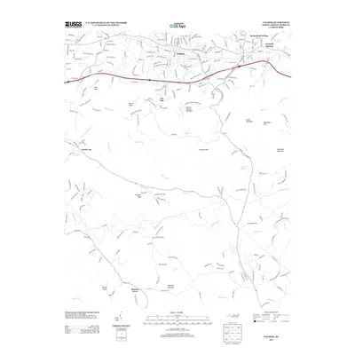
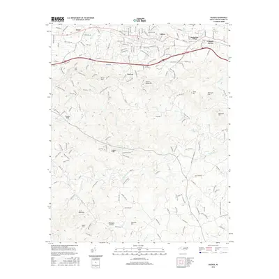
 1956 Drexel1959 Print · USGSThe Catawba River valley in the mid-1950s is captured here just as the region’s industrial and transit networks were maturing. Local historians can trace the development of Drexel and Valdese along the Southern railroad or locate family-named sites like Puett Cem and Corpening Bridge.
 - 1956 Map of Lenoir, 1963 Print
 1956 Lenoir1963 Print · USGSCaldwell and Burke Counties come alive in the 1950s, showing the Foothills region as it transitioned from mountain timberlands to bustling rail towns. Trace old community hubs like Arneys Store, family-named creeks such as Elijah Bates Mill Creek, and the many churches like St Marys Mission Ch.
 - 1960 Map of Charlotte
 1960 Charlotte1960 Print · USGSMid-century North Carolina and South Carolina meet in this 1960 survey of the Piedmont's industrial and textile heartland. Trace the growth of Charlotte alongside historic landmarks like Kings Mountain National Military Park and the Charlotte Naval Ammunition Depot.2 unique versions available
 - 1962 Map of Charlotte
 1962 Charlotte1962 Print · USGSThe North Carolina Piedmont in the early sixties showcases a landscape transformed by massive reservoirs and industrial growth. Researchers can trace the development of Lake Norman, locate the Charlotte Naval Ammunition Depot, or find family landmarks like Wesley Chapel and Brown & Norcott Mills.
 - 1986 Map of Hickory
 1986 Hickory1986 Print · USGSWestern North Carolina's foothills are seen here in the mid-eighties as textile and furniture towns flourished along the river. Trace the development of Hickory and Lenoir or locate local landmarks like Burke Chapel, Saw Mills, and Rhodhiss Lake.3 unique versions available
 - 1993 Map of Drexel, 1995 Print
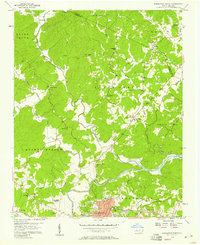
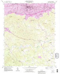
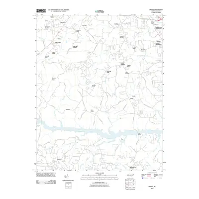
 1993 Drexel1995 Print · USGSThe river-and-rail corridor of central North Carolina is captured here in the 1990s as the communities of Drexel and Valdese continued their growth south of Rhodhiss Lake. Genealogists can trace local roots through numerous landmarks like North Catawba Ch, Puett Cem, and the old settlement of Baton.2 unique versions available
 - 1993 Map of Valdese, 1996 Print
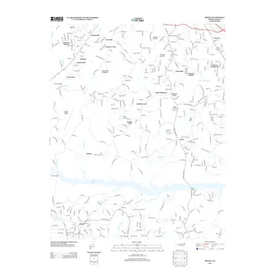
 1993 Valdese1996 Print · USGSBurke County in the early nineties shows the busy manufacturing corridor along the railroad being overtaken by suburban growth. Genealogists and historians can trace family locations through numerous rural landmarks like Walker Chapel, Bollingers Chapel, and Rutherford College.
 - 1993 Map of Morganton North, 1996 Print
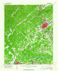
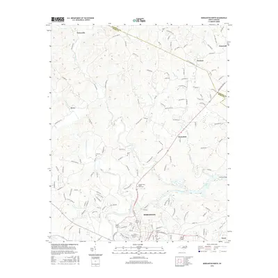
 1993 Morganton North1996 Print · USGSThe Johns River and Catawba River valleys in Burke County were undergoing notable suburban expansion in the 1990s. Researchers can locate historic rural centers like Arneys Store and Hartland, along with family landmarks such as Houck Cem and Bost Cem.
 - 2002 Map of Morganton North, 2003 Print
 2002 Morganton North2003 Print · USGSBurke County at the turn of the millennium shows the intersection of deep-rooted rural communities and modern municipal growth near the Catawba River. Researchers can trace old family footprints at Arneys Store, Corpening Sch, and Littlejohn Ch.
 - 2002 Map of Valdese, 2003 Print
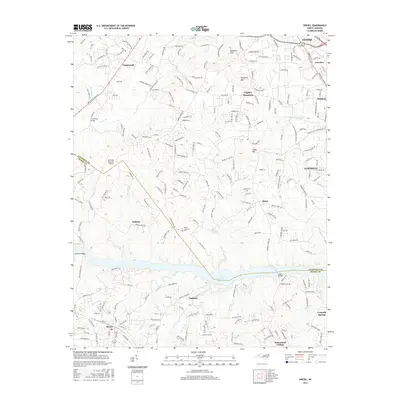
 2002 Valdese2003 Print · USGSValdese and the foothills of the South Mountains are captured here in the early twenty-first century as the area continued its transition from textile manufacturing to a regional hub. Researchers can locate dozens of historic landmarks including Bollingers Chapel, Laurel Sch, and the high peak of Mineral Springs Mtn.
 - 2010 Map of Drexel, 2010 Print
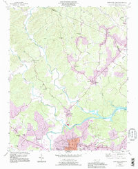
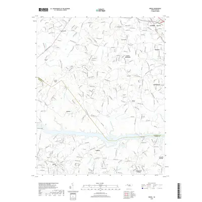
 2010 Drexel2010 Print · USGSCovers Drexel, including Lenoir, Sawmills, and other nearby areas
 - 2010 Map of Valdese, 2010 Print
 2010 Valdese2010 Print · USGSCovers Drexel, including Valdese, Connelly Springs, and other nearby areas
 - 2010 Map of Morganton North, 2010 Print
 2010 Morganton North2010 Print · USGSCovers Drexel, including Morganton, Chesterfield, and other nearby areas
 - 2013 Map of Valdese, 2013 Print
 2013 Valdese2013 Print · USGSCovers Drexel, including Valdese, Connelly Springs, and other nearby areas
 - 2013 Map of Morganton North, 2013 Print
 2013 Morganton North2013 Print · USGSCovers Drexel, including Morganton, Chesterfield, and other nearby areas
 - 2013 Map of Drexel, 2013 Print
 2013 Drexel2013 Print · USGSCovers Drexel, including Lenoir, Sawmills, and other nearby areas
 - 2016 Map of Drexel, 2016 Print
 2016 Drexel2016 Print · USGSCovers Drexel, including Lenoir, Sawmills, and other nearby areas
 - 2016 Map of Valdese, 2016 Print
 2016 Valdese2016 Print · USGSCovers Drexel, including Valdese, Connelly Springs, and other nearby areas
 - 2016 Map of Morganton North, 2016 Print
 2016 Morganton North2016 Print · USGSCovers Drexel, including Morganton, Chesterfield, and other nearby areas
 - 2019 Map of Drexel, 2019 Print
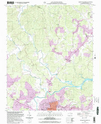
 2019 Drexel2019 Print · USGSCovers Drexel, including Lenoir, Sawmills, and other nearby areas
Showing maps 1-25 of 30
Top cities near Drexel
- Hickory historical maps
- Lenoir historical maps
- Morganton historical maps
- Sawmills historical maps
- Long View historical maps
- Granite Falls historical maps
See more
Frequently asked questions
- What are the different types of historical maps available for Drexel?
- What is the oldest map of Drexel?
- Where can I purchase historical maps of Drexel for my home or office?
- Where can I download high-res historical maps of Drexel?
- Are there historical topographic maps available for Drexel?
- Is there historical aerial imagery available for Drexel?
- Where are historical maps of Drexel sourced from?