Old Maps of Caldwell County, North Carolina
Explore 53 old maps of Caldwell County, spanning from 1889 to today. These high-resolution historic maps reveal how streets, neighborhoods, landmarks, and natural features evolved over time — perfect for genealogy, metal detecting, research, and local history exploration.
What you can do with these maps:
- See how Caldwell County changed over time: Compare historical maps to modern-day views to trace roads, homesites, rail lines & more.
- View detailed metadata: Each map includes creators, publishers, year, scale, and archive source.
- Overlay maps with satellite & LiDAR: Visualize the past alongside modern tools to explore terrain & human change.
- Trusted historical sources: Maps sourced from the USGS, Library of Congress, and other archives.
- Access maps your way: View online, download high-res files, or order prints for personal or research use.
Start exploring old maps of Caldwell County to uncover forgotten places, hidden landmarks, and the deep history beneath your feet.
Caldwell County, NC maps
(53)- 1889 Map of Wilkesboro, 1960 Print
 1889 Wilkesboro1960 Print · USGSCovers Caldwell County, including North Wilkesboro, Wilkesboro, and other nearby areas
 - 1891 Map of Wilkesboro, 1940 Print
 1891 Wilkesboro1940 Print · USGSCovers Caldwell County, including North Wilkesboro, Wilkesboro, and other nearby areas
 - 1893 Map of Cranberry
 1893 Cranberry1893 Print · USGSCovers Caldwell County, including Boone, Mountain City, and other nearby areas
 - 1895 Map of Hickory
 1895 Hickory1895 Print · USGSCovers Caldwell County, including Hickory, Lenoir, and other nearby areas5 unique versions available
 - 1895 Map of Cranberry
 1895 Cranberry1895 Print · USGSCovers Caldwell County, including Boone, Mountain City, and other nearby areas
 - 1899 Map of Cranberry
 1899 Cranberry1899 Print · USGSCovers Caldwell County, including Boone, Mountain City, and other nearby areas
 - 1902 Map of Cranberry
 1902 Cranberry1902 Print · USGSCovers Caldwell County, including Boone, Mountain City, and other nearby areas6 unique versions available
 - 1905 Map of Morganton, 1941 Print
 1905 Morganton1941 Print · USGSCovers Caldwell County, including Lenoir, Morganton, and other nearby areas2 unique versions available
 - 1936 Map of Blowing Rock
 1936 Blowing Rock1936 Print · USGSCovers Caldwell County, including Boone, Blowing Rock, and other nearby areas
 - 1942 Map of Blowing Rock
 1942 Blowing Rock1942 Print · USGSCovers Caldwell County, including Boone, Blowing Rock, and other nearby areas4 unique versions available
 - 1944 Map of Linville
 1944 Linville1944 Print · USGSCovers Caldwell County, including Banner Elk, Newland, and other nearby areas2 unique versions available
 - 1953 Map of Charlotte, 1968 Print
 1953 Charlotte1968 Print · USGSCovers Caldwell County, including Charlotte, Winston-Salem, and other nearby areas3 unique versions available
 - 1953 Map of Winston-Salem, 1974 Print
 1953 Winston-Salem1974 Print · USGSCovers Caldwell County, including Greensboro, Winston-Salem, and other nearby areas2 unique versions available
 - 1954 Map of Charlotte
 1954 Charlotte1954 Print · USGSCovers Caldwell County, including Charlotte, Winston-Salem, and other nearby areas2 unique versions available
 - 1955 Map of Winston-Salem
 1955 Winston-Salem1955 Print · USGSCovers Caldwell County, including Greensboro, Winston-Salem, and other nearby areas
 - 1956 Map of Collettsville, 1958 Print
 1956 Collettsville1958 Print · USGSCovers Caldwell County, including Collettsville, Rufus, and other nearby areas3 unique versions available
 - 1956 Map of Morganton North, 1958 Print
 1956 Morganton North1958 Print · USGSCovers Caldwell County, including Morganton, Drexel, and other nearby areas2 unique versions available
 - 1956 Map of Lenoir, 1958 Print
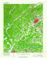
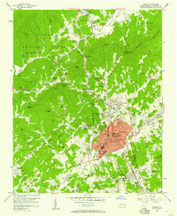 1956 Lenoir1958 Print · USGSCovers Caldwell County, including Lenoir, Gamewell, and other nearby areas2 unique versions available
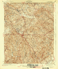
 - 1956 Map of Chestnut Mtn., 1958 Print
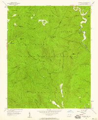 1956 Chestnut Mtn.1958 Print · USGSCovers Caldwell County, including Cold Springs, Kawana, and other nearby areas4 unique versions available
 - 1956 Map of Drexel, 1959 Print
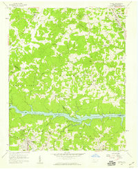 1956 Drexel1959 Print · USGSCovers Caldwell County, including Lenoir, Sawmills, and other nearby areas
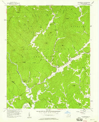
 - 1956 Map of Linville Falls, 1962 Print
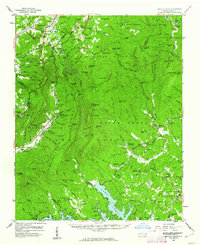 1956 Linville Falls1962 Print · USGSCovers Caldwell County, including Spruce Pine, Glen Alpine, and other nearby areas2 unique versions available
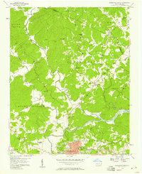
 - 1956 Map of Lenoir, 1963 Print
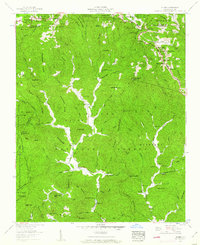
 1956 Lenoir1963 Print · USGSCovers Caldwell County, including Lenoir, Morganton, and other nearby areas
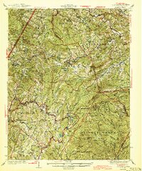
 - 1959 Map of Globe, 1962 Print
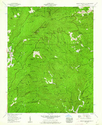
 1959 Globe1962 Print · USGSCovers Caldwell County, including Blowing Rock, Blowing Rock Estates, and other nearby areas3 unique versions available
 - 1960 Map of Charlotte
 1960 Charlotte1960 Print · USGSCovers Caldwell County, including Charlotte, Winston-Salem, and other nearby areas2 unique versions available
 - 1960 Map of Grandfather Mountain, 1961 Print
 1960 Grandfather Mountain1961 Print · USGSCovers Caldwell County, including Seven Devils, Sugar Mountain, and other nearby areas5 unique versions available
Showing maps 1-25 of 53
Top cities of Caldwell County
- Lenoir historical maps
- Sawmills historical maps
- Granite Falls historical maps
- Gamewell historical maps
- Hudson historical maps
- Cedar Rock historical maps
Frequently asked questions
- What are the different types of historical maps available for Caldwell County?
- What is the oldest map of Caldwell County?
- Where can I purchase historical maps of Caldwell County for my home or office?
- Where can I download high-res historical maps of Caldwell County?
- Are there historical topographic maps available for Caldwell County?
- Is there historical aerial imagery available for Caldwell County?
- Where are historical maps of Caldwell County sourced from?