Old Maps of Caswell County, North Carolina for Hiking & Exploration
Hike through history with 106 historic maps of Caswell County. Explore old trails, ghost towns, and forgotten backroads — perfect for outdoor adventurers and local explorers.
- Rediscover forgotten places: Map out old mining camps, roads, and footpaths that no longer exist on modern maps.
- Layer with modern tools: Combine with LiDAR or satellite views to plan hikes through historical terrain.
- Made for exploration: Popular among hikers, overlanders, and local history lovers.
Use these maps to find adventure and explore the hidden past of Caswell County.
Caswell County, NC maps
(106)- 1923 Map of Danville
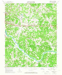
 1923 Danville1923 Print · USGSThe Virginia and North Carolina borderlands come alive in the 1920s as the Dan River winds through a landscape of rail-driven trade and rural education. Genealogists can trace family roots through numerous landmark schools and stores, including Lovelace Hall School, Gibsons Store, and Sandy Creek Church.
 - 1924 Map of Draper
 1924 Draper1924 Print · USGSThe rural Piedmont of Southside Virginia is mapped here during the mid-twenties, showcasing a landscape of small tobacco farms and river-valley settlements. Researchers can trace family sites like Laceys Store, the Soapstone Quarry, and early depots at Leaksville Junction.
 - 1925 Map of Danville
 1925 Danville1925 Print · USGSThe borderlands of Pittsylvania County and North Carolina appear here in the mid-1920s, centered on the growing industrial hub of Danville. Genealogists and historians can trace neighborhood developments in Schoolfield and locate rural landmarks like Laniers Mill and Lovelace Hall School.3 unique versions available
 - 1926 Map of Draper
 1926 Draper1926 Print · USGSThe Virginia and North Carolina borderlands come alive in the mid-1920s, showing a landscape of small tobacco farms and rail-dependent hamlets. Genealogists can trace family roots through numerous local landmarks like Swansonville, Bachelors Hall Church, and the Danville and Western rail line.3 unique versions available
 - 1944 Map of Draper
 1944 Draper1944 Print · USGSThe Virginia and North Carolina borderlands come alive in the 1940s, showing the industrial and rail corridor stretching from Spray to Draper. Researchers can trace the Danville and Western Ry route through old stops like Cascade Station and discover dozens of rural community hubs like Stony Mill and Anderson Chapel.
 - 1952 Map of Milton, 1953 Print
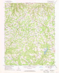
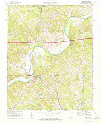
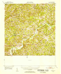 1952 Milton1953 Print · USGSThe Dan River valley at the start of the 1950s reveals a landscape of tobacco farms and rural schoolhouses across the Virginia-North Carolina line. Genealogists and local historians can trace family roots through landmarks like Sutherlin Millpond, Mercy Seat Ch, and the Tan-yard.
 - 1953 Map of Greensboro, 1981 Print
 1953 Greensboro1981 Print · USGSThe Piedmont borderlands of North Carolina and Virginia show a landscape defined by new reservoirs and old rail lines. Trace family roots and the changing river geography through Elon College, the John H Kerr Reservoir, and South Boston.
 - 1954 Map of Greensboro
 1954 Greensboro1954 Print · USGSThe Piedmont borderlands of North Carolina and Virginia come alive in this mid-fifties study of a region defined by its rivers and rails. Researchers can trace the growing Buggs Island Lake or follow the paths of the Southern Ry and Seaboard Air Line RR through towns like Oxford and Reidsville.
 - 1956 Map of Milton, 1957 Print
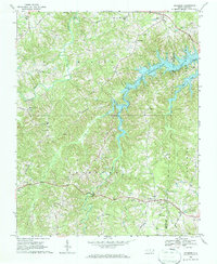
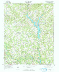
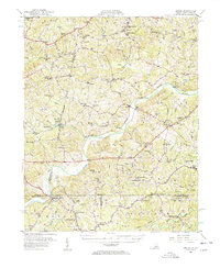 1956 Milton1957 Print · USGSThe borderlands of Caswell County and southern Virginia are captured here in the mid-1950s as a landscape of river-driven commerce and rail depots. Researchers can trace family sites from Milton to Ghent, locating landmarks like Sutherlin Millpond and the Archibald Murphy Sch.2 unique versions available
 - 1962 Map of Greensboro
 1962 Greensboro1962 Print · USGSThe Piedmont region along the Virginia and North Carolina border comes alive in the early 1960s, showing a landscape defined by industry and new reservoirs. Trace the path of the Virginian RR or explore the early development of Greensboro and Durham.
 - 1965 Map of Danville, 1966 Print
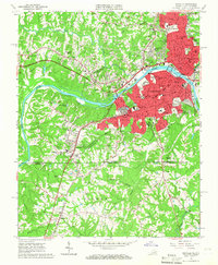 1965 Danville1966 Print · USGSDanville and the surrounding borderlands of Virginia and North Carolina appear here during a period of mid-century suburban and educational expansion. Genealogists and local historians can trace family-named sites and vanished school districts, from Schoolfield to the grounds of Averett College and Green Hill Cemetery.4 unique versions available
 - 1965 Map of Brosville, 1966 Print
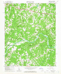 1965 Brosville1966 Print · USGSCrossing the Virginia and North Carolina border in the mid-sixties, this area shows a landscape defined by the loops of the Dan River. Genealogists can locate family landmarks like Judy Byrd Mountain and rural congregations at Piney Grove Ch or Vandola Ch.4 unique versions available
 - 1965 Map of Ringgold, 1967 Print
 1965 Ringgold1967 Print · USGSThe Virginia and North Carolina borderlands come to life in the mid-1960s, showing the growth of industrial Danville alongside rural river towns. Researchers can trace family history through numerous landmarks like White Rock Ch, the Rice Sch, and the community at Blanch.5 unique versions available
 - 1966 Map of Greensboro
 1966 Greensboro1966 Print · USGSThe North Carolina and Virginia Piedmont thrives during the mid-sixties, showcasing a landscape of textile hubs and expanding river reservoirs. Researchers can trace the rail corridors of the Southern Railway, find local landmarks like Elon College, or locate the extensive Camp Butner Military Reservation.
 - 1967 Map of Cedar Grove, 1969 Print
 1967 Cedar Grove1969 Print · USGSNorthern Orange County's rolling hills and headwaters are captured in the late sixties as rural communities and new reservoirs shaped the land. Genealogists can trace family roots through landmarks like Harmony Cem, Mt Zion Ch, and the school at Cedar Grove.
 - 1968 Map of Leasburg, 1969 Print
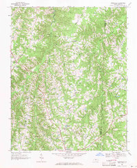
 1968 Leasburg1969 Print · USGSCaswell County in the late sixties shows a landscape transformed by the newly formed Hyco Lake and its sprawling fingers. Genealogists and local historians can trace family locations along Hesters Store Road or find rural landmarks like Blanch Prison, Semora, and New Hope Ch.3 unique versions available
 - 1968 Map of Ridgeville, 1971 Print
 1968 Ridgeville1971 Print · USGSThe rural borderlands of Caswell and Person counties come into focus during the late sixties, a landscape of family-run stores and country parishes. Researchers can trace the heritage of Prospect Hill and Ridgeville or locate historic sites like Lea Bethel Ch and Hesters Store.2 unique versions available
 - 1968 Map of Milton, 1972 Print
 1968 Milton1972 Print · USGSThe Dan River valley near the Virginia-North Carolina state line is shown here in the late sixties, as rural life centered on crossroads like Milton and Semora. Genealogists and historians can locate numerous rural churches and schools, such as White Stone Ch and New Dotmond Sch.3 unique versions available
 - 1969 Map of Lake Burlington, 1972 Print
 1969 Lake Burlington1972 Print · USGSNorth Carolina’s Piedmont countryside is captured here in the late sixties as new reservoirs began to reshape the rural landscape. Researchers can find traditional settlements like Altamahaw and Union Ridge alongside old landmarks like Stony Creek Ch and Glencoe.2 unique versions available
 - 1969 Map of Burlington NE, 1972 Print
 1969 Burlington NE1972 Print · USGSNorth Carolina's Piedmont region in the late sixties shows a landscape of rural schoolhouses and family churches at the crossroads of three counties. Researchers can trace the communities of Pleasant Grove and Just Crossroads or locate Martins Chapel and Snow Hill Ch.2 unique versions available
 - 1970 Map of Ossipee, 1973 Print
 1970 Ossipee1973 Print · USGSThe borderlands of Alamance and Guilford Counties come into focus in the early 1970s as the Haw River winds past small rural hubs. Researchers can trace local heritage through numerous landmarks like Altamahaw-Ossipee Sch, Apples Chapel Cem, and Friedens Ch.
 - 1971 Map of Ruffin, 1974 Print
 1971 Ruffin1974 Print · USGSRockingham and Caswell counties come into focus in the early 1970s, showing a Piedmont landscape tied to the rail line. Local historians can trace family roots at Mullins-Stacy Cem or locate community hubs like Wolf Island Ch and the settlement of Ruffin.2 unique versions available
 - 1972 Map of Anderson, 1974 Print
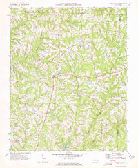
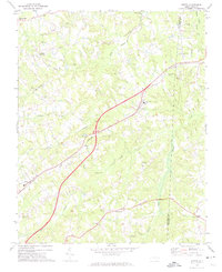
 1972 Anderson1974 Print · USGSCaswell County rural life is preserved here during the early seventies, centered on small crossroads and woodland camps. Researchers can locate family landmarks like Sweet Gum Sch, Graves Chapel, and the Cherokee Scout Reservation.
 - 1972 Map of Williamsburg, 1974 Print
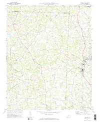
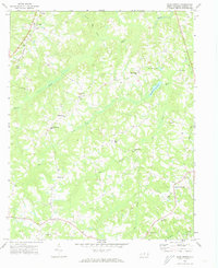
 1972 Williamsburg1974 Print · USGSRockingham and Caswell counties in the early 1970s reveal a landscape of interconnected farm communities and country roads. Genealogists can trace family footprints at Williamsburg, Settle Cem, and numerous rural sanctuaries like Browns Arbor Ch.
 - 1972 Map of Park Spring, 1974 Print
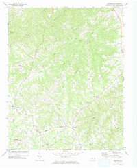
 1972 Park Spring1974 Print · USGSCaswell County's rural character is captured here in the early 1970s, showing a landscape of small settlements and dispersed country congregations. Researchers can trace family roots through landmarks like Gwynns Chapel, New Ephesus Ch, and the Cobb Memorial Sch near Blackwell.3 unique versions available
Showing maps 1-25 of 106
Top cities of Caswell County
Frequently asked questions
- What are the different types of historical maps available for Caswell County?
- What is the oldest map of Caswell County?
- Where can I purchase historical maps of Caswell County for my home or office?
- Where can I download high-res historical maps of Caswell County?
- Are there historical topographic maps available for Caswell County?
- Is there historical aerial imagery available for Caswell County?
- Where are historical maps of Caswell County sourced from?