1900s (20th Century) Maps of Safe, North Carolina
Explore 6 historic maps of Safe from the 1900s (20th Century). These maps offer a rare glimpse into what life looked like during the 1900s — showing old roads, neighborhoods, homes, and landmarks that have changed or disappeared over time.
Whether you're researching your family's past, planning a metal detecting trip, or studying how Safe's landscape evolved across the 1900s, these high-resolution maps are a powerful tool for exploring the history of this region.
- Focus on a specific era: All maps on this page are from the 1900s, giving you a focused view of this time period.
- See what’s changed: Compare century-old streets, trails, and buildings to today's modern landscape using overlays and satellite layers.
- Research with precision: Use these maps for genealogy, historical research, land use analysis, or educational projects.
- View, download, or print: Maps are fully viewable online in high resolution, and can be downloaded or printed for your own records.
Start exploring Safe's history through authentic maps from the 1900s. This is your window into the past.
Safe, NC maps
(6)- 1953 Map of Florence, 1964 Print
 1953 Florence1964 Print · USGSThe Carolina borderlands in the mid-fifties were a landscape of vast river swamps and rising rail towns. Trace the legacy of the Seaboard Air Line through Florence or explore the wetlands surrounding Lake Waccamaw and the Green Swamp.3 unique versions available
 - 1954 Map of Florence
 1954 Florence1954 Print · USGSThe Carolinas borderlands come alive in the early fifties, showing the vital rail-and-river networks of the coastal plain. Genealogists can trace family footprints across the Green Swamp or through settlements like Red Springs, Chadbourn, and McColl.
 - 1955 Map of Atkinson, 1957 Print
 1955 Atkinson1957 Print · USGSCoastal plain life in the mid-1950s revolves around the timberlands and rail-stops between the Black River and Moores Creek. Genealogists and historians can trace family ties through dozens of rural landmarks like Newtons Crossroads, St. Marys Ch, and Bland High Sch.2 unique versions available
 - 1982 Map of Elizabethtown, 1983 Print
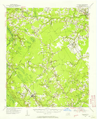
 1982 Elizabethtown1983 Print · USGSSoutheastern North Carolina's coastal plain is captured here in the early eighties, showcasing a landscape defined by the Cape Fear River and mysterious Carolina Bays. Genealogists and researchers can trace the rail network of the Seaboard Coast Line through rural communities like Autryville, Ivanhoe, and the recreational hub of White Lake.
 - 1984 Map of Wallace West
 1984 Wallace West1984 Print · USGSIn the 1980s, the Pender County countryside reflected a mix of New Deal planning and deep-rooted family history. Trace the layout of Penderlea or locate family sites like Alderman Cem and Newkirk Chapel along the Rockfish Creek basin.
 - 1997 Map of Wallace West, 2001 Print
 1997 Wallace West2001 Print · USGSCoastal plain life in the late nineties is defined by the rural settlements and creek systems of Pender and Duplin counties. Genealogists and historians can trace family roots through sites like Alderman Cem, the planned community layout of Penderlea, and an Old Railroad Grade.
End of results
Showing maps 1-6 of 6
Top cities near Safe
- Burgaw historical maps
- Rose Hill historical maps
- Magnolia historical maps
- Kenansville historical maps
- Greenevers historical maps
- Delway historical maps
See more
Frequently asked questions
- What are the different types of historical maps available for Safe?
- What is the oldest map of Safe?
- Where can I purchase historical maps of Safe for my home or office?
- Where can I download high-res historical maps of Safe?
- Are there historical topographic maps available for Safe?
- Is there historical aerial imagery available for Safe?
- Where are historical maps of Safe sourced from?