Old Maps of Mountain View, North Carolina
Explore 17 old maps of Mountain View, spanning from 1906 to today. These high-resolution historic maps reveal how streets, neighborhoods, landmarks, and natural features evolved over time — perfect for genealogy, metal detecting, research, and local history exploration.
What you can do with these maps:
- See how Mountain View changed over time: Compare historical maps to modern-day views to trace roads, homesites, rail lines & more.
- View detailed metadata: Each map includes creators, publishers, year, scale, and archive source.
- Overlay maps with satellite & LiDAR: Visualize the past alongside modern tools to explore terrain & human change.
- Trusted historical sources: Maps sourced from the USGS, Library of Congress, and other archives.
- Access maps your way: View online, download high-res files, or order prints for personal or research use.
Start exploring old maps of Mountain View to uncover forgotten places, hidden landmarks, and the deep history beneath your feet.
Mountain View, NC maps
(17)- 1906 Map of Kings Mountain, 1970 Print
 1906 Kings Mountain1970 Print · USGSThe North and South Carolina borderlands come alive in this early century survey of the Kings Mountain vicinity. Genealogists can locate family landmarks including Lincoln Academy, Bordens Ferry, and Pleasant Hill Church.
 - 1908 Map of Kings Mountain
 1908 Kings Mountain1908 Print · USGSThe Carolina borderlands come alive in the first decade of the 1900s, centered on the landmark Kings Mountain Battleground and its namesake ridge. Genealogists can trace family roots through numerous rural churches and schools, including Ramah Church, Beersheba Church, and the Lincoln Academy.6 unique versions available
 - 1953 Map of Charlotte, 1968 Print
 1953 Charlotte1968 Print · USGSThe North Carolina Piedmont and South Carolina borderlands are shown in detail during a period of significant growth and reservoir development. Trace the rail corridors of the Southern Railway or find family roots in towns like China Grove, Misenheimer, and Lincolnton.3 unique versions available
 - 1954 Map of Charlotte
 1954 Charlotte1954 Print · USGSThe North Carolina Piedmont in the mid-1950s shows a region of rapid growth and industrial expansion centered around Charlotte. Trace the era's infrastructure through the Southern railroad lines and locate significant landmarks like the Charlotte Naval Ammunition Depot and Lake Norman.2 unique versions available
 - 1960 Map of Charlotte
 1960 Charlotte1960 Print · USGSMid-century North Carolina and South Carolina meet in this 1960 survey of the Piedmont's industrial and textile heartland. Trace the growth of Charlotte alongside historic landmarks like Kings Mountain National Military Park and the Charlotte Naval Ammunition Depot.2 unique versions available
 - 1962 Map of Charlotte
 1962 Charlotte1962 Print · USGSThe North Carolina Piedmont in the early sixties showcases a landscape transformed by massive reservoirs and industrial growth. Researchers can trace the development of Lake Norman, locate the Charlotte Naval Ammunition Depot, or find family landmarks like Wesley Chapel and Brown & Norcott Mills.
 - 1971 Map of Kings Mountain, 1973 Print
 1971 Kings Mountain1973 Print · USGSThe foothills of the Carolinas come into focus during the early seventies as the industrial growth of Kings Mountain meets the preserved heights of the state and military parks. Researchers can trace the legacy of rural congregations and local landmarks like Pisgah Cem, Camp Rotary, and The Pinnacle.
 - 1976 Map of Kings Mountain, 1978 Print
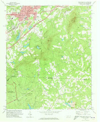
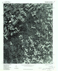 1976 Kings Mountain1978 Print · USGSKings Mountain and the surrounding Piedmont landscape are captured in mid-1970s aerial detail, showing the era's mining and forest clearings. Trace early residential footprints near Mountain View or study the industrial sites near Kings Mountain and Lake York.
 - 1986 Map of Gastonia
 1986 Gastonia1986 Print · USGSThe Carolina Piedmont in the mid-eighties shows a landscape shaped by Revolutionary War history and the textile industry. Trace the footprints of early battles at Kings Mountain National Military Park and locate depots along the Southern Railway in Shelby and Gastonia.
 - 1991 Map of Gastonia
 1991 Gastonia1991 Print · USGSThe Piedmont region along the North Carolina and South Carolina border shows a bustling industrial and transit corridor in the early nineties. Researchers can trace the sprawling footprints of Gastonia and Shelby or explore the grounds of Kings Mountain National Military Park and Lake Wylie.
 - 1993 Map of Kings Mountain, 1996 Print
 1993 Kings Mountain1996 Print · USGSThe North and South Carolina borderlands come alive in this early 1990s survey, showing the deep connection between the Piedmont landscape and its industrial and military history. Genealogists and researchers can locate family landmarks like Pisgah Cem and Trinity Ch alongside industrial sites such as the Mine Shaft near Henry Knob.
 - 1997 Map of Kings Mountain, 2000 Print
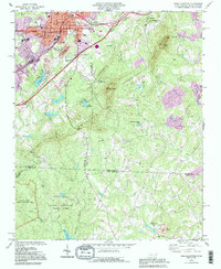
 1997 Kings Mountain2000 Print · USGSThe foothills and high ridges of the Piedmont come into focus in the late nineties as industrial activity and conservation efforts met along the border. Local researchers can find family landmarks like Pisgah Cem, the Trinity Ch, and the prominent rise of The Pinnacle.
 - 2011 Map of Kings Mountain, 2011 Print
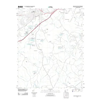 2011 Kings Mountain2011 Print · USGSCovers Mountain View, including Gastonia, Kings Mountain, and other nearby areas
 - 2013 Map of Kings Mountain, 2013 Print
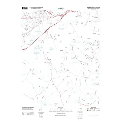 2013 Kings Mountain2013 Print · USGSCovers Mountain View, including Gastonia, Kings Mountain, and other nearby areas
 - 2016 Map of Kings Mountain, 2016 Print
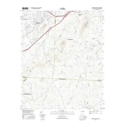 2016 Kings Mountain2016 Print · USGSCovers Mountain View, including Gastonia, Kings Mountain, and other nearby areas
 - 2019 Map of Kings Mountain, 2019 Print
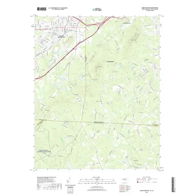 2019 Kings Mountain2019 Print · USGSCovers Mountain View, including Gastonia, Kings Mountain, and other nearby areas
 - 2022 Map of Kings Mountain, 2022 Print
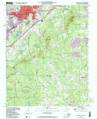
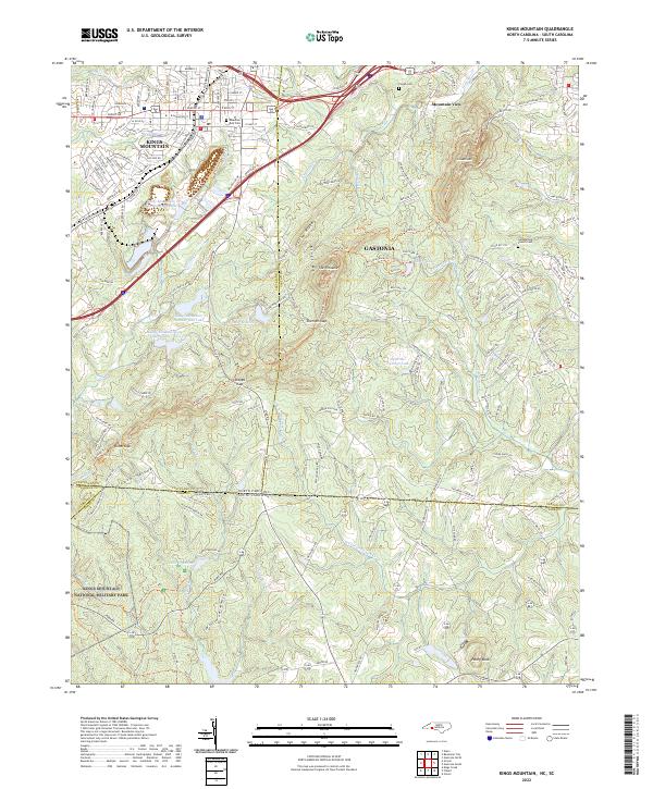 2022 Kings Mountain2022 Print · USGSThe borderlands of Cleveland and York counties come alive in this survey of the peaks and valleys surrounding the Revolutionary War site. Researchers can trace family sites near Mountain Rest Cem, the waters of Lake Montonia, and the heights of The Pinnacle.
End of results
Showing maps 1-17 of 17
Top cities near Mountain View
- Gastonia historical maps
- Shelby historical maps
- Lincolnton historical maps
- Kings Mountain historical maps
- Belmont historical maps
- York historical maps
See more
Frequently asked questions
- What are the different types of historical maps available for Mountain View?
- What is the oldest map of Mountain View?
- Where can I purchase historical maps of Mountain View for my home or office?
- Where can I download high-res historical maps of Mountain View?
- Are there historical topographic maps available for Mountain View?
- Is there historical aerial imagery available for Mountain View?
- Where are historical maps of Mountain View sourced from?