Old Maps of Cooleys Crossroads, North Carolina for Academic Research
Study the evolution of Cooleys Crossroads with 9 high-resolution historic maps. Whether you're teaching, researching, or modeling changes in land use, these maps provide essential visual documentation of urban, environmental, and geographic change.
- Analyze long-term change: Track patterns in development, transportation, and natural features.
- Ideal for environmental or urban studies: Support academic projects with primary historical map data.
- Use in the classroom or lab: Educators and researchers rely on these maps to bring historical context to life.
These maps are a powerful tool for teaching, research, and visualizing how Cooleys Crossroads has changed over the decades.
Cooleys Crossroads, NC maps
(9)- 1953 Map of Norfolk, 1954 Print
 1953 Norfolk1954 Print · USGSCoastal Virginia and northeastern North Carolina appear here during the post-war industrial boom, showing the critical rail-and-sea connections of Hampton Roads. Genealogists can trace family roots through rural landmarks like Gethsemane Ch, the Caledonia State Prison Farm, and the vast interior of the Dismal Swamp.4 unique versions available
 - 1973 Map of Littleton, 1977 Print
 1973 Littleton1977 Print · USGSThe border of Warren and Halifax Counties in the early 1970s is captured here as the Seaboard Coast Line passes through several rural communities. Researchers can trace the layout of Littleton, find Panacea Springs, and locate country churches like Ashley Grove Ch.
 - 1977 Map of Littleton, 1979 Print
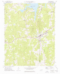
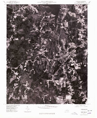 1977 Littleton1979 Print · USGSThe town of Littleton and the southern shores of Lake Gaston are captured in this late-seventies aerial survey of the North Carolina interior. Genealogists and historians can examine the precise layout of Littleton and nearby Vaughan or trace the timberlines near Enterprise.
 - 1985 Map of Roanoke Rapids
 1985 Roanoke Rapids1985 Print · USGSNorthern North Carolina's river-driven economy is on display here in the mid-1980s, from the hydro-power at Roanoke Rapids to the rural millponds. Genealogists can trace family lands near Wiccacanee Pond, Mush Island, or the remote Urahaw Swamp.2 unique versions available
 - 2010 Map of Littleton, 2010 Print
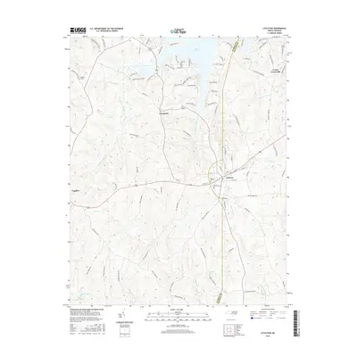
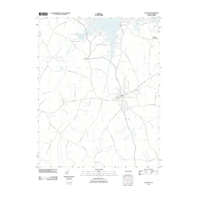 2010 Littleton2010 Print · USGSCovers Cooleys Crossroads, including Enterprise, Littleton, and other nearby areas
 - 2013 Map of Littleton, 2013 Print
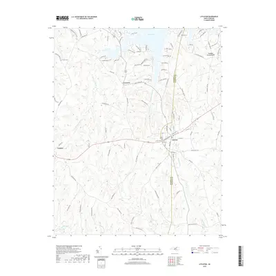
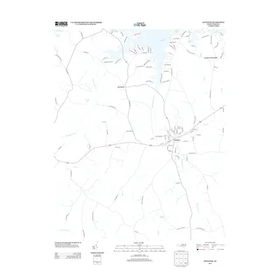 2013 Littleton2013 Print · USGSCovers Cooleys Crossroads, including Enterprise, Littleton, and other nearby areas
 - 2016 Map of Littleton, 2016 Print
 2016 Littleton2016 Print · USGSCovers Cooleys Crossroads, including Enterprise, Littleton, and other nearby areas
 - 2019 Map of Littleton, 2019 Print
 2019 Littleton2019 Print · USGSCovers Cooleys Crossroads, including Enterprise, Littleton, and other nearby areas
 - 2022 Map of Littleton, 2022 Print
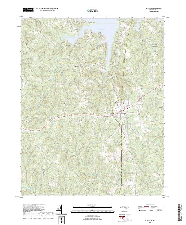 2022 Littleton2022 Print · USGSLittleton and the Warren-Halifax county line are shown here in the 2020s, highlighting the area's blend of lakeside growth and rural tradition. Researchers can trace local history through sites like Panacea Springs, Sunset Hill Cemetery, and the Vaughan School.
End of results
Showing maps 1-9 of 9
Top cities near Cooleys Crossroads
- Roanoke Rapids historical maps
- South Hill historical maps
- South Rosemary historical maps
- Gaston historical maps
- La Crosse historical maps
- Gasburg historical maps
See more
Frequently asked questions
- What are the different types of historical maps available for Cooleys Crossroads?
- What is the oldest map of Cooleys Crossroads?
- Where can I purchase historical maps of Cooleys Crossroads for my home or office?
- Where can I download high-res historical maps of Cooleys Crossroads?
- Are there historical topographic maps available for Cooleys Crossroads?
- Is there historical aerial imagery available for Cooleys Crossroads?
- Where are historical maps of Cooleys Crossroads sourced from?