Old Maps of Harnett County, North Carolina for Academic Research
Study the evolution of Harnett County with 144 high-resolution historic maps. Whether you're teaching, researching, or modeling changes in land use, these maps provide essential visual documentation of urban, environmental, and geographic change.
- Analyze long-term change: Track patterns in development, transportation, and natural features.
- Ideal for environmental or urban studies: Support academic projects with primary historical map data.
- Use in the classroom or lab: Educators and researchers rely on these maps to bring historical context to life.
These maps are a powerful tool for teaching, research, and visualizing how Harnett County has changed over the decades.
Harnett County, NC maps
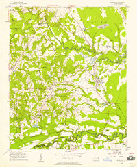
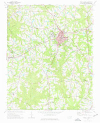
(144)- 1948 Map of Fayetteville, 1954 Print
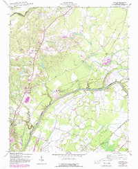
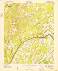
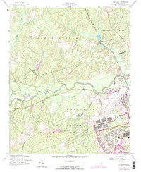
 1948 Fayetteville1954 Print · USGSFayetteville and its sprawling military neighbor are caught here just after the war, showing the area's mix of urban growth and rural heritage. Genealogists can locate family landmarks like Bonnie Doone and Magnolia Ch, or trace the rails of the Atlantic Coast Line.
 - 1948 Map of Clifdale, 1967 Print
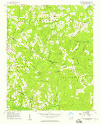
 1948 Clifdale1967 Print · USGSHoke and Cumberland Counties appear just after World War II, showing the vast footprint of the Fort Bragg Military Reservation. Local historians can trace old community landmarks like Longstreet Church, the Atlantic Coast Line railroad, and the Frys Mission School.
 - 1948 Map of Slocomb, 1982 Print
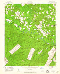
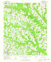
 1948 Slocomb1982 Print · USGSCumberland County's river valleys are captured here in the late forties, showing a landscape of small churches and rail lines. Trace family roots at Palestine Church or the Long Hill School, and follow the old routes of the Norfolk Southern.2 unique versions available
 - 1950 Map of Lobelia
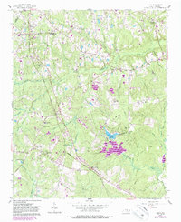
 1950 Lobelia1950 Print · USGSThe North Carolina Sandhills met military expansion during the mid-century as the Fort Bragg boundary reached northward. Genealogists can trace early landmarks like Frys Mission School, Lobelia, and Cypress Church along the Little River.
 - 1950 Map of Manchester
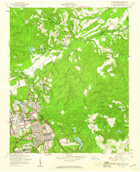
 1950 Manchester1950 Print · USGSMid-century Cumberland County is captured here during a period of significant military growth and rail activity. Researchers can trace the development of Fort Bragg alongside civilian landmarks like Manchester Spring Lake PO and Bethel Ch.
 - 1950 Map of Slocomb
 1950 Slocomb1950 Print · USGSCumberland County at the dawn of the 1950s shows a landscape of river-bend settlements and rail-line industry. Researchers can trace the roots of small communities like Slocomb and Carlos, or locate rural landmarks like Palestine Church and the Brick Kilns.2 unique versions available
 - 1951 Map of Clifdale
 1951 Clifdale1951 Print · USGSMid-century Hoke and Cumberland counties are defined here by the growth of the Fort Bragg Military Reservation. Genealogists and historians can trace older community landmarks like Longstreet Church, the Aberdeen & Rockfish RR, and the Frys Mission School.
 - 1953 Map of Raleigh, 1965 Print
 1953 Raleigh1965 Print · USGSCentral North Carolina in the early sixties shows a landscape of growing towns and military hubs before the full expansion of the interstate system. Genealogists can trace family footprints across the Piedmont through Wake Forest, Siler City, and the large Fort Bragg Military Reservation.4 unique versions available
 - 1954 Map of Raleigh
 1954 Raleigh1954 Print · USGSThe North Carolina Piedmont and Sandhills are captured in the mid-fifties during a period of steady regional growth. Genealogists and historians can trace the development of towns like Siler City or locate landmarks such as Falls of Neuse and Camp Mackall.
 - 1956 Map of Anderson Creek, 1958 Print
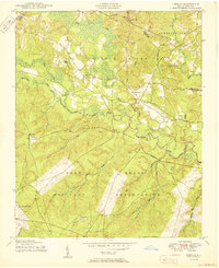
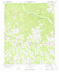
 1956 Anderson Creek1958 Print · USGSHarnett County during the mid-fifties is characterized by a network of rural schools and country churches. Researchers can trace family history through locations like Hairtown, McRaes Chapel, and the Norrington Sch.3 unique versions available
 - 1956 Map of Bunnlevel, 1958 Print
 1956 Bunnlevel1958 Print · USGSHarnett and Cumberland counties are captured here in the mid-fifties, showing a landscape of small farming communities and country parishes. Researchers can trace family history through sites like McLean Cem, Anderson Ch, and the rural hub of Bunnlevel.2 unique versions available
 - 1957 Map of Murchisontown, 1958 Print
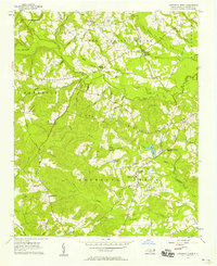
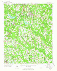
 1957 Murchisontown1958 Print · USGSIn the late fifties, the rural borders of Harnett, Lee, and Moore Counties remained a landscape of timber and tobacco farms tied together by country churches. Researchers can locate numerous local landmarks including McIver Sch, Murchison Chapel, and an ancient Indian Mound near Huckleberry Pond.2 unique versions available
 - 1957 Map of Lobelia, 1960 Print
 1957 Lobelia1960 Print · USGSNorth Carolina's Sandhills region is captured here during the late 1950s as military and civilian landscapes intersected near the Little River. Genealogists and local historians can trace family locations near Lobelia and Frys Chapel or locate mid-century landmarks like Ranger Station No 2.5 unique versions available
 - 1957 Map of Manchester, 1960 Print
 1957 Manchester1960 Print · USGSThe Fort Bragg and Pope Air Force Base area is shown here during a period of mid-century expansion. Genealogists and historians can trace the intersection of military and civilian life at Manchester, Spring Lake, and Raksam Chapel.4 unique versions available
 - 1957 Map of Fayetteville, 1961 Print
 1957 Fayetteville1961 Print · USGSThe Cape Fear River valley and Fayetteville's growing suburbs are captured here in the late fifties, showing the expanding footprint of the Fort Bragg Military Reservation. Genealogists can trace early neighborhood development and rural landmarks like Lakedale, Manchester, and Central High Sch.2 unique versions available
 - 1957 Map of Overhills, 1973 Print
 1957 Overhills1973 Print · USGSCumberland and Harnett Counties are shown during a period of significant military expansion in the mid-fifties. Genealogists and historians can trace the development of Pope Air Force Base, locate the Murray Sch, or follow the Seaboard Coast Line through Overhills.
 - 1957 Map of Olivia, 1986 Print
 1957 Olivia1986 Print · USGSIn mid-century Harnett County, the Seaboard Coast Line Railroad connects the small farming and timber communities of central North Carolina. Genealogists and local historians can trace legacy sites like the Old Charter Cem, Benhaven High Sch, and the community at Johnsonville.
 - 1964 Map of Angier, 1965 Print
 1964 Angier1965 Print · USGSAngier and the surrounding tobacco-farming country appear here in the mid-1960s at the junction of three counties. Genealogists and researchers can trace local family roots through numerous cemeteries and country churches like St Ann Ch, Fellowship Ch, and Ogburn Crossroads.3 unique versions available
 - 1964 Map of Garner, 1965 Print
 1964 Garner1965 Print · USGSThe rural landscapes south of Raleigh were transitioning from farm to suburb in the mid-sixties. Researchers can trace family roots at numerous country churches like Wooten Chapel Ch or locate sites such as McCullers, Willow Springs, and the historic McGee Mill.
 - 1973 Map of Benson, 1975 Print
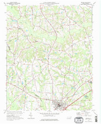 1973 Benson1975 Print · USGSBenson and the surrounding Johnston County countryside are captured here in the early seventies during a period of steady rural development. Genealogists can trace family landmarks like Hardee Cross Roads, Stevens Chapel, and the Drive-in Theater.2 unique versions available
 - 1973 Map of Dunn, 1975 Print
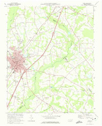 1973 Dunn1975 Print · USGSDunn and Benson were thriving railroad and agricultural hubs in the early 1970s. Genealogists and local historians can trace family church roots at Jonesboro Ch and Mingo Hill Ch or locate landmarks like the Young Lookout Tower.2 unique versions available
 - 1973 Map of Erwin, 1975 Print
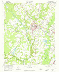 1973 Erwin1975 Print · USGSHarnett and Cumberland Counties are captured in the early seventies as the Cape Fear and Little Rivers meet amid a landscape of small-town industry. Genealogists can trace family connections through the Averasboro Cem, Turlington Grove Ch, and the streets of Erwin.2 unique versions available
 - 1973 Map of Coats, 1975 Print
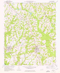 1973 Coats1975 Print · USGSHarnett County in the early seventies shows a landscape of small farming communities and academic growth centered around Campbell College. Genealogists and historians can trace the paths of the Durham and Southern line or locate rural landmarks like Barclaysville and Bethel Ch.3 unique versions available
 - 1974 Map of Fuquay-Varina, 1977 Print
 1974 Fuquay-Varina1977 Print · USGSThe intersection of the Durham and Norfolk Southern rail lines defines the Wake and Harnett county border in the mid-1970s. Local historians can trace the foundations of Fuquay-Varina and outlying communities like Chalybeate Springs, Wilbon, and Rawls.3 unique versions available
 - 1974 Map of Mamers, 1977 Print
 1974 Mamers1977 Print · USGSHarnett County remains a rural landscape in the 1970s, defined by the winding course of the Cape Fear River and the newly established Raven Rock State Park. Researchers can trace the heritage of local crossroads like Mamers or locate family-named landmarks such as Antioch Ch and Boone Trail.2 unique versions available
Showing maps 1-25 of 144
Top cities of Harnett County
- Linden Oaks historical maps
- Dunn historical maps
- Erwin historical maps
- Lillington historical maps
- Coats historical maps
- Mamers historical maps
Frequently asked questions
- What are the different types of historical maps available for Harnett County?
- What is the oldest map of Harnett County?
- Where can I purchase historical maps of Harnett County for my home or office?
- Where can I download high-res historical maps of Harnett County?
- Are there historical topographic maps available for Harnett County?
- Is there historical aerial imagery available for Harnett County?
- Where are historical maps of Harnett County sourced from?