Old Maps of Burnett Siding, North Carolina
Explore 15 old maps of Burnett Siding, spanning from 1905 to today. These high-resolution historic maps reveal how streets, neighborhoods, landmarks, and natural features evolved over time — perfect for genealogy, metal detecting, research, and local history exploration.
What you can do with these maps:
- See how Burnett Siding changed over time: Compare historical maps to modern-day views to trace roads, homesites, rail lines & more.
- View detailed metadata: Each map includes creators, publishers, year, scale, and archive source.
- Overlay maps with satellite & LiDAR: Visualize the past alongside modern tools to explore terrain & human change.
- Trusted historical sources: Maps sourced from the USGS, Library of Congress, and other archives.
- Access maps your way: View online, download high-res files, or order prints for personal or research use.
Start exploring old maps of Burnett Siding to uncover forgotten places, hidden landmarks, and the deep history beneath your feet.
Burnett Siding, NC maps
(15)- 1905 Map of Pisgah, 1956 Print
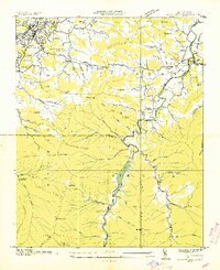
 1905 Pisgah1956 Print · USGSThe North Carolina high country around the turn of the century reveals a land of timber tracts and emerging mountain retreats. Genealogists and hikers can trace early routes to Buck Spring Lodge, follow the Southern RR tracks, and locate vanished settlements like Angeline and Calhoun.
 - 1906 Map of Pisgah, 1934 Print
 1906 Pisgah1934 Print · USGSThe Blue Ridge highlands at the turn of the century reveal a landscape of mountain river valleys and early timber frontiers. Genealogists and historians can trace family-named bridges and crossings like Graham Bridge or locate vanished settlements such as Grange and Retreat.2 unique versions available
 - 1935 Map of Waynesville
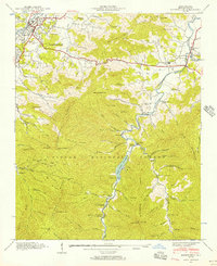
 1935 Waynesville1935 Print · USGSWaynesville and the surrounding Haywood County peaks are captured here in the mid-1930s as the regional economy balanced town industry with upland farming. Researchers can trace families near Greenhill Cem, locate the Cecil Sch, and follow the old routes of State Highway No 10.
 - 1941 Map of Waynesville, 1956 Print
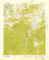
 1941 Waynesville1956 Print · USGSWaynesville and the surrounding Blue Ridge coves are captured here in the early 1940s as the regional economy balanced valley industry with mountain resources. Genealogists and hikers can trace family sites like Ratcliff Cove Ch, the Big Ridge Mine, and Lake Logan.3 unique versions available
 - 1942 Map of Waynesville
 1942 Waynesville1942 Print · USGSWaynesville and the high peaks of the Blue Ridge are captured here in the early 1940s as the regional timber and mountain economy matured. Genealogists can locate family landmarks like Elizabeth Chapel, Greenhill Cem, and the rural Cecil Sch.2 unique versions available
 - 1955 Map of Knoxville
 1955 Knoxville1955 Print · USGSThe Southern Appalachians and the Smoky Mountains are shown here at a peak of mid-century development and conservation. Genealogists and historians can trace the early road networks connecting Gatlinburg, Waynesville, and the Cherokee Indian Reservation across the high ridges.
 - 1957 Map of Knoxville, 1966 Print
 1957 Knoxville1966 Print · USGSThe Southern Appalachians of Tennessee and North Carolina are mapped here during the mid-twentieth century as new highways reached the high country. Genealogists and historians can trace the topography between Knoxville and Asheville, locating family landmarks near Fontana Lake or along the Blue Ridge Parkway.4 unique versions available
 - 1960 Map of Knoxville
 1960 Knoxville1960 Print · USGSThe Southern Appalachians come alive in the 1950s, showing the intersection of new national park tourism and deep-rooted mountain industry. Trace old rail lines like the Clinchfield RR and find high-altitude landmarks from Mt Le Conte to the Cherokee Indian Reservation.2 unique versions available
 - 1964 Map of Knoxville
 1964 Knoxville1964 Print · USGSThe Southern Appalachians and Great Smokies are captured here during the mid-sixties, showing the rugged borderlands of Tennessee and North Carolina. Researchers can trace historic mountain routes like U S 441, the expanse of Pisgah National Forest, and the growing footprints of Asheville and Knoxville.
 - 1986 Map of Hendersonville
 1986 Hendersonville1986 Print · USGSThe Blue Ridge foothills of North and South Carolina are documented here in the mid-eighties as modern highways began to reshape mountain travel. Local historians can trace the paths of the Southern Railway through Hendersonville or locate landmarks like Looking Glass Rock and Inman Mills.2 unique versions available
 - 2011 Map of Waynesville, 2011 Print
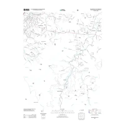
 2011 Waynesville2011 Print · USGSCovers Burnett Siding, including Waynesville, Retreat, and other nearby areas
 - 2013 Map of Waynesville, 2013 Print
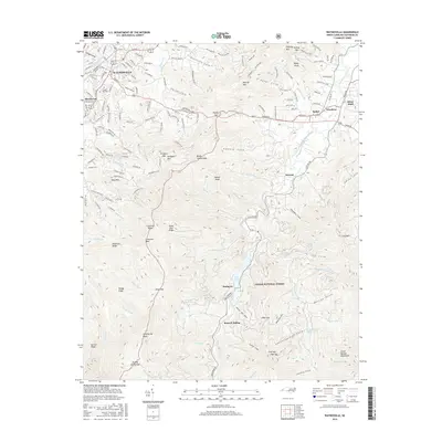
 2013 Waynesville2013 Print · USGSCovers Burnett Siding, including Waynesville, Retreat, and other nearby areas
 - 2016 Map of Waynesville, 2016 Print
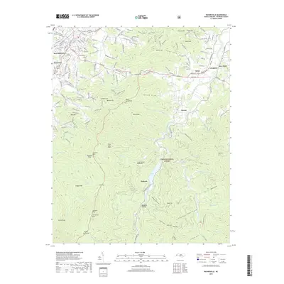
 2016 Waynesville2016 Print · USGSCovers Burnett Siding, including Waynesville, Retreat, and other nearby areas
 - 2019 Map of Waynesville, 2019 Print
 2019 Waynesville2019 Print · USGSCovers Burnett Siding, including Waynesville, Retreat, and other nearby areas
 - 2022 Map of Waynesville, 2022 Print
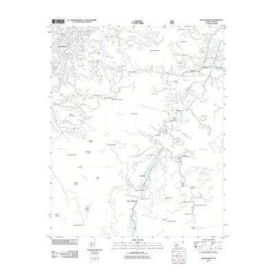
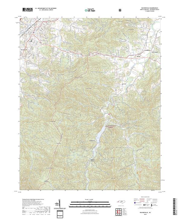 2022 Waynesville2022 Print · USGSHaywood County's mountain valleys and high ridges are shown here in the early 2020s as modern growth meets public forest land. Genealogists and hikers can trace the terrain around Lake Logan, the historic Green Hill Cem, and local landmarks like Burnett Siding.
End of results
Showing maps 1-15 of 15
Top cities near Burnett Siding
- Waynesville historical maps
- Brevard historical maps
- Canton historical maps
- Clyde historical maps
- Maggie Valley historical maps
Frequently asked questions
- What are the different types of historical maps available for Burnett Siding?
- What is the oldest map of Burnett Siding?
- Where can I purchase historical maps of Burnett Siding for my home or office?
- Where can I download high-res historical maps of Burnett Siding?
- Are there historical topographic maps available for Burnett Siding?
- Is there historical aerial imagery available for Burnett Siding?
- Where are historical maps of Burnett Siding sourced from?