Old Maps of Hoke County, North Carolina for Genealogy
Trace your family roots with 113 historic maps of Hoke County. These high-res maps reveal old neighborhoods, homesites, landmarks, and streets — helping you uncover where your ancestors lived and how the area evolved over time.
- Explore historic neighborhoods: Identify where your relatives may have lived in the 1800s or 1900s.
- Compare maps over time: Trace the changes in streets, buildings, and landmarks for multi-generational research.
- Perfect for genealogy & ancestry research: Used by family historians and researchers to map out lineage and migration.
These maps are an incredible resource for exploring your personal connection to Hoke County's past.
Hoke County, NC maps
(113)- 1948 Map of Southern Pines, 1954 Print
 1948 Southern Pines1954 Print · USGSThe North Carolina Sandhills were a hub of transit and military expansion just after the war. This survey allows researchers to trace family landmarks like St Mathews Ch and Taylor Town or map the early footprints of Fort Bragg and Camp Mackall.
 - 1948 Map of Clifdale, 1967 Print
 1948 Clifdale1967 Print · USGSHoke and Cumberland Counties appear just after World War II, showing the vast footprint of the Fort Bragg Military Reservation. Local historians can trace old community landmarks like Longstreet Church, the Atlantic Coast Line railroad, and the Frys Mission School.
 - 1948 Map of Pinebluff, 1972 Print
 1948 Pinebluff1972 Print · USGSThe Sand Hills of Moore and Richmond counties are shown here just after the war, where military expansions met rural North Carolina life. Genealogists and researchers can trace the Seaboard Air Line through Addor, find family roots at Silver Springs Cemetery, and locate the old McFarland Sch.3 unique versions available
 - 1948 Map of Nicholson Creek, 1974 Print
 1948 Nicholson Creek1974 Print · USGSThe Hoke County countryside at the end of the 1940s reveals a mix of military expansion and rural settlement. Genealogists and historians can locate the Abandoned CCC Camp near Mott Lake or trace the early paths around Johnsons Mill and East Freedom Church.4 unique versions available
 - 1948 Map of Clifdale, 1983 Print
 1948 Clifdale1983 Print · USGSCumberland County at the midpoint of the century shows a unique transition between military land and residential growth. Genealogists and historians can trace family locations near Galatia Church, the Aberdeen and Rockfish line, and the Caisson Hill Cem.
 - 1948 Map of Mc Cain, 1984 Print
 1948 Mc Cain1984 Print · USGSHoke County settlement and military expansion meet in the late 1940s along the Aberdeen and Rockfish line. Trace local roots through the rail sidings and rural hamlets of Montrose, Ashley Heights, and Timberland.3 unique versions available
 - 1949 Map of Wagram, 1953 Print
 1949 Wagram1953 Print · USGSScotland and Hoke counties were defined by the confluence of the Lumber River and vital rail lines during the late nineteen-forties. Researchers can trace ancestral locations like Gaineys Place, Purcell Cem, and the historic Bowmore station.2 unique versions available
 - 1949 Map of Silver Hill, 1953 Print
 1949 Silver Hill1953 Print · USGSScotland County's agrarian and rail-centered landscape is captured here in the mid-twentieth century, centered on the Wagram community. Genealogists and local historians can locate several family cemeteries such as McNeill Cem and rural schools like the Nashville Sch.3 unique versions available
 - 1949 Map of Wakulla, 1953 Print
 1949 Wakulla1953 Print · USGSRobeson and Scotland counties appear here just after the war, where the Lumber River meets a network of lowland swamps. Genealogists can trace family names at Floral College, McPhatter Cem, and the rural Cherokee Sch.2 unique versions available
 - 1949 Map of Laurinburg, 1954 Print
 1949 Laurinburg1954 Print · USGSThe mid-century landscape of Scotland County comes alive in this survey of a growing rail hub and its rural surroundings. Researchers can trace the lines of the Seaboard Air Line, locate historic institutions like Flora College, or find family landmarks such as McNeill Cem and Gaineys Place.
 - 1950 Map of Clifdale
 1950 Clifdale1950 Print · USGSCumberland County at mid-century reveals the intersection of expanding military operations and established rural communities south of the base. Genealogists and historians can trace family-named landmarks and gathering places like Galatia Church, 71st High School, and the settlement at Clifdale.2 unique versions available
 - 1950 Map of Sanatorium
 1950 Sanatorium1950 Print · USGSThe rural communities of Hoke and Moore counties are shown here just after the war, centered on the State Tuberculosis Sanatorium. Genealogists can trace family footprints near Ashley Heights and Timberland, or locate old landmarks like Sandy Grove Ch.2 unique versions available
 - 1950 Map of Lobelia
 1950 Lobelia1950 Print · USGSThe North Carolina Sandhills met military expansion during the mid-century as the Fort Bragg boundary reached northward. Genealogists can trace early landmarks like Frys Mission School, Lobelia, and Cypress Church along the Little River.
 - 1950 Map of Pine Bluff
 1950 Pine Bluff1950 Print · USGSThe North Carolina Sandhills are captured here at the start of the 1950s, showing a landscape defined by military training and the railroad. Genealogists and local historians can trace family sites like Silver Springs Cemetery, the McFarland Sch, and the wartime infrastructure of Camp Mackall.
 - 1950 Map of Niagara
 1950 Niagara1950 Print · USGSIn the Sand Hills during the late 1940s, the rural landscapes of Moore and Hoke Counties were defined by rail corridors and expanding military grounds. Researchers can trace family sites like McCrimmons Chapel, the Goins Cem, and the small rail settlements of Niagara and Manly.
 - 1950 Map of Southern Pines
 1950 Southern Pines1950 Print · USGSMoore County transitioned from rural timberland to a premier resort hub during the mid-century, as shown in this detailed survey of the Sandhills. Researchers can trace the development of Pinehurst and Southern Pines, locating landmarks like the Village Chapel, The Ark Sch, and Bethesda Church.
 - 1950 Map of Nicholson Creek
 1950 Nicholson Creek1950 Print · USGSHoke County in the early post-war era shows a landscape split between civilian rural life and the expanding military presence of the Sandhills. Genealogists and local historians can trace family-named sites like Johnsons Mill, Campbells Crossroad, and the Abandoned CCC Camp.
 - 1951 Map of Clifdale
 1951 Clifdale1951 Print · USGSMid-century Hoke and Cumberland counties are defined here by the growth of the Fort Bragg Military Reservation. Genealogists and historians can trace older community landmarks like Longstreet Church, the Aberdeen & Rockfish RR, and the Frys Mission School.
 - 1953 Map of Florence, 1964 Print
 1953 Florence1964 Print · USGSThe Carolina borderlands in the mid-fifties were a landscape of vast river swamps and rising rail towns. Trace the legacy of the Seaboard Air Line through Florence or explore the wetlands surrounding Lake Waccamaw and the Green Swamp.3 unique versions available
 - 1953 Map of Raleigh, 1965 Print
 1953 Raleigh1965 Print · USGSCentral North Carolina in the early sixties shows a landscape of growing towns and military hubs before the full expansion of the interstate system. Genealogists can trace family footprints across the Piedmont through Wake Forest, Siler City, and the large Fort Bragg Military Reservation.4 unique versions available
 - 1954 Map of Florence
 1954 Florence1954 Print · USGSThe Carolinas borderlands come alive in the early fifties, showing the vital rail-and-river networks of the coastal plain. Genealogists can trace family footprints across the Green Swamp or through settlements like Red Springs, Chadbourn, and McColl.
 - 1954 Map of Raleigh
 1954 Raleigh1954 Print · USGSThe North Carolina Piedmont and Sandhills are captured in the mid-fifties during a period of steady regional growth. Genealogists and historians can trace the development of towns like Siler City or locate landmarks such as Falls of Neuse and Camp Mackall.
 - 1957 Map of Southern Pines, 1960 Print
 1957 Southern Pines1960 Print · USGSThe North Carolina Sand Hills come into focus in the late fifties, centered on the growing resorts and rail hubs of Moore County. Researchers can trace historic lineages through local landmarks like Old Notre Dame Academy, McCrimmons Chapel, and the Silver Spring Cem.
 - 1957 Map of Southern Pines, 1960 Print
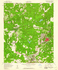 1957 Southern Pines1960 Print · USGSThe Sandhills of Moore County are shown here in the late fifties as the resort and rail hub centers reach their mid-century form. Researchers can trace the development of Pinehurst and Southern Pines, identifying landmarks like the Pinehurst Trotting Track, Village Chapel, and the Seaboard Air Line railroad.4 unique versions available
 - 1957 Map of Niagara, 1960 Print
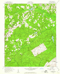 1957 Niagara1960 Print · USGSMoore County in the late fifties shows the steady influence of the railroad and the expansion of the Fort Bragg Military Reservation. Researchers can locate specific sites like the Old Notre Dame Academy, Gains Cem, and the village of Manly.5 unique versions available
Showing maps 1-25 of 113
Top cities of Hoke County
Frequently asked questions
- What are the different types of historical maps available for Hoke County?
- What is the oldest map of Hoke County?
- Where can I purchase historical maps of Hoke County for my home or office?
- Where can I download high-res historical maps of Hoke County?
- Are there historical topographic maps available for Hoke County?
- Is there historical aerial imagery available for Hoke County?
- Where are historical maps of Hoke County sourced from?