1900s (20th Century) Maps of Macon County, North Carolina
Explore 70 historic maps of Macon County from the 1900s (20th Century). These maps offer a rare glimpse into what life looked like during the 1900s — showing old roads, neighborhoods, homes, and landmarks that have changed or disappeared over time.
Whether you're researching your family's past, planning a metal detecting trip, or studying how Macon County's landscape evolved across the 1900s, these high-resolution maps are a powerful tool for exploring the history of this region.
- Focus on a specific era: All maps on this page are from the 1900s, giving you a focused view of this time period.
- See what’s changed: Compare century-old streets, trails, and buildings to today's modern landscape using overlays and satellite layers.
- Research with precision: Use these maps for genealogy, historical research, land use analysis, or educational projects.
- View, download, or print: Maps are fully viewable online in high resolution, and can be downloaded or printed for your own records.
Start exploring Macon County's history through authentic maps from the 1900s. This is your window into the past.
Macon County, NC maps
(70)- 1903 Map of Dahlonega
 1903 Dahlonega1903 Print · USGSNorth Georgia and the Blue Ridge were defined by mountain settlements and early industry at the turn of the century. Genealogists and historians can trace family locations across the Nacoochee Valley, locate the Asbestos Mines, or find old sites like Loudsville and Porter Springs.5 unique versions available
 - 1907 Map of Cowee
 1907 Cowee1907 Print · USGSWestern North Carolina at the turn of the century shows a landscape of rail-connected river towns and high mountain gaps. Genealogists can trace early homesteads and industry through landmarks like West Mill, Roanes Mill, and the many settlements along the Southern Railway.5 unique versions available
 - 1933 Map of Bryson
 1933 Bryson1933 Print · USGSThe mountain valleys of Swain County are captured in the early 1930s, showing the early settlement patterns of the Great Smoky Mountains. Genealogists and historians can trace community roots through schoolhouses like Lands Creek Sch and Indian Creek Sch.
 - 1933 Map of Bushnell
 1933 Bushnell1933 Print · USGSSwain County high country in the late 1920s is defined by a remote landscape of steep ridges and small mountain schools. Researchers can trace the locations of Mill Creek Sch and School No 2 or identify family landmarks like Loudermilk Ridge and Welch Bald.
 - 1935 Map of Franklin
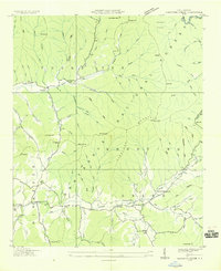
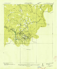
 1935 Franklin1935 Print · USGSMacon County's mountain valleys and river bends are captured here in the mid-1930s just as the TVA began shaping the region. Genealogists and local historians can trace rural homesteads near Louisa Chapel, Burningtown School, and the Franklin Cem.
 - 1935 Map of Rainbow Springs
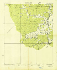
 1935 Rainbow Springs1935 Print · USGSThe Macon County backcountry in the mid-1930s shows an active logging era as timber lines competed with the rising National Forest. Map collectors and genealogists can locate the CCC Camp No F 12, the logging path of the Lumber Company RR, and the Rainbow Sch.
 - 1935 Map of Prentiss
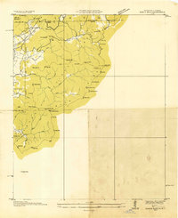
 1935 Prentiss1935 Print · USGSMacon County in the mid-1930s shows a landscape of high ridges and narrow valleys where the forestry economy was taking root. Genealogists and researchers can locate numerous rural landmarks like Mulberry Sch, Coweeta Ch, and the Tallulah Falls Railroad.
 - 1935 Map of Cashiers
 1935 Cashiers1935 Print · USGSJackson County and the North Carolina-South Carolina border appear here in the mid-1930s as modern surveying techniques were first being applied. Researchers can trace early state infrastructure such as St Hy No 106 as it passes through the Nantahala National Forest.
 - 1935 Map of Shooting Creek
 1935 Shooting Creek1935 Print · USGSClay County mountain life is recorded in this mid-1930s survey of the high ridges and deep coves. Genealogists can locate family landmarks like Tidwell Sch, Marshall Chapel, and the community at Tusquitee long before modern road improvements.
 - 1935 Map of Burningtown Bald
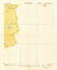
 1935 Burningtown Bald1935 Print · USGSMacon County's high ridges and deep coves are captured in the mid-1930s, showing the early infrastructure of the Nantahala National Forest. Researchers can trace the original path of the Appalachian Trail past the Wayah Bald Fire Tower and locate local landmarks like Mt Sinai Ch and the Corundum No 1 mine.
 - 1935 Map of Dillard
 1935 Dillard1935 Print · USGSThe Georgia and North Carolina borderlands are captured here in the mid-1930s as the rail and highway networks expanded through the mountains. Researchers can locate the Rabun Gap Nacoochee Sch, trace the Tallulah Falls RR, and find local landmarks like Wolf Fork Ch.
 - 1935 Map of Topton
 1935 Topton1935 Print · USGSWestern North Carolina’s mountain timber and rail landscape is captured here in the mid-thirties as federal relief work takes root. Trace the winding Ritter Lumber RR alongside CCC Camp No F 13 and the remote settlement of Aquone.
 - 1935 Map of Wayah Bald
 1935 Wayah Bald1935 Print · USGSHigh in the Blue Ridge Mountains during the mid-1930s, this survey reveals the isolated homesteads and forest tracts of Macon County. Genealogists can locate family landmarks like Marshall Chapel, Oakdale Sch, and the remote Kyle PO or Flats PO.
 - 1935 Map of Scaly
 1935 Scaly1935 Print · USGSMacon County's high ridges and isolated valleys are captured here during the mid-thirties, showing the rural communities of Scaly and Tessentee. Local historians can locate vanished landmarks like Drymans Chapel, Gold Mine Sch, and early trails through Nickajack Gap.
 - 1935 Map of Rabun Bald
 1935 Rabun Bald1935 Print · USGSThe Georgia and North Carolina high country is captured here during the mid-thirties, dominated by the ridge lines of the Blue Ridge. Researchers can trace old mountain trails to landmarks like the Fire Tower at Rabun Bald or locate family sites near Dillard and Stillhouse Creek.
 - 1935 Map of Hightower Bald
 1935 Hightower Bald1935 Print · USGSThe Georgia and North Carolina high country is captured here in the mid-1930s, showing the ridge-top border and the early Appalachian Trail. Genealogists and hikers can locate the Pleasant Hill School and the settlement of Hightower along the banks of Big Creek.
 - 1935 Map of Glenville
 1935 Glenville1935 Print · USGSJackson County's high mountain settlements and river valleys are shown in the mid-1930s, prior to the major dam projects of the era. Researchers can trace family roots through numerous remote landmarks like Erastus, the Yellow Mtn Sch, and Hamburg Ch.
 - 1935 Map of Corbin Knob
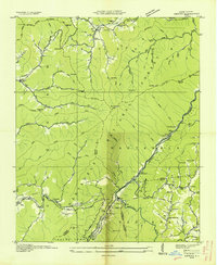
 1935 Corbin Knob1935 Print · USGSMacon County in the mid-1930s is captured here just as modern power infrastructure began to reshape the valley around Franklin. Researchers can trace old mountain communities through a network of rural landmarks, including Higdonville, Sugar Fork Sch, and the Porters Bend Dam on the Little Tennessee River.
 - 1935 Map of Highlands
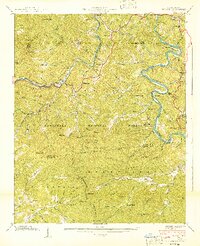
 1935 Highlands1935 Print · USGSHighlands was already established as a prominent mountain destination in the mid-1930s, surrounded by the high peaks of the Blue Ridge. Genealogists and historians can trace old landmarks like Calloway Mill, the Highlands Country Club, and early hydroelectric sites like the Municipal Power Dam.
 - 1936 Map of Greens Creek
 1936 Greens Creek1936 Print · USGSJackson and Swain counties are captured here in the mid-1930s as the TVA and USGS collaborated on surveying the mountain heartland. Genealogists can trace family roots through the many local landmarks like Old Savannah Ch, Greens Creek Sch, and Lisle Knob.
 - 1936 Map of Wesser
 1936 Wesser1936 Print · USGSThe Southern Appalachian highlands are captured here in the mid-1930s, showing a landscape defined by timber flumes and the Southern Railway. Genealogists can locate family landmarks like Wright Place, early schools such as Silvermine Sch, and numerous mountain burials including Euchulla Cem.
 - 1936 Map of Hewitt
 1936 Hewitt1936 Print · USGSGraham County's high ridges and river gorges are captured here in the mid-1930s, just as the regional infrastructure was being formalized by the Tennessee Valley Authority. Researchers can trace the early Appalachian Trail or locate family sites like Jenkins Cem, Rowlin Sch, and the Cheoah Mill.
 - 1936 Map of Alarka
 1936 Alarka1936 Print · USGSSwain and Macon Counties come alive in this mid-1930s survey of the high ridges and river bends before the landscape changed. Genealogists and local historians can trace family locations near Etna PO, CCC Camp No 20, and the Morgan Cem.
 - 1940 Map of Wesser
 1940 Wesser1940 Print · USGSThe Nantahala Gorge and the winding Little Tennessee River define this high-country landscape as it appeared in the early 1940s. Genealogists can trace family footprints at Watia Ch, Tabor Cem, and mountain schools like Hightower Sch.2 unique versions available
 - 1940 Map of Greens Creek, 1957 Print
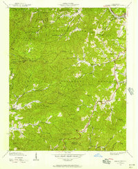 1940 Greens Creek1957 Print · USGSIn the early 1940s, these North Carolina mountain communities were connected by high gaps and winding creek forks. Local historians can trace the foundations of Pumpkintown or locate rural landmarks like Greens Creek Sch and the Lookout Tower on Cowee Bald.6 unique versions available
Showing maps 1-25 of 70
Top cities of Macon County
Frequently asked questions
- What are the different types of historical maps available for Macon County?
- What is the oldest map of Macon County?
- Where can I purchase historical maps of Macon County for my home or office?
- Where can I download high-res historical maps of Macon County?
- Are there historical topographic maps available for Macon County?
- Is there historical aerial imagery available for Macon County?
- Where are historical maps of Macon County sourced from?