1940s Maps of Hot Springs, North Carolina
Explore 3 historic maps of Hot Springs from the 1940s. These maps offer a rare glimpse into what life looked like during the 1940s — showing old roads, neighborhoods, homes, and landmarks that have changed or disappeared over time.
Whether you're researching your family's past, planning a metal detecting trip, or studying how Hot Springs's landscape evolved across the 1940s, these high-resolution maps are a powerful tool for exploring the history of this region.
- Focus on a specific era: All maps on this page are from the 1940s, giving you a focused view of this time period.
- See what’s changed: Compare century-old streets, trails, and buildings to today's modern landscape using overlays and satellite layers.
- Research with precision: Use these maps for genealogy, historical research, land use analysis, or educational projects.
- View, download, or print: Maps are fully viewable online in high resolution, and can be downloaded or printed for your own records.
Start exploring Hot Springs's history through authentic maps from the 1940s. This is your window into the past.
Hot Springs, NC maps
(3)- 1940 Map of Hot Springs
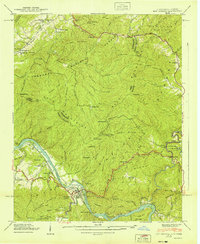 1940 Hot Springs1940 Print · USGSMadison County and the Tennessee borderlands are captured here in the early 1940s, showing the intersection of mountain life and federal work projects. Researchers can trace family history through sites like CCC Camp No F 7, Hurricane Chapel, and the riverfront settlement at Stackhouse.6 unique versions available
 - 1946 Map of Spring Creek, 1957 Print
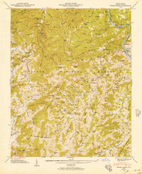 1946 Spring Creek1957 Print · USGSMadison County in the mid-forties remains a landscape of high ridges and isolated hollows within the Pisgah National Forest. Genealogists can trace family names through dozens of sites like Treadway Cem, Gentry Branch, and rural schools like Spring Creek Sch.3 unique versions available
 - 1947 Map of Spring Creek
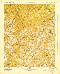 1947 Spring Creek1947 Print · USGSMadison County's mountain interior shows a network of family farms and timbered ridges just after the war. Genealogists can trace family lines through dozen of landmarks like Goforth Cem, Liberty Ch, and the high Duckett Lookout Tower.
End of results
Showing maps 1-3 of 3
Top cities near Hot Springs
Top neighborhoods of Hot Springs
Frequently asked questions
- What are the different types of historical maps available for Hot Springs?
- What is the oldest map of Hot Springs?
- Where can I purchase historical maps of Hot Springs for my home or office?
- Where can I download high-res historical maps of Hot Springs?
- Are there historical topographic maps available for Hot Springs?
- Is there historical aerial imagery available for Hot Springs?
- Where are historical maps of Hot Springs sourced from?