Old Maps of Mount Pleasant, North Carolina for Genealogy
Trace your family roots with 12 historic maps of Mount Pleasant. These high-res maps reveal old neighborhoods, homesites, landmarks, and streets — helping you uncover where your ancestors lived and how the area evolved over time.
- Explore historic neighborhoods: Identify where your relatives may have lived in the 1800s or 1900s.
- Compare maps over time: Trace the changes in streets, buildings, and landmarks for multi-generational research.
- Perfect for genealogy & ancestry research: Used by family historians and researchers to map out lineage and migration.
These maps are an incredible resource for exploring your personal connection to Mount Pleasant's past.
Mount Pleasant, NC maps
(12)- 1948 Map of Clifdale, 1967 Print
 1948 Clifdale1967 Print · USGSHoke and Cumberland Counties appear just after World War II, showing the vast footprint of the Fort Bragg Military Reservation. Local historians can trace old community landmarks like Longstreet Church, the Atlantic Coast Line railroad, and the Frys Mission School.
 - 1950 Map of Lobelia
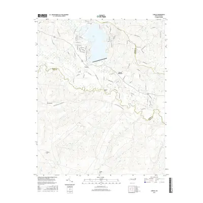
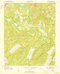 1950 Lobelia1950 Print · USGSThe North Carolina Sandhills met military expansion during the mid-century as the Fort Bragg boundary reached northward. Genealogists can trace early landmarks like Frys Mission School, Lobelia, and Cypress Church along the Little River.
 - 1951 Map of Clifdale
 1951 Clifdale1951 Print · USGSMid-century Hoke and Cumberland counties are defined here by the growth of the Fort Bragg Military Reservation. Genealogists and historians can trace older community landmarks like Longstreet Church, the Aberdeen & Rockfish RR, and the Frys Mission School.
 - 1953 Map of Raleigh, 1965 Print
 1953 Raleigh1965 Print · USGSCentral North Carolina in the early sixties shows a landscape of growing towns and military hubs before the full expansion of the interstate system. Genealogists can trace family footprints across the Piedmont through Wake Forest, Siler City, and the large Fort Bragg Military Reservation.4 unique versions available
 - 1954 Map of Raleigh
 1954 Raleigh1954 Print · USGSThe North Carolina Piedmont and Sandhills are captured in the mid-fifties during a period of steady regional growth. Genealogists and historians can trace the development of towns like Siler City or locate landmarks such as Falls of Neuse and Camp Mackall.
 - 1957 Map of Lobelia, 1960 Print
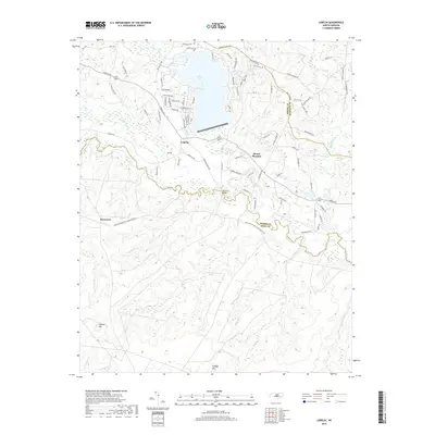
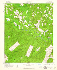 1957 Lobelia1960 Print · USGSNorth Carolina's Sandhills region is captured here during the late 1950s as military and civilian landscapes intersected near the Little River. Genealogists and local historians can trace family locations near Lobelia and Frys Chapel or locate mid-century landmarks like Ranger Station No 2.5 unique versions available
 - 1976 Map of Lobelia, 1978 Print
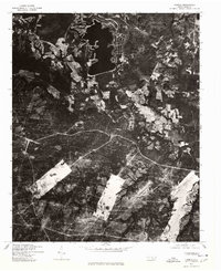 1976 Lobelia1978 Print · USGSNorth Carolina's rural landscape is captured here in the mid-1970s through detailed aerial imagery of Hoke County. Researchers can trace the layout of the Mt Pleasant settlement and examine the precise field patterns and wooded tracts of the era.
 - 1982 Map of Southern Pines, 1983 Print
 1982 Southern Pines1983 Print · USGSCentral North Carolina in the early eighties shows a landscape defined by military expansion and historic rail corridors. Researchers can trace the legacy of the Seaboard Coast Line through Pinehurst or locate landmarks like the Town Creek Indian Mound State Historic Site.
 - 2013 Map of Lobelia, 2013 Print
 2013 Lobelia2013 Print · USGSCovers Mount Pleasant, including Woodlake Country Club, Inverness, and other nearby areas
 - 2016 Map of Lobelia, 2016 Print
 2016 Lobelia2016 Print · USGSCovers Mount Pleasant, including Woodlake Country Club, Inverness, and other nearby areas
 - 2019 Map of Lobelia, 2019 Print
 2019 Lobelia2019 Print · USGSCovers Mount Pleasant, including Woodlake Country Club, Inverness, and other nearby areas
 - 2022 Map of Lobelia, 2022 Print
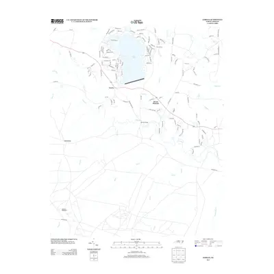
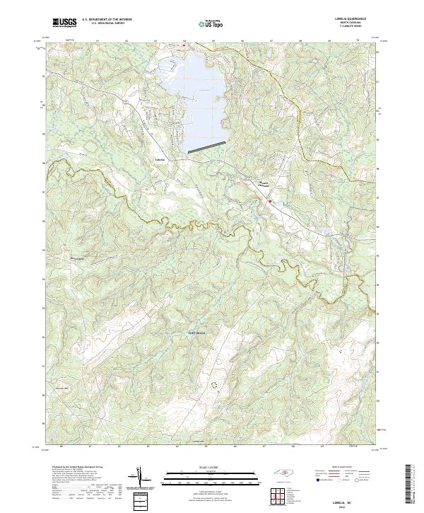 2022 Lobelia2022 Print · USGSThe rural Sandhills country at the meeting of Moore, Harnett, and Hoke counties comes into focus in this early twenty-first-century survey. Genealogists and researchers can trace local family landholdings along Lobelia Rd and near Lake Surf or the banks of the Little River.
End of results
Showing maps 1-12 of 12
Top cities near Mount Pleasant
- Fayetteville historical maps
- Sanford historical maps
- Linden Oaks historical maps
- Southern Pines historical maps
- Hope Mills historical maps
- Spring Lake historical maps
See more
Frequently asked questions
- What are the different types of historical maps available for Mount Pleasant?
- What is the oldest map of Mount Pleasant?
- Where can I purchase historical maps of Mount Pleasant for my home or office?
- Where can I download high-res historical maps of Mount Pleasant?
- Are there historical topographic maps available for Mount Pleasant?
- Is there historical aerial imagery available for Mount Pleasant?
- Where are historical maps of Mount Pleasant sourced from?