Old Maps of Windemere, Wilmington for Genealogy
Trace your family roots with 15 historic maps of Windemere. These high-res maps reveal old neighborhoods, homesites, landmarks, and streets — helping you uncover where your ancestors lived and how the area evolved over time.
- Explore historic neighborhoods: Identify where your relatives may have lived in the 1800s or 1900s.
- Compare maps over time: Trace the changes in streets, buildings, and landmarks for multi-generational research.
- Perfect for genealogy & ancestry research: Used by family historians and researchers to map out lineage and migration.
These maps are an incredible resource for exploring your personal connection to Windemere's past.
Windemere, Wilmington maps
(15)- 1942 Map of Wilmington
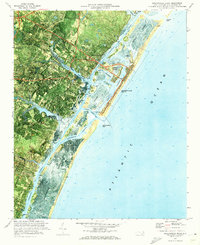
 1942 Wilmington1942 Print · USGSWilmington and its coastal sounds are shown during the early years of the war, when the riverfront and beach communities were expanding. Researchers can trace family-named landmarks like Everett Creek, the riverside Ruins Anderson Landing, and the seaside Seabreeze resort.
 - 1948 Map of Wilmington
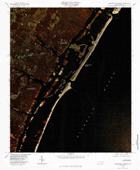
 1948 Wilmington1948 Print · USGSWilmington and the New Hanover coast are captured here in the late 1940s, as the region's river-based industry and beach communities began their post-war expansion. Researchers can trace historical sites from the Ruins Anderson Landing to urban landmarks like Union Station and Customs House.2 unique versions available
 - 1953 Map of Beaufort, 1965 Print
 1953 Beaufort1965 Print · USGSThe North Carolina coastline in the mid-fifties reveals an era of massive military expansion alongside traditional maritime life. Genealogists can trace family names and small settlements from Sealevel to Sneads Ferry or locate landmarks like Fort Macon.3 unique versions available
 - 1954 Map of Beaufort
 1954 Beaufort1954 Print · USGSCoastal North Carolina in the mid-fifties reveals a landscape of strategic military installations, sprawling wetlands, and thriving rail towns. Genealogists and historians can trace the foundations of Wilmington, the rural reaches of Duplin County, and shoreline landmarks like Cape Lookout and Carolina Beach.
 - 1970 Map of Wrightsville Beach, 1972 Print
 1970 Wrightsville Beach1972 Print · USGSCoastal New Hanover County comes into focus in the early seventies, showing the development of beach communities and mainland neighborhoods. Researchers can locate the University of North Carolina at Wilmington and trace waterways like Banks Channel and the Intracoastal Waterway.
 - 1972 Map of Beaufort, 1975 Print
 1972 Beaufort1975 Print · USGSThe North Carolina coast in the early seventies shows a landscape defined by massive military bases and coastal sounds. Trace rural family roots at Sarecta and Catherine Lake or explore the barrier islands of the Cape Lookout National Seashore.
 - 1980 Map of Wrightsville Beach, 1985 Print
 1980 Wrightsville Beach1985 Print · USGSCoastal New Hanover County enters the 1980s as a burgeoning residential and resort hub along the Atlantic shore. Genealogists and historians can trace the early suburban footprints of Winter Park and Seagate alongside the tidal reaches of Bradley Creek.
 - 1984 Map of Wilmington, 1985 Print
 1984 Wilmington1985 Print · USGSThe Lower Cape Fear region is shown here in the mid-1980s as the coastal corridor between Wilmington and the barrier islands experienced significant development. Researchers can trace historic river landings, the winding Intracoastal Waterway, and established communities from Castle Hayne to Topsail Beach.
 - 1990 Map of Wilmington
 1990 Wilmington1990 Print · USGSThe North Carolina coast in the early nineties reveals a landscape defined by the convergence of the Cape Fear River and the Atlantic shore. Genealogists and historians can trace suburban growth and maritime infrastructure from the inland Kendall Chapel to coastal hubs like Wrightsville Beach and Carolina Beach.
 - 1997 Map of Wrightsville Beach, 2000 Print
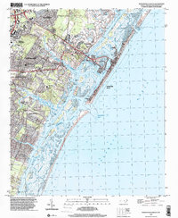 1997 Wrightsville Beach2000 Print · USGSCoastal New Hanover County is shown here in the late 1990s as the suburbs of Wilmington reached the tidal marshes. Genealogists and local researchers can trace family landmarks like Zion Chapel Cem and Shiloh Ch or explore the developed waterfront of Harbor Island.
 - 2010 Map of Wrightsville Beach, 2010 Print
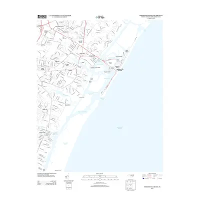
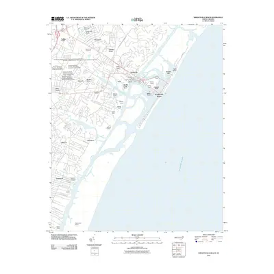 2010 Wrightsville Beach2010 Print · USGSCovers Windemere, including Wilmington, Wrightsville Beach, and other nearby areas
 - 2013 Map of Wrightsville Beach, 2013 Print
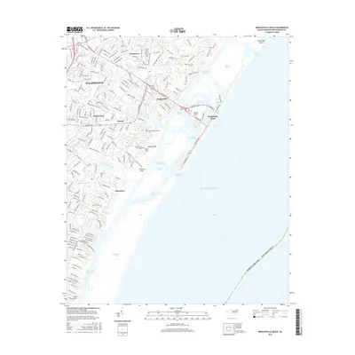
 2013 Wrightsville Beach2013 Print · USGSCovers Windemere, including Wilmington, Wrightsville Beach, and other nearby areas
 - 2016 Map of Wrightsville Beach, 2016 Print
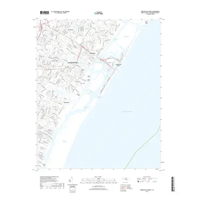
 2016 Wrightsville Beach2016 Print · USGSCovers Windemere, including Wilmington, Wrightsville Beach, and other nearby areas
 - 2019 Map of Wrightsville Beach, 2019 Print
 2019 Wrightsville Beach2019 Print · USGSCovers Windemere, including Wilmington, Wrightsville Beach, and other nearby areas
 - 2022 Map of Wrightsville Beach, 2022 Print
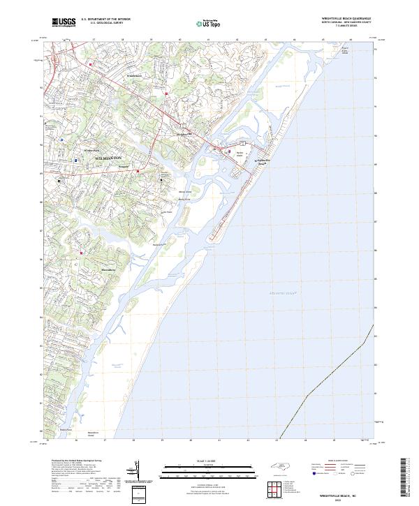 2022 Wrightsville Beach2022 Print · USGSWrightsville Beach and the Wilmington coastline are shown in high detail at the start of the 2020s. Trace local growth and maritime geography from Seagate to the dunes of Masonboro Island and the UNC Wilmington campus.
End of results
Showing maps 1-15 of 15
Top cities near Windemere
- Wilmington historical maps
- Leland historical maps
- Boiling Spring Lakes historical maps
- Carolina Beach historical maps
- Wrightsville Beach historical maps
- Kure Beach historical maps
See more
Frequently asked questions
- What are the different types of historical maps available for Windemere?
- What is the oldest map of Windemere?
- Where can I purchase historical maps of Windemere for my home or office?
- Where can I download high-res historical maps of Windemere?
- Are there historical topographic maps available for Windemere?
- Is there historical aerial imagery available for Windemere?
- Where are historical maps of Windemere sourced from?