Old Maps of Jacksonville, North Carolina for Academic Research
Study the evolution of Jacksonville with 34 high-resolution historic maps. Whether you're teaching, researching, or modeling changes in land use, these maps provide essential visual documentation of urban, environmental, and geographic change.
- Analyze long-term change: Track patterns in development, transportation, and natural features.
- Ideal for environmental or urban studies: Support academic projects with primary historical map data.
- Use in the classroom or lab: Educators and researchers rely on these maps to bring historical context to life.
These maps are a powerful tool for teaching, research, and visualizing how Jacksonville has changed over the decades.
Jacksonville, NC maps
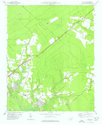
(34)- 1943 Map of Jacksonville
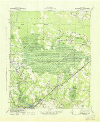 1943 Jacksonville1943 Print · USGSThe Onslow County coastal plain at the height of the Second World War shows a landscape defined by timberlands and the growing importance of Jacksonville. Genealogists can locate family landmarks at Sabiston Crossing, rural communities like Pumpkin Center, and the route of the Atlantic Coast Line Railroad.
 - 1948 Map of New River
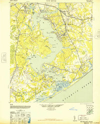 1948 New River1948 Print · USGSCoastal Onslow County underwent a massive transformation just after the war as the Marine Corps expanded its footprint along the New River. Researchers can trace early military infrastructure at the Peters Point Field Glider Base alongside civilian landmarks like Sneads Ferry and Mumfords Mill.2 unique versions available
 - 1952 Map of Camp Lejeune, 1954 Print
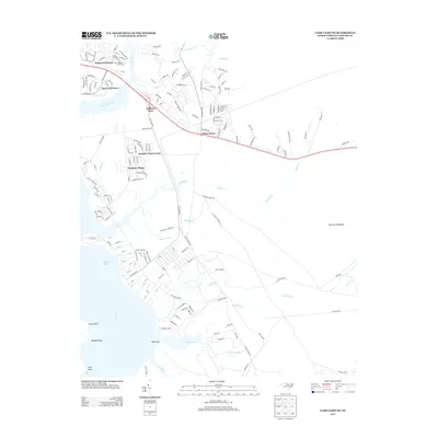
 1952 Camp Lejeune1954 Print · USGSCoastal Onslow County is seen here during the mid-century expansion of the Camp Lejeune Military Reservation. Local historians can trace established communities like Piney Green and Kelluntown alongside early base housing at Midway Park.4 unique versions available
 - 1952 Map of Jacksonville South, 1954 Print
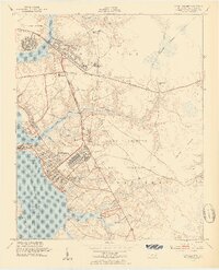
 1952 Jacksonville South1954 Print · USGSCoastal Onslow County is seen here during the post-war expansion of military and civilian infrastructure along the New River. Genealogists and historians can locate Verona, the Georgetown High Sch, and the Peters Point Field Glider Base.4 unique versions available
 - 1953 Map of Beaufort, 1965 Print
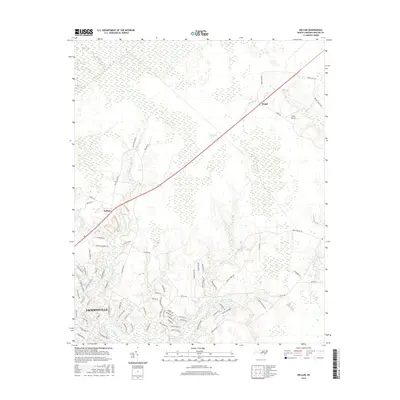
 1953 Beaufort1965 Print · USGSThe North Carolina coastline in the mid-fifties reveals an era of massive military expansion alongside traditional maritime life. Genealogists can trace family names and small settlements from Sealevel to Sneads Ferry or locate landmarks like Fort Macon.3 unique versions available
 - 1954 Map of Beaufort
 1954 Beaufort1954 Print · USGSCoastal North Carolina in the mid-fifties reveals a landscape of strategic military installations, sprawling wetlands, and thriving rail towns. Genealogists and historians can trace the foundations of Wilmington, the rural reaches of Duplin County, and shoreline landmarks like Cape Lookout and Carolina Beach.
 - 1972 Map of Beaufort, 1975 Print
 1972 Beaufort1975 Print · USGSThe North Carolina coast in the early seventies shows a landscape defined by massive military bases and coastal sounds. Trace rural family roots at Sarecta and Catherine Lake or explore the barrier islands of the Cape Lookout National Seashore.
 - 1977 Map of Kellum
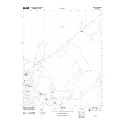
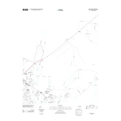
 1977 Kellum1977 Print · USGSCoastal Onslow County in the late seventies is shown as a mix of managed timberlands and emerging suburban pockets. Genealogists and local historians can locate many rural cemeteries and community landmarks like White Oak High School and Kellum.2 unique versions available
 - 1978 Map of Jacksonville North
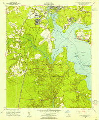
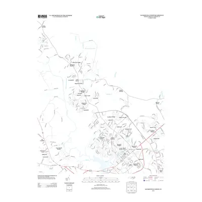
 1978 Jacksonville North1978 Print · USGSJacksonville and the New River valley were entering a period of significant growth in the late seventies. Researchers can trace the expansion of neighborhoods like Northwoods Park and Hawkside or locate rural landmarks such as Bethlehem Ch and Tar Landing.
 - 1986 Map of New River
 1986 New River1986 Print · USGSCoastal Onslow County in the mid-eighties shows a landscape shaped by military expansion and the preserved wetlands of the Carolina coast. Genealogists and historians can trace the foundations of Jacksonville and small outlying communities like Richlands and Swansboro.
 - 1991 Map of New River
 1991 New River1991 Print · USGSCoastal Onslow and Pender counties appear here in the early 1990s as the military and maritime economies matured. Researchers can trace the expansive Camp Lejeune grounds and find rural landings like Fulcher Landing and Sanders Landing.
 - 1997 Map of Jacksonville South, 2000 Print
 1997 Jacksonville South2000 Print · USGSThe Jacksonville waterfront and the northern reaches of Camp Lejeune are captured here in the late 1990s. Researchers can trace the layout of New River MCAS, explore the small community of Verona, and locate local landmarks like Georgetown High Sch.
 - 1997 Map of Kellum, 2000 Print
 1997 Kellum2000 Print · USGSCoastal Onslow County in the late nineties shows the expansion of residential life near the edge of the great White Oak Pocosin. Researchers can locate several rural cemeteries, the White Oak Airport, and old crossroads like Kellum and Pumpkin Center.
 - 1997 Map of Jacksonville North, 2000 Print
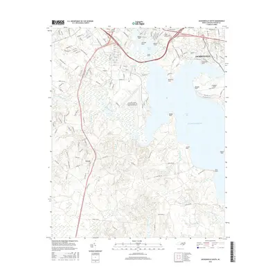
 1997 Jacksonville North2000 Print · USGSJacksonville and Onslow County are captured during a period of rapid northward expansion in the late nineties. Genealogists and local historians can trace the evolution of communities like Gum Branch and Tar Landing alongside landmarks like Bethlehem Ch and Onslow Memorial Hospital.
 - 2010 Map of Jacksonville South, 2010 Print
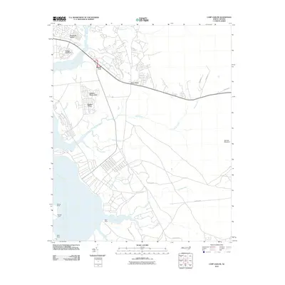
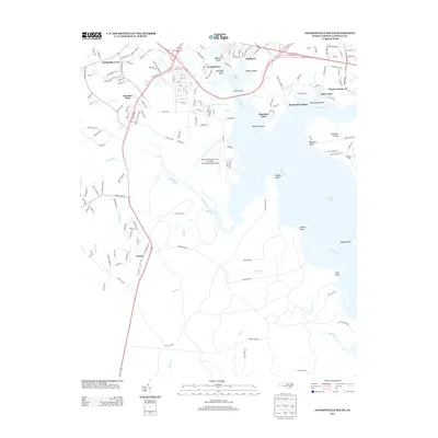
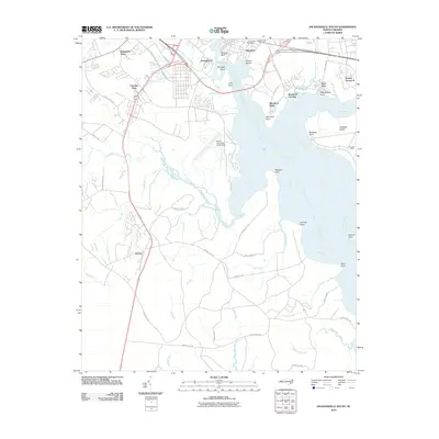 2010 Jacksonville South2010 Print · USGSCovers Jacksonville, including Paradise Park, Utopia Mobile Home Park, and other nearby areas
 - 2010 Map of Jacksonville North, 2010 Print
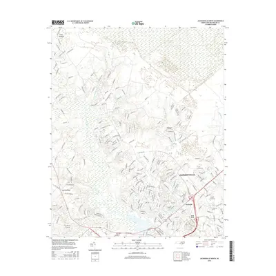
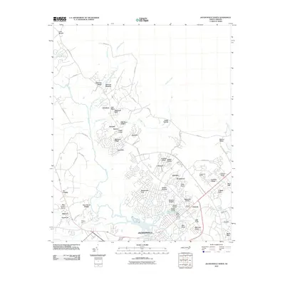 2010 Jacksonville North2010 Print · USGSCovers Jacksonville, including Half Moon, Gum Branch, and other nearby areas
 - 2010 Map of Kellum, 2010 Print
 2010 Kellum2010 Print · USGSCovers Jacksonville, including Pumpkin Center, Colonial Hills, and other nearby areas
 - 2010 Map of Camp Lejeune, 2010 Print
 2010 Camp Lejeune2010 Print · USGSCovers Jacksonville, including Piney Green, Holiday Mobile Home City, and other nearby areas
 - 2013 Map of Jacksonville North, 2013 Print
 2013 Jacksonville North2013 Print · USGSCovers Jacksonville, including Half Moon, Gum Branch, and other nearby areas
 - 2013 Map of Camp Lejeune, 2013 Print
 2013 Camp Lejeune2013 Print · USGSCovers Jacksonville, including Piney Green, Holiday Mobile Home City, and other nearby areas
 - 2013 Map of Kellum, 2013 Print
 2013 Kellum2013 Print · USGSCovers Jacksonville, including Pumpkin Center, Colonial Hills, and other nearby areas
 - 2013 Map of Jacksonville South, 2013 Print
 2013 Jacksonville South2013 Print · USGSCovers Jacksonville, including Paradise Park, Utopia Mobile Home Park, and other nearby areas
 - 2016 Map of Jacksonville North, 2016 Print
 2016 Jacksonville North2016 Print · USGSCovers Jacksonville, including Half Moon, Gum Branch, and other nearby areas
 - 2016 Map of Kellum, 2016 Print
 2016 Kellum2016 Print · USGSCovers Jacksonville, including Pumpkin Center, Colonial Hills, and other nearby areas
 - 2016 Map of Jacksonville South, 2016 Print
 2016 Jacksonville South2016 Print · USGSCovers Jacksonville, including Paradise Park, Utopia Mobile Home Park, and other nearby areas
Showing maps 1-25 of 34
Top cities near Jacksonville
- Piney Green historical maps
- Half Moon historical maps
- Swansboro historical maps
- Sneads Ferry historical maps
- Richlands historical maps
- Holly Ridge historical maps
See more
Top neighborhoods of Jacksonville
- College Park historical maps
- Foxhorn Village historical maps
- Humphrey historical maps
- Pine Hill historical maps
- Pinewood Downs historical maps
- Brynn Marr historical maps
See more
Frequently asked questions
- What are the different types of historical maps available for Jacksonville?
- What is the oldest map of Jacksonville?
- Where can I purchase historical maps of Jacksonville for my home or office?
- Where can I download high-res historical maps of Jacksonville?
- Are there historical topographic maps available for Jacksonville?
- Is there historical aerial imagery available for Jacksonville?
- Where are historical maps of Jacksonville sourced from?