2020s Maps of Jacksonville, North Carolina
Explore 4 historic maps of Jacksonville from the 2020s. These maps offer a rare glimpse into what life looked like during the 2020s — showing old roads, neighborhoods, homes, and landmarks that have changed or disappeared over time.
Whether you're researching your family's past, planning a metal detecting trip, or studying how Jacksonville's landscape evolved across the 2020s, these high-resolution maps are a powerful tool for exploring the history of this region.
- Focus on a specific era: All maps on this page are from the 2020s, giving you a focused view of this time period.
- See what’s changed: Compare century-old streets, trails, and buildings to today's modern landscape using overlays and satellite layers.
- Research with precision: Use these maps for genealogy, historical research, land use analysis, or educational projects.
- View, download, or print: Maps are fully viewable online in high resolution, and can be downloaded or printed for your own records.
Start exploring Jacksonville's history through authentic maps from the 2020s. This is your window into the past.
Jacksonville, NC maps
(4)- 2022 Map of Jacksonville South, 2022 Print
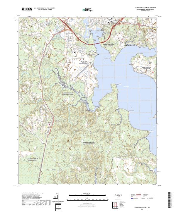 2022 Jacksonville South2022 Print · USGSCoastal North Carolina's military and maritime landscape is documented in this 2022 survey of Onslow County. Researchers can trace the modern layout of Jacksonville, the New River Marine Corps Air Station, and the hallowed grounds of Montford Point National Cemetery.
 - 2022 Map of Camp Lejeune, 2022 Print
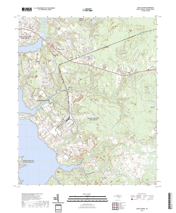 2022 Camp Lejeune2022 Print · USGSThe Onslow County coast during the early twenty-first century reveals a landscape defined by the growth of Jacksonville and Camp Lejeune. Trace family sites and coastal development near the Raymond Kellum Cem, Midway Park, and Piney Green.
 - 2022 Map of Jacksonville North, 2022 Print
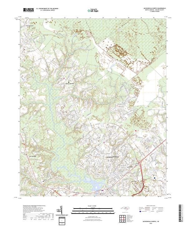 2022 Jacksonville North2022 Print · USGSJacksonville and the surrounding Onslow County wetlands are shown here during a period of modern expansion. Researchers can trace local history through the Greer Cem, the Onslow County Courthouse, and the rural crossroads of Gum Branch.
 - 2022 Map of Kellum, 2022 Print
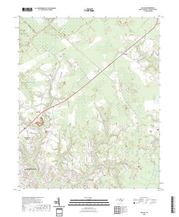 2022 Kellum2022 Print · USGSCoastal North Carolina at the start of the 2020s reveals the expanding residential footprints around Jacksonville and Pumpkin Center. Researchers can trace local landmarks like Epley Airport or the transition into the dense White Oak Pocosin.
End of results
Showing maps 1-4 of 4
Top cities near Jacksonville
- Piney Green historical maps
- Half Moon historical maps
- Swansboro historical maps
- Sneads Ferry historical maps
- Richlands historical maps
- Holly Ridge historical maps
See more
Top neighborhoods of Jacksonville
- College Park historical maps
- Foxhorn Village historical maps
- Humphrey historical maps
- Pine Hill historical maps
- Pinewood Downs historical maps
- Brynn Marr historical maps
See more
Frequently asked questions
- What are the different types of historical maps available for Jacksonville?
- What is the oldest map of Jacksonville?
- Where can I purchase historical maps of Jacksonville for my home or office?
- Where can I download high-res historical maps of Jacksonville?
- Are there historical topographic maps available for Jacksonville?
- Is there historical aerial imagery available for Jacksonville?
- Where are historical maps of Jacksonville sourced from?